Sidi Amrane
Sidi Amrane (Arabic: ﺳﻴﺪي ﻋﻤﺮان) (also written Sīdī Amran[2]) is a town and commune in Djamaa District, El Oued Province, Algeria, 5 kilometres (3.1 mi) south of Djamaa. According to the 2008 census it has a population of 21,772,[1] up from 18,732 in 1998,[2] and an annual growth rate of 1.5%.[1]
Sidi Amrane
ﺳﻴﺪي ﻋﻤﺮان | |
|---|---|
Commune and town | |
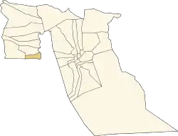 Location of Sidi Amrane commune within El Oued Province | |
 Sidi Amrane Location of Sidi Amrane within Algeria | |
| Coordinates: 33°30′N 6°1′E | |
| Country | |
| Province | El Oued Province |
| District | Djamaa District |
| Elevation | 46 m (151 ft) |
| Population (2008)[1] | |
| • Total | 21,772 |
| Time zone | UTC+1 (CET) |
Climate
Sidi Amrane has a hot desert climate (Köppen climate classification BWh), with very hot summers and mild winters. Rainfall is light and sporadic, and summers are particularly dry.
Transportation
Sidi Amrane is connect by two short local roads to the national highway N3; one road leads directly west, and the other leads north through Djamaa. The N3 runs from Biskra in the north to Touggourt in the south. There is also a station on the Biskra-Touggourt railway line at Djamaa.
Education
5.8% of the population has a tertiary education, and another 17.2% has completed secondary education.[3] The overall literacy rate is 78.4%, and is 85.1% among males and 72.1% among females.[4]
Localities
The commune of Sidi Amrane is composed of six localities:[5]
- Sidi Amrane
- Aïn Choucha
- Tamerna Djedida
- Tamerna Guedima
- Zaoualia
- Chémora
References
- "Population: El Oued Wilaya" (PDF) (in French). Office National des Statistiques Algérie. Retrieved 12 February 2013.
- "Algeria Communes". Statoids. Retrieved 9 March 2013.
- "Structure relative de la population résidente des ménages ordinaires et collectifs âgée de 6 ans et plus selon le niveau d'instruction et la commune de résidence" (PDF) (in French). Office National des Statistiques Algérie. Retrieved 13 February 2013.
- "Taux d'analphabétisme et taux d'alphabétisation de la population âgée de 15 ans et plus, selon le sexe et la commune de résidence " (PDF) (in French). Office National des Statistiques Algérie. Retrieved 13 February 2013.
- "Décret n° 84-365, fixant la composition, la consistance et les limites territoriale des communes. Wilaya d'El Oued" (PDF) (in French). Journal officiel de la République Algérienne. 19 December 1984. p. 1565. Archived from the original (PDF) on 2 March 2013 or before. Retrieved 2 March 2013. Check date values in:
|archivedate=(help)
Places adjacent to Sidi Amrane | |
|---|---|
.svg.png.webp)