Situbondo Regency
Situbondo Regency is a regency (kabupaten) of East Java province, Indonesia. It covers an area of 1,669.87 km2, and had a population of 647,619 at the 2010 Census;[1] the latest official estimate (as at January 2014) is 665,818. It is located in east end of Java before Banyuwangi. The administrative centre is Situbondo, a small town within the regency. One of the famous tourist sites is Baluran National Park.
Situbondo Regency
Kabupaten Situbondo | |
|---|---|
 Coat of arms | |
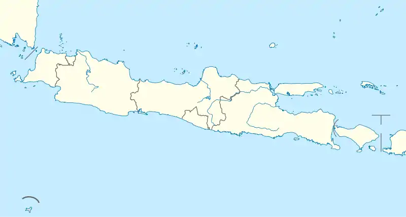
 Location within East Java | |
| Coordinates: 7°42′S 114°00′E | |
| Country | |
| Province | East Java |
| Capital | Situbondo |
| Government | |
| • Regent | Dadang Wigiarto |
| • Vice Regent | Yoyok Mulyadi |
| Area | |
| • Total | 1,669.87 km2 (644.74 sq mi) |
| Population (2014) | |
| • Total | 665,818 |
| • Density | 400/km2 (1,000/sq mi) |
| Time zone | UTC+7 (IWST) |
| Area code | (+62) 338 |
| Website | situbondokab |

Administrative Division
Situbondo has seventeen (17) districts, which are:
- Banyuglugur
- Besuki
- Jatibanteng
- Sumbermalang
- Suboh
- Mlandingan
- Bungatan
- Kendit
- Panarukan
- Situbondo
- Kendit
- Panji
- Mangaran
- Kapongan
- Arjasa
- Asembagus
- Banyuputih
Climate
Situbondo has a tropical savanna climate (Aw) with heavy rainfall from December to March and moderate to little rainfall from April to November.
| Climate data for Situbondo | |||||||||||||
|---|---|---|---|---|---|---|---|---|---|---|---|---|---|
| Month | Jan | Feb | Mar | Apr | May | Jun | Jul | Aug | Sep | Oct | Nov | Dec | Year |
| Average high °C (°F) | 31.1 (88.0) |
31.1 (88.0) |
31.3 (88.3) |
31.7 (89.1) |
31.7 (89.1) |
31.6 (88.9) |
31.5 (88.7) |
31.9 (89.4) |
33.0 (91.4) |
33.6 (92.5) |
33.2 (91.8) |
31.9 (89.4) |
32.0 (89.6) |
| Daily mean °C (°F) | 26.0 (78.8) |
26.0 (78.8) |
26.1 (79.0) |
26.4 (79.5) |
26.3 (79.3) |
25.9 (78.6) |
25.4 (77.7) |
25.8 (78.4) |
26.6 (79.9) |
27.2 (81.0) |
27.2 (81.0) |
26.5 (79.7) |
26.3 (79.3) |
| Average low °C (°F) | 20.9 (69.6) |
21.0 (69.8) |
21.0 (69.8) |
21.2 (70.2) |
20.9 (69.6) |
20.2 (68.4) |
19.3 (66.7) |
19.7 (67.5) |
20.2 (68.4) |
20.8 (69.4) |
21.2 (70.2) |
21.1 (70.0) |
20.6 (69.1) |
| Average rainfall mm (inches) | 281 (11.1) |
243 (9.6) |
193 (7.6) |
77 (3.0) |
64 (2.5) |
35 (1.4) |
20 (0.8) |
6 (0.2) |
4 (0.2) |
18 (0.7) |
67 (2.6) |
187 (7.4) |
1,195 (47.1) |
| Source: Climate-Data.org[2] | |||||||||||||
Gallery

 Two groups of men under a large banyan tree in Situbondo
 River and washed away bridge in the area of Situbondo
References
- Biro Pusat Statistik, Jakarta, 2011.
- "Climate: Situbondo". Climate-Data.org. Retrieved 10 November 2020.

| Authority control |
|---|
This article is issued from Wikipedia. The text is licensed under Creative Commons - Attribution - Sharealike. Additional terms may apply for the media files.
