South Carolina Highway 187
South Carolina Highway 187 (SC 187) is a 30.334-mile-long (48.818 km) state highway in the U.S. state of South Carolina. The highway travels through mostly rural areas of Anderson County.
| ||||
|---|---|---|---|---|
| ||||
| Route information | ||||
| Maintained by SCDOT | ||||
| Length | 30.334 mi[1] (48.818 km) | |||
| Tourist routes | ||||
| Major junctions | ||||
| South end | ||||
| ||||
| North end | ||||
| Location | ||||
| Counties | Anderson | |||
| Highway system | ||||
| ||||

Route description
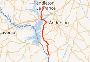
SC 187 begins at an intersection with SC 184 (Elberton Highway) southwest of Iva, within Anderson County. It travels in a fairly northerly direction. It passes Mountain View Cemetery and Poplar Spring Cemetery before intersecting SC 181 (Smith–McGee Road). They have a brief concurrency. SC 187 travels to the northwest and crosses over Weems Creek and then Buchanan Creek. It has an intersection with SC 412 (Rainey Road) and one with U.S. Route 29 (US 29). The highway begins curving to the northeast. In West Gate, it intersects SC 24. The two highways travel concurrently to the northwest and cross over part of Lake Hartwell on the Calvin Wesley Belcher Bridge. A short distance later, they split at the Portman Shoals Intersection, with SC 187 traveling to the north. It passes by a KOA Kampground just before an interchange with Interstate 85 (I-85). Just to the west of La France, the highway passes Pendleton High School. Farther to the northeast, it meets its northern terminus, an intersection with US 76/SC 28, just south of Pendleton.[2]
Major intersections
The entire route is in Anderson County.
| Location | mi[1] | km | Destinations | Notes | |
|---|---|---|---|---|---|
| | 0.000 | 0.000 | Southern terminus | ||
| | 5.580 | 8.980 | Southern end of SC 181 concurrency | ||
| | 6.400 | 10.300 | Northern end of SC 181 concurrency | ||
| | 10.710 | 17.236 | |||
| | 12.360 | 19.891 | |||
| West Gate | 20.310 | 32.686 | Southern end of SC 24 concurrency | ||
| Lake Hartwell | 21.959 22.212 | 35.340 35.747 | Calvin Wesley Belcher Bridge | ||
| | 23.087 | 37.155 | Northern end of SC 24 concurrency; Portman Shoals Intersection | ||
| | 24.354– 24.388 | 39.194– 39.249 | I-85 exit 14 | ||
| | 30.334 | 48.818 | Northern terminus | ||
1.000 mi = 1.609 km; 1.000 km = 0.621 mi
| |||||
See also
 U.S. roads portal
 United States portal
References
- "Highway Logmile Report". South Carolina Department of Transportation. Retrieved November 20, 2020.
- Google (May 10, 2016). "Overview map of SC 187" (Map). Google Maps. Google. Retrieved May 10, 2016.
External links
 Media related to South Carolina Highway 187 at Wikimedia Commons
- SC 187 South Carolina Hwy Index