South East Delhi district
South East Delhi is an administrative district of the National Capital Territory of Delhi in India.
South East Delhi | |
|---|---|
District of Delhi | |
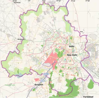 South East Delhi Location in Delhi, India | |
| Coordinates: 28.60955°N 77.13967°E | |
| Country | |
| Union Territory | Delhi |
| Created | 2012 |
| Headquarters | Defence Colony |
| Area | |
| • Total | 333.855 km2 (128.902 sq mi) |
| Languages | |
| • Official | Hindi, English |
| Time zone | UTC+5:30 (IST) |
| Vehicle registration | DL |
| Lok Sabha constituencies | South Delhi and New Delhi |
| Civic agency | South Delhi Municipal Corporation |
| Website | Official website |
This district was carved out in 2012 along with Shahdara, taking the total number to 11 administrative districts in Delhi.[1]
Geography
The South East Delhi district is bordered in west by South Delhi district, in south by the Faridabad district of Haryana, in east by River Yamuna, and by New Delhi district and East Delhi districts in north-west and north-east respectively.
The district stretches from Jor Bagh, Lodhi road, Khan Market and Sunder Nagar, through Defence colony, Lajpat Nagar,Badarpur,Ashram,Jaitpur,Nizamuddin, Sarai Kale Khan, New Friends Colony, Nehru Place, Jamia Nagar, Kalkaji, Chittaranjan Park, Govindpuri, Okhla Phase- II, to Greater Kailash Part II, Alaknanda and Sarita Vihar.
Administration
Administratively, the district is divided into three subdivisions, Defence Colony, Kalkaji and Sarita Vihar. Defence Colony is the administrative headquarters of the district.
Demographics
Since the district was created after the latest Census of India was completed in 2011, independent statistics for South East Delhi is not available yet.
References
- "Delhi gets two more revenue districts: Southeast, Shahdara - Indian Express". archive.indianexpress.com. Retrieved 12 September 2012.