Sterling, Nebraska
Sterling is a village in Johnson County, Nebraska, United States. The population was 476 at the 2010 census.
Sterling, Nebraska | |
|---|---|
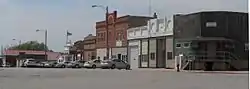 Downtown Sterling: Broadway | |
| Motto(s): "Small Town...Big Heart"[1] | |
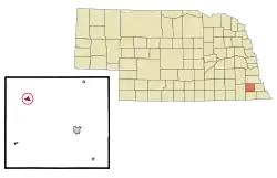 Location of Sterling, Nebraska | |
| Coordinates: 40°27′43″N 96°22′42″W | |
| Country | United States |
| State | Nebraska |
| County | Johnson |
| Area | |
| • Total | 0.41 sq mi (1.05 km2) |
| • Land | 0.41 sq mi (1.05 km2) |
| • Water | 0.00 sq mi (0.00 km2) |
| Elevation | 1,188 ft (362 m) |
| Population | |
| • Total | 476 |
| • Estimate (2019)[4] | 459 |
| • Density | 1,127.76/sq mi (435.29/km2) |
| Time zone | UTC-6 (Central (CST)) |
| • Summer (DST) | UTC-5 (CDT) |
| ZIP code | 68443 |
| Area code(s) | 402 |
| FIPS code | 31-47150[5] |
| GNIS feature ID | 0833812[6] |
| Website | http://www.ci.sterling.ne.us/ |
History
Sterling was platted in 1870 when the Atchison and Nebraska Railroad was extended to that point.[7][8] The village was named after Sterling, Illinois.[9]
Geography
Sterling is located at 40°27′43″N 96°22′42″W (40.461893, -96.378355).[10]
According to the United States Census Bureau, the village has a total area of 0.41 square miles (1.06 km2), all land.[11]
Demographics
| Historical population | |||
|---|---|---|---|
| Census | Pop. | %± | |
| 1900 | 782 | — | |
| 1910 | 714 | −8.7% | |
| 1920 | 804 | 12.6% | |
| 1930 | 702 | −12.7% | |
| 1940 | 640 | −8.8% | |
| 1950 | 547 | −14.5% | |
| 1960 | 471 | −13.9% | |
| 1970 | 476 | 1.1% | |
| 1980 | 526 | 10.5% | |
| 1990 | 451 | −14.3% | |
| 2000 | 507 | 12.4% | |
| 2010 | 476 | −6.1% | |
| 2019 (est.) | 459 | [4] | −3.6% |
| U.S. Decennial Census[12] | |||
2010 census
As of the census[3] of 2010, there were 476 people, 206 households, and 126 families residing in the village. The population density was 1,161.0 inhabitants per square mile (448.3/km2). There were 229 housing units at an average density of 558.5 per square mile (215.6/km2). The racial makeup of the village was 99.8% White and 0.2% from other races. Hispanic or Latino people of any race were 1.7% of the population.
There were 206 households, of which 30.6% had children under the age of 18 living with them, 51.5% were married couples living together, 7.8% had a female householder with no husband present, 1.9% had a male householder with no wife present, and 38.8% were non-families. 32.5% of all households were made up of individuals, and 18% had someone living alone who was 65 years of age or older. The average household size was 2.31 and the average family size was 3.02.
The median age in the village was 40.8 years. 26.5% of residents were under the age of 18; 4.3% were between the ages of 18 and 24; 23.1% were from 25 to 44; 28.7% were from 45 to 64; and 17.2% were 65 years of age or older. The gender makeup of the village was 47.7% male and 52.3% female.
2000 census
As of the census[5] of 2000, there were 507 people, 223 households, and 134 families residing in the village. The population density was 1,253.8 people per square mile (489.4/km2). There were 234 housing units at an average density of 578.7 per square mile (225.9/km2). The racial makeup of the village was 98.62% White, 0.39% Native American, and 0.99% from two or more races. Hispanic or Latino people of any race were 1.18% of the population.
There were 223 households, out of which 28.3% had children under the age of 18 living with them, 49.3% were married couples living together, 7.2% had a female householder with no husband present, and 39.9% were non-families. 36.3% of all households were made up of individuals, and 24.2% had someone living alone who was 65 years of age or older. The average household size was 2.27 and the average family size was 3.01.
In the village, the population was spread out, with 25.8% under the age of 18, 6.3% from 18 to 24, 26.0% from 25 to 44, 21.5% from 45 to 64, and 20.3% who were 65 years of age or older. The median age was 39 years. For every 100 females, there were 85.7 males. For every 100 females age 18 and over, there were 82.5 males.
As of 2000 the median income for a household in the village was $30,313, and the median income for a family was $43,036. Males had a median income of $28,839 versus $25,000 for females. The per capita income for the village was $16,302. About 4.5% of families and 6.7% of the population were below the poverty line, including 1.9% of those under age 18 and 19.0% of those age 65 or over.
Arts and culture
Annual cultural events
The Johnson County Fair is an annual event held each year in August. The event includes parades, carnival rides, livestock shows and exhibits, arts and crafts, and a softball tournament.[1]
The Antique Tractor & Machinery Show is an annual event held each year in August and is sponsored by the Deer Creek Sodbusters, a club dedicated to the preservation of America's agricultural heritage. The event began in 1983 as a plowing bee, and is now an antique show with family entertainment.[1] The event received national recognition in 1999 when it was officially designed a "Local Legacy" by the U.S. Library of Congress.[13]
Parks and recreation
The Wirth Brothers Lake is a twenty-seven acre lake located nine miles from Sterling. The area offers tent camping, fishing, and an archery range.[1][14]
Education
Sterling is part of the Sterling Public Schools district. The district has an elementary school, middle school and high school. Students attend Sterling High School.[15][16]
References
- "Sterling Nebraska". Sterling Nebraska. Retrieved October 19, 2012.
- "2019 U.S. Gazetteer Files". United States Census Bureau. Retrieved July 26, 2020.
- "U.S. Census website". United States Census Bureau. Retrieved 2012-06-24.
- "Population and Housing Unit Estimates". United States Census Bureau. May 24, 2020. Retrieved May 27, 2020.
- "U.S. Census website". United States Census Bureau. Retrieved 2008-01-31.
- "US Board on Geographic Names". United States Geological Survey. 2007-10-25. Retrieved 2008-01-31.
- "Sterling, Hall County". Center for Advanced Land Management Information Technologies. University of Nebraska. Retrieved 14 August 2014.
- Burr, George L. (1921). History of Hamilton and Clay Counties, Nebraska, Volume 1. S.J. Clarke Publishing Company. p. 121.
- "Profile for Sterling, Nebraska, NE". ePodunk. Retrieved October 19, 2012.
- "US Gazetteer files: 2010, 2000, and 1990". United States Census Bureau. 2011-02-12. Retrieved 2011-04-23.
- "US Gazetteer files 2010". United States Census Bureau. Archived from the original on 2012-01-25. Retrieved 2012-06-24.
- "Census of Population and Housing". Census.gov. Retrieved June 4, 2015.
- "Deer Creek Sodbusters Antique Machinery Show". The Library of Congress. Retrieved October 19, 2012.
- "Wirth Brothers Lake". Nebraska’s NRDs. Retrieved October 19, 2012.
- "Sterling Public Schools". Sterling Public Schools. Retrieved October 19, 2012.
- "Sterling Public Schools". education.com. Retrieved October 19, 2012.
External links
| Wikimedia Commons has media related to Sterling, Nebraska. |
- Sterling, Nebraska homepage
- Sterling Public Schools
- City-Data.com
- ePodunk: profile for Sterling, Nebraska
Municipalities and communities of Johnson County, Nebraska, United States | ||
|---|---|---|
| City | Map of Nebraska highlighting Johnson County | |
| Villages | ||
| Unincorporated communities | ||
| ||