Strasburg, Colorado
Strasburg is an unincorporated town, a post office, and a census-designated place (CDP) located in and governed by Adams and Arapahoe counties, Colorado, United States. The CDP is a part of the Denver–Aurora–Lakewood, CO Metropolitan Statistical Area. The Strasburg post office has the ZIP Code 80136.[3] At the United States Census 2010, the population of the Strasburg CDP was 2,447, while the population of the 80136 ZIP Code Tabulation Area was 4834 including adjacent communities.[4]
Strasburg, Colorado | |
|---|---|
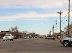 Strasburg, looking east along 15th Avenue. | |
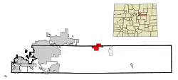 Location of the Strasburg CDP in Adams and Arapahoe County, Colorado. | |
 Strasburg Location of the Strasburg CDP in the United States. | |
| Coordinates: 39°43′05″N 104°19′10″W[1] | |
| Country | |
| State | |
| County | Adams and Arapahoe |
| Government | |
| • Type | unincorporated town |
| Area | |
| • Total | 20.830 sq mi (53.949 km2) |
| • Land | 20.805 sq mi (53.885 km2) |
| • Water | 0.025 sq mi (0.064 km2) |
| Elevation | 5,420 ft (1,652 m) |
| Population (2010) | |
| • Total | 2,447 |
| • Density | 118/sq mi (45/km2) |
| Time zone | UTC-7 (MST) |
| • Summer (DST) | UTC-6 (MDT) |
| ZIP Code[3] | 80136 |
| Area codes | 303 & 720 |
| GNIS feature[2] | Strasburg CDP |
History
A post office called Strasburg has been in operation since 1908.[5] The community was named after John Strasburg, a railroad official.[6]
Geography
The Strasburg CDP has an area of 13,331 acres (53.949 km2), including 16 acres (0.064 km2) of water.[1]
Demographics
The United States Census Bureau initially defined the Strasburg CDP for the United States Census 2000.
| Year | Pop. | ±% |
|---|---|---|
| 2000 | 1,402 | — |
| 2010 | 2,447 | +74.5% |
| 2020 | — | |
| Source: United States Census Bureau | ||
Education
The Strasburg 31J School District serves Starsburg.
See also
- Outline of Colorado
- State of Colorado
- Colorado cities and towns
- Colorado counties
- Colorado metropolitan areas
References
- "State of Colorado Census Designated Places - BAS20 - Data as of January 1, 2020". United States Census Bureau. Retrieved December 9, 2020.
- "U.S. Board on Geographic Names: Domestic Names". United States Geological Survey. Retrieved December 9, 2020.
- "Look Up a ZIP Code". United States Postal Service. Retrieved December 9, 2020.
- "2010: DEC Summary File 1". United States Census Bureau. Retrieved December 20, 2020.
- "Post offices". Jim Forte Postal History. Retrieved 11 July 2016.
- Dawson, John Frank. Place names in Colorado: why 700 communities were so named, 150 of Spanish or Indian origin. Denver, CO: The J. Frank Dawson Publishing Co. p. 48.
External links
- Strasburg @ Colorado.com
- Strasburg @ UncoverColorado.com
- Strasburg 31J School District
- Strasburg Metropolitan Park & Recreation District
- Adams County website
- Arapahoe County website
Municipalities and communities of Adams County, Colorado, United States | ||
|---|---|---|
| Cities | 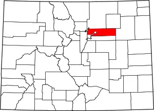 Map of Colorado highlighting Adams County | |
| Towns | ||
| CDPs | ||
| Unincorporated communities |
| |
| Footnotes | ‡This populated place also has portions in an adjacent county or counties | |
| ||
Municipalities and communities of Arapahoe County, Colorado, United States | ||
|---|---|---|
| Cities | 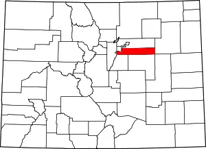 Map of Colorado highlighting Arapahoe County | |
| Towns | ||
| CDPs | ||
| Footnotes | ‡This populated place also has portions in an adjacent county or counties | |
| ||