Columbine, Colorado
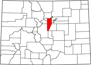
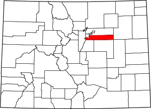
Columbine is an unincorporated community and a census-designated place (CDP) located in and governed by Jefferson and Arapahoe counties, Colorado, United States. The CDP is a part of the Denver–Aurora–Lakewood, CO Metropolitan Statistical Area. Located primarily in Jefferson County, Columbine lies immediately south of Denver. The population of the Columbine CDP was 24,280 at the United States Census 2010.[4] The community lies in ZIP code 80123.[5]
Columbine, Colorado | |
|---|---|
 | |
 Columbine Location of the Columbine CDP in the United States. | |
| Coordinates: 39°35′16″N 105°04′10″W[1] | |
| Country | |
| State | |
| Counties | Jefferson & Arapahoe |
| Government | |
| • Type | unincorporated community |
| Area | |
| • Total | 6.753 sq mi (17.491 km2) |
| • Land | 6.631 sq mi (17.173 km2) |
| • Water | 0.123 sq mi (0.318 km2) |
| Elevation | 5,545 ft (1,690 m) |
| Population (2010) | |
| • Total | 24,280 |
| • Density | 3,662/sq mi (1,414/km2) |
| Time zone | UTC-7 (MST) |
| • Summer (DST) | UTC-6 (MDT) |
| ZIP Code[3] | 80123 |
| Area codes | 303 & 720 |
History
Columbine grew rapidly during the Space Race years from 1958 to 1968 with the construction of the Martin Company missile facility in Waterton Canyon. Its population exceeded 20,000 for the first time in 1980.
Columbine is mostly known because it was the site of the Columbine High School massacre in 1999.
Geography
Columbine is located on the eastern edge of Jefferson County with a small portion extending east into Arapahoe County. Columbine is bordered to the east by Littleton and Columbine Valley, and to the west by Ken Caryl. The Denver city limits are 0.3 miles (0.48 km) north of the northern border of Columbine, and to the south the community extends as far as the Chatfield Reservoir dam.
The Columbine CDP has an area of 4,322 acres (17.491 km2), including 79 acres (0.318 km2) of water.[1]
Demographics
The United States Census Bureau initially defined the Columbine CDP for the 1980 United States Census.
| Year | Pop. | ±% |
|---|---|---|
| 1980 | 23,523 | — |
| 1990 | 23,969 | +1.9% |
| 2000 | 24,095 | +0.5% |
| 2010 | 24,280 | +0.8% |
| Source: United States Census Bureau | ||
Education
The portion of Columbine in Jefferson County is served by the Jefferson County Public Schools.[6]
- Zoned elementary schools: Columbine Hills, Dutch Creek, Leawood, and Normandy[7]
- Ken Caryl Middle School[8]
- Columbine High School[9]
The portion of Columbine in Arapahoe County is served by the Littleton Public Schools.
See also
- Outline of Colorado
- State of Colorado
- Colorado cities and towns
- Colorado counties
- Colorado metropolitan areas
References
- "State of Colorado Census Designated Places - BAS20 - Data as of January 1, 2020". United States Census Bureau. Retrieved December 17, 2020.
- "U.S. Board on Geographic Names: Domestic Names". United States Geological Survey. Retrieved December 17, 2020.
- "Zip Code 80123 Map and Profile". zipdatamaps.com. 2020. Retrieved December 20, 2020.
- "2010: DEC Summary File 1". United States Census Bureau. Retrieved December 20, 2020.
- "Look Up a ZIP Code". United States Postal Service. Retrieved December 17, 2020.
- "Columbine CDP" (PDF). U.S. Census Bureau. Retrieved 2020-03-28.
- "Elementary Schools". Jeffco Public Schools. Retrieved 2020-03-28. Detail maps: Columbine Hills, Dutch Creek, Leawood, and Normandy
- "Middle Schools". Jeffco Public Schools. Retrieved 2020-03-28. - Detail map
- "High Schools". Jeffco Public Schools. Retrieved 2020-03-28. - Detail map

