Arapahoe County, Colorado
Arapahoe County (/əˈræpəhoʊ/ ə-RAP-ə-hoh) is a county located in the U.S. state of Colorado. As of the 2010 census, its population was 572,003,[3] making it the third-most populous county in Colorado. The county seat is Littleton,[4] and the most populous city is Aurora. The county was named for the Arapaho Native American tribe, who once lived in the region.[1]
Arapahoe County | |
|---|---|
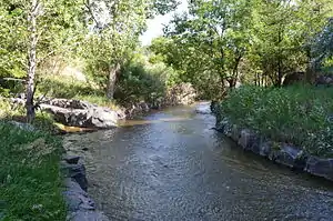 Little Dry Creek in Englewood | |
 Flag | |
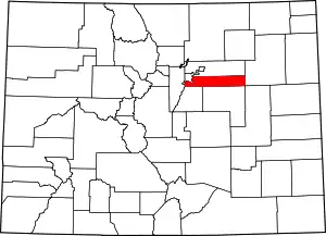 Location within the U.S. state of Colorado | |
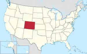 Colorado's location within the U.S. | |
| Coordinates: 39°38′N 104°20′W | |
| Country | |
| State | |
| Founded | November 1, 1861 |
| Named for | The Arapaho Nation[1] |
| Seat | Littleton |
| Largest city | Aurora |
| Area | |
| • Total | 805 sq mi (2,080 km2) |
| • Land | 798 sq mi (2,070 km2) |
| • Water | 7.3 sq mi (19 km2) 0.9%% |
| Population (2010) | |
| • Total | 572,003[2] |
| • Density | 806/sq mi (234/km2) |
| Time zone | UTC−7 (Mountain) |
| • Summer (DST) | UTC−6 (MDT) |
| Congressional districts | 1st, 4th, 6th |
| Website | www |
Arapahoe County is part of the Denver-Aurora-Lakewood metropolitan statistical area. Arapahoe County calls itself "Colorado's First County", since its origins antedate the Pike's Peak Gold Rush.
History
On August 25, 1855, the Kansas Territorial Legislature created a huge Arapahoe County to govern the entire western portion of the Territory of Kansas. The county was named for the Arapaho Nation, who lived in the region.[1]
In July 1858, gold was discovered along the South Platte River in Arapahoe County (in present-day Englewood). This discovery precipitated the Pike's Peak Gold Rush. Many residents of the mining region felt disconnected from the remote territorial governments of Kansas and Nebraska, so they voted to form their own Territory of Jefferson on October 24, 1859. The following month, the Jefferson Territorial Legislature organized 12 counties for the new territory, including a smaller Arapahoe County. Denver City served as the county seat of Arapahoe County.
The Jefferson Territory never received federal sanction, and when the State of Kansas was admitted to the Union on January 29, 1861, the mining regions temporarily reverted to unorganized territory. On February 28, 1861, Congress passed an act organizing the Territory of Colorado, using present-day borders.[5] On November 1, 1861, the Colorado Territorial Assembly organized the 17 original counties of Colorado, including a new Arapahoe County. Arapahoe County originally stretched from the line of present-day Sheridan Boulevard 160 miles (258 km) east to the Kansas border, and from the line of present-day County Line Road 30 miles (48 km) north to the 40th parallel north (168th Avenue). Denver City served as the county seat of Arapahoe County until 1902.
In 1901, the Colorado General Assembly voted to split Arapahoe County into three parts - a new consolidated City and County of Denver, a new Adams County, and the remainder of the Arapahoe County to be renamed South Arapahoe County. A ruling by the Colorado Supreme Court, subsequent legislation, and a referendum delayed the reorganization until November 15, 1902. Governor James Bradley Orman designated Littleton as the temporary county seat of South Arapahoe County. On April 11, 1903, the Colorado General Assembly changed the name of South Arapahoe County back to Arapahoe County. On November 8, 1904, Arapahoe County voters chose Littleton over Englewood by a vote of 1310 to 829 to be the permanent county seat.
Geography
According to the U.S. Census Bureau, the county has a total area of 805 square miles (2,080 km2), of which 798 square miles (2,070 km2) are land and 7.3 square miles (19 km2) (0.9%) are covered by water.[6] The county measures 72 mi (116 km) east-west and 4 to 12 mi (6 to 19 km) north-south.
Two exclaves of Arapahoe County are entirely surrounded by the City and County of Denver, the City of Glendale, and the Holly Hills neighborhood, a census-designated place.
Adjacent counties
- City and County of Denver – northwest and exclaves
- Adams County – north
- Washington County – east
- Lincoln County – southeast
- Elbert County – south
- Douglas County – southwest
- Jefferson County – west
Major highways
.svg.png.webp) Interstate 25
Interstate 25.svg.png.webp) Interstate 70
Interstate 70.svg.png.webp) Interstate 225
Interstate 225 I-70 BL
 I-70 BS
- I-70 BS
- I-70 BS
 U.S. Highway 85
 U.S. Highway 285
 State Highway 30
 State Highway 36
 State Highway 40
 State Highway 75
 State Highway 79
 State Highway 83
 State Highway 88
 State Highway 177
 State Highway 470
- E-470 (tollway)
State park
Historic trails
Recreation trails
- Highline Canal National Recreation Trail
- Platte River Greenway National Recreation Trail
Demographics
| Historical population | |||
|---|---|---|---|
| Census | Pop. | %± | |
| 1870 | 6,829 | — | |
| 1880 | 38,644 | 465.9% | |
| 1890 | 132,135 | 241.9% | |
| 1900 | 153,017 | 15.8% | |
| 1910 | 10,263 | −93.3% | |
| 1920 | 13,766 | 34.1% | |
| 1930 | 22,647 | 64.5% | |
| 1940 | 32,150 | 42.0% | |
| 1950 | 52,125 | 62.1% | |
| 1960 | 113,426 | 117.6% | |
| 1970 | 162,142 | 42.9% | |
| 1980 | 293,621 | 81.1% | |
| 1990 | 391,511 | 33.3% | |
| 2000 | 487,967 | 24.6% | |
| 2010 | 572,003 | 17.2% | |
| 2019 (est.) | 656,590 | [7] | 14.8% |
| U.S. Decennial Census[8] 1790-1960[9] 1900-1990[10] 1990-2000[11] 2010-2015[3] | |||
As of the census of 2000, 487,967 people, 190,909 households, and 125,809 families were residing in the county. The population density was 608 people/sq mi (235/km2). The 196,835 housing units averaged 245/sq mi (95/km2). The racial makeup of the county was 79.93% White, 7.67% African American, 0.66% Native American, 3.95% Asian, 0.12% Pacific Islander, 4.51% from other races, and 3.16% from two or more races. Hispanics or Latinos of any race made up 11.81% of the population .
Of the 190,909 households, 34.90% had children under the age of 18 living with them, 51.20% were married couples living together, 10.60% had a female householder with no husband present, and 34.10% were not families. About 27.00% of all households were made up of individuals, and 5.90% had someone living alone who was 65 years of age or older. The average household size was 2.53, and the average family size was 3.11.
In the county, the age distribution was 26.70% under 18, 8.60% from 18 to 24, 33.10% from 25 to 44, 23.00% from 45 to 64, and 8.60% who were 65 or older. The median age was 34 years. For every 100 females, there were 97.10 males. For every 100 females age 18 and over, there were 94.20 males.
The median income for a household was $53,570, and for a family was $63,875. Males had a median income of $41,601 versus $31,612 for females. The per capita income for the county was $28,147. About 4.20% of families and 5.80% of the population were below the poverty line, including 7.00% of those under age 18 and 5.10% of those age 65 or over.
Politics
Arapahoe County was once a Republican stronghold, and a classic bastion of suburban conservatism. However, demographic changes and population increases, especially around Aurora, have caused the county to become much more competitive since the 1990s. In 2008, the county swung over dramatically to support Barack Obama, who became the first Democrat to carry it since 1964, and only the second since 1936. It swung from a four-point win for George W. Bush in 2004 to a 13-point win for Obama in 2008. It voted for Obama by a similar margin in 2012, and provided much of Hillary Clinton's statewide margin in 2016 as Donald Trump failed to win even 40 percent of the vote in one of the worst showings for a Republican in the county's history. In the 2020 election, Joe Biden became the first Democrat to carry the county with over 60% of the vote since 1916.[12]
| Year | Republican | Democratic | Others |
|---|---|---|---|
| 2020 | 36.4% 127,323 | 61.0% 213,607 | 2.6% 9,253 |
| 2016 | 38.6% 117,053 | 52.8% 159,885 | 8.6% 26,110 |
| 2012 | 44.0% 125,588 | 53.9% 153,905 | 2.1% 6,023 |
| 2008 | 42.8% 113,868 | 55.7% 148,224 | 1.5% 4,064 |
| 2004 | 51.4% 119,475 | 47.5% 110,262 | 1.1% 2,628 |
| 2000 | 51.5% 97,768 | 43.5% 82,614 | 5.0% 9,560 |
| 1996 | 50.8% 82,778 | 41.9% 68,306 | 7.3% 11,912 |
| 1992 | 39.3% 72,221 | 36.2% 66,607 | 24.5% 45,107 |
| 1988 | 60.2% 95,926 | 38.4% 61,113 | 1.4% 2,206 |
| 1984 | 71.9% 107,556 | 26.7% 39,891 | 1.4% 2,107 |
| 1980 | 62.2% 79,594 | 23.6% 30,148 | 14.3% 18,238 |
| 1976 | 63.5% 63,154 | 33.9% 33,685 | 2.7% 2,687 |
| 1972 | 72.2% 52,283 | 25.7% 18,631 | 2.0% 1,462 |
| 1968 | 59.7% 33,712 | 32.9% 18,569 | 7.5% 4,238 |
| 1964 | 44.9% 23,071 | 54.4% 27,940 | 0.7% 347 |
| 1960 | 60.1% 26,379 | 39.6% 17,400 | 0.3% 137 |
| 1956 | 63.1% 19,716 | 36.3% 11,351 | 0.6% 176 |
| 1952 | 60.3% 15,402 | 38.6% 9,843 | 1.1% 289 |
| 1948 | 52.7% 7,943 | 46.2% 6,962 | 1.2% 175 |
| 1944 | 54.5% 9,057 | 45.1% 7,485 | 0.4% 69 |
| 1940 | 50.9% 7,988 | 48.2% 7,571 | 0.9% 137 |
| 1936 | 38.2% 4,272 | 58.1% 6,489 | 3.7% 410 |
| 1932 | 40.3% 4,287 | 54.5% 5,796 | 5.3% 559 |
| 1928 | 70.3% 6,086 | 28.4% 2,463 | 1.3% 110 |
| 1924 | 64.2% 4,267 | 18.2% 1,209 | 17.6% 1,167 |
| 1920 | 59.8% 2,930 | 35.8% 1,752 | 4.5% 218 |
| 1916 | 33.9% 1,443 | 62.3% 2,652 | 3.8% 160 |
| 1912 | 20.2% 765 | 36.3% 1,379 | 43.5% 1,652[14] |
| 1908 | 50.5% 1,514 | 44.7% 1,340 | 4.8% 144 |
| 1904 | 62.9% 1,351 | 33.4% 717 | 3.6% 79 |
| 1900 | 42.1% 25,469 | 55.8% 33,754 | 2.0% 1,260 |
| 1896 | 12.3% 6,057 | 86.5% 42,521 | 1.1% 556 |
| 1892 | 48.1% 11,331 | 51.8% 12,222 | |
| 1888 | 56.5% 11,541 | 40.7% 8,320 | 2.6% 547 |
| 1884 | 54.1% 7,133 | 40.3% 5,310 | 5.5% 725 |
| 1880 | 53.3% 4,214 | 45.3% 3,582 | 1.2% 102 |
Communities
Cities
- Aurora (part; also extends into Adams County and Douglas County)
- Centennial
- Cherry Hills Village
- Englewood
- Glendale
- Greenwood Village
- Littleton
- Sheridan
Towns
- Bennett
- Bow Mar (part; also extends into Jefferson County)
- Columbine Valley
- Deer Trail
- Foxfield
Census-designated places
Former census-designated places
- Castlewood (now part of Centennial)
- Southglenn (now part of Centennial)
See also
References
- Gannett, Henry (1905). The Origin of Certain Place Names in the United States. U.S. Government Printing Office. pp. 27.
- "U.S. Census website". U.S. Census Bureau. March 23, 2018. Retrieved March 23, 2018.
- "State & County QuickFacts". United States Census Bureau. Archived from the original on July 6, 2011. Retrieved June 7, 2014.
- "Find a County". National Association of Counties. Archived from the original on 2011-05-31. Retrieved 2011-06-07.
- "An Act to provide a temporary Government for the Territory of Colorado" (PDF). Thirty-sixth United States Congress. 1861-02-28. Archived (PDF) from the original on 26 November 2007. Retrieved 2007-11-26.
- "US Gazetteer files: 2010, 2000, and 1990". United States Census Bureau. 2011-02-12. Retrieved 2011-04-23.
- "Population and Housing Unit Estimates". Retrieved December 3, 2019.
- "U.S. Decennial Census". United States Census Bureau. Retrieved June 7, 2014.
- "Historical Census Browser". University of Virginia Library. Retrieved June 7, 2014.
- "Population of Counties by Decennial Census: 1900 to 1990". United States Census Bureau. Retrieved June 7, 2014.
- "Census 2000 PHC-T-4. Ranking Tables for Counties: 1990 and 2000" (PDF). United States Census Bureau. Retrieved June 7, 2014.
- Mason, Kara. "LEFT TURN: Aurora, area suburbs veering left politically". Aurora Sentinel. Associated Press. Retrieved 17 June 2020.
- "Dave Leip's Atlas of U.S. Presidential Elections". Retrieved 2011-06-11.
- There were 1,344 votes for the leading "other" candidate, Progressive Theodore Roosevelt, followed by 267 votes for Socialist Eugene Debs, 40 votes for Prohibition candidate Eugene Chafin, and 1 vote for Socialist Labor candidate Arthur E. Reimer.
External links
- Arapahoe County Government website
- Colorado County Evolution by Don Stanwyck
- Colorado Historical Society
Places adjacent to Arapahoe County, Colorado | ||||||||||
|---|---|---|---|---|---|---|---|---|---|---|
| ||||||||||
Municipalities and communities of Arapahoe County, Colorado, United States | ||
|---|---|---|
| Cities | Map of Colorado highlighting Arapahoe County | |
| Towns | ||
| CDPs | ||
| Footnotes | ‡This populated place also has portions in an adjacent county or counties | |
| ||

| Authority control |
|---|