Sund, Norway
Sund is a former municipality in the old Hordaland county in Norway. The municipality existed from 1838 until its dissolution in 2020 when it joined Øygarden Municipality. It was located in the traditional district of Midhordland. The administrative centre of the municipality was the village of Skogsvåg. Other larger villages in Sund included Klokkarvik, Tælavåg, Kausland, and Hammarsland.
Sund kommune | |
|---|---|
Muret.jpg.webp) View of an old stone fence on the island of Sotra | |
 Coat of arms  Hordaland within Norway | |
 Sund within Hordaland | |
| Coordinates: 60°13′56″N 05°06′17″E | |
| Country | Norway |
| County | Hordaland |
| District | Midhordland |
| Established | 1 Jan 1838 |
| Disestablished | 1 Jan 2020 |
| Administrative centre | Skogsvåg |
| Government | |
| • Mayor (2013-2019) | Kari-Anne Landro (H) |
| Area | |
| • Total | 99.54 km2 (38.43 sq mi) |
| • Land | 94.68 km2 (36.56 sq mi) |
| • Water | 4.86 km2 (1.88 sq mi) 4.9% |
| Area rank | 381 in Norway |
| *Area at municipal dissolution. | |
| Population (2019) | |
| • Total | 7,058 |
| • Rank | 149 in Norway |
| • Density | 74.5/km2 (193/sq mi) |
| • Change (10 years) | 24.5% |
| Demonym(s) | Sundsokning[1] |
| Time zone | UTC+01:00 (CET) |
| • Summer (DST) | UTC+02:00 (CEST) |
| ISO 3166 code | NO-1245 |
| Official language form | Nynorsk[2] |
| Created as | Formannskapsdistrikt in 1838 |
| Succeeded by | Øygarden in 2020 |
| Website | sund |
Sund covered the southern third of the island of Store Sotra, west of the city of Bergen. It also included many smaller, surrounding islands. Sund was a predominantly rural municipality, with no major settlements, the largest being Hammarsland with approximately 900 inhabitants (in 2013). Due to the proximity to the city of Bergen, a large proportion of the population commuted to the city to work.
Prior to its dissolution in 2020, the 100-square-kilometre (39 sq mi) municipality is the 381st largest by area out of the 422 municipalities in Norway. Sund is the 149th most populous municipality in Norway with a population of 7,058. The municipality's population density is 74.5 inhabitants per square kilometre (193/sq mi) and its population has increased by 24.5% over the last decade.[3]
General information

The parish of Sund was established as a formannskapsdistrikt (municipality) on 1 January 1838. It originally included many islands to the southwest of the Bergen Peninsula. On 1 January 1886, the southern archipelago in Sund (population: 2,396) was separated to form the new Austevoll Municipality. This left Sund with 2,112 residents.[4]
On 1 January 2020, the three neighboring municipalities of Fjell, Sund, and Øygarden were merged into one large island municipality called Øygarden.[5]
Name
The municipality was named after the old Sund farm, where the first Sund Church was built. The name is identical with the Norwegian word "sund", which translates into English as "strait".[6]
Coat of arms
The coat of arms was granted on 23 March 1988. They show a blue lighthouse on a white or silver background. This symbolized the importance of the se and the alertness of the local population. The previous arms were in use from 1966 until 1988 and the new 1988 arms were a simplified version of the old arms. The previous arms were blue with a black and white lighthouse on an island surrounded by waves.[7][8]
- Arms from 1988 to 2019 (Arms of Øygarden since 2020).
 Arms from 1966 to 1988
Churches
The Church of Norway had one parish (sokn) within the municipality of Sund. It is part of the Vesthordland prosti (deanery) in the Diocese of Bjørgvin.
| Parish (sokn) | Church name | Location of the church | Year built |
|---|---|---|---|
| Sund | Sund Church | Klokkarvik | 1997 |
| Kausland Church | Kausland | 1881 |
Transport
The Sotra Bridge, opened in 1971, drastically improved travel to and from Sund and it spurred rapid population growth after ages of stagnancy. Due to the rapidly increasing traffic across the bridge and on the highways of Sotra, the Norwegian Public Roads Administration developed plans in the 2000s for a new bridge and highway between Bergen and Sotra. The plans include a new dual carriageway bridge to replace the Sotra Bridge, and new highways that lead northwards to Øygarden and southwards to Sund.[9]
History
| Year | Pop. | ±% |
|---|---|---|
| 1951 | 2,998 | — |
| 1960 | 3,092 | +3.1% |
| 1970 | 3,110 | +0.6% |
| 1980 | 3,900 | +25.4% |
| 1990 | 4,976 | +27.6% |
| 2000 | 5,160 | +3.7% |
| 2010 | 5,995 | +16.2% |
| 2017 | 7,058 | +17.7% |
| Source: Statistics Norway. | ||
| Population development, 1951-2008 | ||
|---|---|---|
 | ||
| Source: Statistics Norway | ||
On 26 April 1942, after having discovered that two men from the Linge company were being hidden in Telavåg, the Gestapo arrived to arrest the Norwegian officers. Shots were exchanged, and two prominent German Gestapo officers, Johannes Behrens and Henry Bertram, and the Norwegian Arne Værum, were shot dead. Reichskommissar Josef Terboven ordered the Gestapo to retaliate, burning all buildings in the village, executing or sending the men to the Sachsenhausen concentration camp, and imprisoning the women and children for two years. In addition, 18 Norwegian prisoners at a Norwegian internment camp were killed as a reprisal.[10] The event has since become known as the "Telavåg tragedy", and is sometimes compared to similar World War II atrocities, such as the Lidice massacre, with higher death tolls.[11]
Geography


Sund covered the southern third of the island of Store Sotra, as well as the many islands that surround it. The largest of the smaller islands are Toftøya, Lerøyna, Bjelkarøyna, Tyssøyna, Risøy, Vardøy, Golten, and Viksøy. In total, the municipality encompasses 466 islands and skerries, which gives it a total coastline of about 110 kilometres (68 mi).[12]
The highest peak in Sund is the 284-metre (932 ft) tall Førdesveten.[12]
The fjord separating Store Sotra from the mainland, Korsfjorden, is historically the most used sea route into the city of Bergen, and is as much as 600 metres (2,000 ft) deep in some places. The treacherous waters in the area mean there has been a continuous need for piloting services, and this tradition is kept alive by the "Viksøy Losstasjon".
Climate
On an average, Sotra experiences 1,328 millimetres (52.3 in) of rainfall annually, less than the 2,250 millimetres (89 in) that the nearby city of Bergen receives. The year-round average temperature is 7.6 °C (45.7 °F), with the coldest month being February, when the average temperature reaches 2.1 °C (35.8 °F). The warmest month is August, with an average temperature of 12.8 °C (55.0 °F).[12]
Settlements
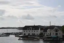
There were six urban settlements, as defined by Statistics Norway, within the border of the municipality. The largest is Hammarsland in northern Sund, with 875 inhabitants as of 2013. The others are Tælavåg, Skogsvåg, Klokkarvik, Forland, and Glesnes.[13]
Government
All municipalities in Norway, including Sund, are responsible for primary education (through 10th grade), outpatient health services, senior citizen services, unemployment and other social services, zoning, economic development, and municipal roads. The municipality is governed by a municipal council of elected representatives, which in turn elect a mayor.[14] The municipality falls under the Bergen District Court and the Gulating Court of Appeal.
Municipal council
The municipal council (Kommunestyre) of Sund is made up of 21 representatives that are elected to four year terms. The party breakdown of the final municipal council was as follows:
| Party Name (in Nynorsk) | Number of representatives | |
|---|---|---|
| Labour Party (Arbeidarpartiet) | 6 | |
| Progress Party (Framstegspartiet) | 3 | |
| Conservative Party (Høgre) | 7 | |
| Christian Democratic Party (Kristeleg Folkeparti) | 1 | |
| Centre Party (Senterpartiet) | 2 | |
| Socialist Left Party (Sosialistisk Venstreparti) | 1 | |
| Liberal Party (Venstre) | 1 | |
| Total number of members: | 21 | |
| Party Name (in Nynorsk) | Number of representatives | |
|---|---|---|
| Labour Party (Arbeidarpartiet) | 5 | |
| Progress Party (Framstegspartiet) | 4 | |
| Conservative Party (Høgre) | 11 | |
| Christian Democratic Party (Kristeleg Folkeparti) | 1 | |
| Centre Party (Senterpartiet) | 2 | |
| Socialist Left Party (Sosialistisk Venstreparti) | 1 | |
| Liberal Party (Venstre) | 1 | |
| Total number of members: | 25 | |
| Party Name (in Nynorsk) | Number of representatives | |
|---|---|---|
| Labour Party (Arbeidarpartiet) | 5 | |
| Progress Party (Framstegspartiet) | 5 | |
| Conservative Party (Høgre) | 10 | |
| Christian Democratic Party (Kristeleg Folkeparti) | 1 | |
| Centre Party (Senterpartiet) | 3 | |
| Liberal Party (Venstre) | 1 | |
| Total number of members: | 25 | |
| Party Name (in Nynorsk) | Number of representatives | |
|---|---|---|
| Labour Party (Arbeidarpartiet) | 6 | |
| Progress Party (Framstegspartiet) | 5 | |
| Conservative Party (Høgre) | 9 | |
| Christian Democratic Party (Kristeleg Folkeparti) | 1 | |
| Centre Party (Senterpartiet) | 2 | |
| Socialist Left Party (Sosialistisk Venstreparti) | 2 | |
| Total number of members: | 25 | |
| Party Name (in Nynorsk) | Number of representatives | |
|---|---|---|
| Labour Party (Arbeidarpartiet) | 7 | |
| Progress Party (Framstegspartiet) | 6 | |
| Conservative Party (Høgre) | 8 | |
| Christian Democratic Party (Kristeleg Folkeparti) | 1 | |
| Centre Party (Senterpartiet) | 2 | |
| Liberal Party (Venstre) | 1 | |
| Total number of members: | 25 | |
| Party Name (in Nynorsk) | Number of representatives | |
|---|---|---|
| Labour Party (Arbeidarpartiet) | 8 | |
| Progress Party (Framstegspartiet) | 4 | |
| Conservative Party (Høgre) | 6 | |
| Christian Democratic Party (Kristeleg Folkeparti) | 1 | |
| Centre Party (Senterpartiet) | 5 | |
| Liberal Party (Venstre) | 1 | |
| Total number of members: | 25 | |
| Party Name (in Nynorsk) | Number of representatives | |
|---|---|---|
| Labour Party (Arbeidarpartiet) | 10 | |
| Progress Party (Framstegspartiet) | 2 | |
| Conservative Party (Høgre) | 8 | |
| Christian Democratic Party (Kristeleg Folkeparti) | 2 | |
| Centre Party (Senterpartiet) | 1 | |
| Liberal Party (Venstre) | 2 | |
| Total number of members: | 25 | |
| Party Name (in Nynorsk) | Number of representatives | |
|---|---|---|
| Labour Party (Arbeidarpartiet) | 11 | |
| Progress Party (Framstegspartiet) | 3 | |
| Conservative Party (Høgre) | 7 | |
| Christian Democratic Party (Kristeleg Folkeparti) | 2 | |
| Liberal Party (Venstre) | 2 | |
| Total number of members: | 25 | |
| Party Name (in Nynorsk) | Number of representatives | |
|---|---|---|
| Labour Party (Arbeidarpartiet) | 7 | |
| Progress Party (Framstegspartiet) | 2 | |
| Conservative Party (Høgre) | 7 | |
| Christian Democratic Party (Kristeleg Folkeparti) | 1 | |
| Liberal Party (Venstre) | 1 | |
| Cross-party list for the Glesvær, Tælavåg, Skogsvåg, and Pollen areas (Tverrpolitisk liste for Glesvær, Tælavåg, Skogsvåg og Pollen krinsar) | 7 | |
| Total number of members: | 25 | |
| Party Name (in Nynorsk) | Number of representatives | |
|---|---|---|
| Labour Party (Arbeidarpartiet) | 3 | |
| Conservative Party (Høgre) | 4 | |
| Christian Democratic Party (Kristeleg Folkeparti) | 2 | |
| Centre Party (Senterpartiet) | 1 | |
| Liberal Party (Venstre) | 1 | |
| Tofterøy and Stranda local list (Tofterøy og Stranda Krinsliste) | 4 | |
| Sund school district list (Sund skulekrins liste) | 2 | |
| Cross-party list for Glesnes, Pollen, and Telavåg (Tverrpolitisk liste for Glesnes, Pollen og Telavåg) | 8 | |
| Total number of members: | 25 | |
| Party Name (in Nynorsk) | Number of representatives | |
|---|---|---|
| Labour Party (Arbeidarpartiet) | 5 | |
| Conservative Party (Høgre) | 7 | |
| Christian Democratic Party (Kristeleg Folkeparti) | 3 | |
| New People's Party (Nye Folkepartiet) | 1 | |
| Centre Party (Senterpartiet) | 1 | |
| Liberal Party (Venstre) | 1 | |
| Pollen local list (Pollen Krinsliste) | 2 | |
| Sund School local list (Sund Skulekrins liste) | 2 | |
| Tofterøy local list (Tofterøy Krinsliste) | 1 | |
| Tælavåg local list (Tælavåg Krinsliste) | 2 | |
| Total number of members: | 25 | |
| Party Name (in Nynorsk) | Number of representatives | |
|---|---|---|
| Labour Party (Arbeidarpartiet) | 7 | |
| Conservative Party (Høgre) | 4 | |
| Christian Democratic Party (Kristeleg Folkeparti) | 2 | |
| Centre Party (Senterpartiet) | 2 | |
| Liberal Party (Venstre) | 5 | |
| Local List(s) (Lokale lister) | 5 | |
| Total number of members: | 25 | |
| Party Name (in Nynorsk) | Number of representatives | |
|---|---|---|
| Labour Party (Arbeidarpartiet) | 3 | |
| Conservative Party (Høgre) | 2 | |
| Christian Democratic Party (Kristeleg Folkeparti) | 2 | |
| Liberal Party (Venstre) | 2 | |
| Local List(s) (Lokale lister) | 8 | |
| Total number of members: | 27 | |
| Party Name (in Nynorsk) | Number of representatives | |
|---|---|---|
| Local List(s) (Lokale lister) | 17 | |
| Total number of members: | 17 | |
| Party Name (in Nynorsk) | Number of representatives | |
|---|---|---|
| Local List(s) (Lokale lister) | 17 | |
| Total number of members: | 17 | |
| Party Name (in Nynorsk) | Number of representatives | |
|---|---|---|
| Local List(s) (Lokale lister) | 17 | |
| Total number of members: | 17 | |
| Party Name (in Nynorsk) | Number of representatives | |
|---|---|---|
| Local List(s) (Lokale lister) | 16 | |
| Total number of members: | 16 | |
| Party Name (in Nynorsk) | Number of representatives | |
|---|---|---|
| Local List(s) (Lokale lister) | 16 | |
| Total number of members: | 16 | |
| Party Name (in Nynorsk) | Number of representatives | |
|---|---|---|
| Christian Democratic Party (Kristeleg Folkeparti) | 2 | |
| List of workers, fishermen, and small farmholders (Arbeidarar, fiskarar, småbrukarar liste) | 2 | |
| Local List(s) (Lokale lister) | 12 | |
| Total number of members: | 16 | |
| Party Name (in Nynorsk) | Number of representatives | |
|---|---|---|
| List of workers, fishermen, and small farmholders (Arbeidarar, fiskarar, småbrukarar liste) | 2 | |
| Local List(s) (Lokale lister) | 7 | |
| Women's list (Kvinnelisten) | 7 | |
| Total number of members: | 16 | |
References
- "Navn på steder og personer: Innbyggjarnamn" (in Norwegian). Språkrådet.
- "Forskrift om målvedtak i kommunar og fylkeskommunar" (in Norwegian). Lovdata.no.
- Statistisk sentralbyrå (2017). "Table: 06913: Population 1 January and population changes during the calendar year (M)" (in Norwegian). Retrieved 2017-10-28.
- Jukvam, Dag (1999). "Historisk oversikt over endringer i kommune- og fylkesinndelingen" (PDF) (in Norwegian). Statistisk sentralbyrå.
- "Vår nye kommune" (in Norwegian). Retrieved 2017-10-28.
- Rygh, Oluf (1910). Norske gaardnavne: Søndre Bergenhus amt (in Norwegian) (11 ed.). Kristiania, Norge: W. C. Fabritius & sønners bogtrikkeri. p. 257.
- "Civic heraldry of Norway - Norske Kommunevåpen". Heraldry of the World. Retrieved 2020-02-08.
- "Kommunevåpen for Sund kommune" (in Norwegian). Sund kommune. Retrieved 2014-12-17.
- "Fastlandssambandet Sotra-Bergen" (in Norwegian). Statens Vegvesen. 2014. Retrieved 2012-12-17.
- Berit Nøkleby. "Telavåg". NorgesLexi (in Norwegian). Archived from the original on 2013-05-29. Retrieved 2008-09-26.
- Eirik Gurandsrud (2005). "Telavåg i tid og rom : Erindringen om et krigsherjet fiskerisamfunn" (PDF) (in Norwegian). University of Bergen. Archived from the original (PDF) on 2007-02-21. Retrieved 2008-09-26.
- Irene K. Melkevik. "Fakta om Sund" (in Norwegian). Sund kommune. Retrieved 2008-09-26.
- "Urban settlements. Population and area, by municipality". Statistics Norway. 1 January 2013. Retrieved 2014-12-17.
- Hansen, Tore, ed. (2016-05-12). "kommunestyre". Store norske leksikon (in Norwegian). Kunnskapsforlaget. Retrieved 2019-04-06.
- "Table: 04813: Members of the local councils, by party/electoral list at the Municipal Council election (M)" (in Norwegian). Statistics Norway.
- "Tall for Norge: Kommunestyrevalg 2011 - Hordaland". Valg Direktoratet. Retrieved 2020-02-02.
- "Kommunestyrevalget 1995" (PDF) (in Norwegian). Oslo-Kongsvinger: Statistisk sentralbyrå. 1996. Retrieved 2020-05-14.
- "Kommunestyrevalget 1991" (PDF) (in Norwegian). Oslo-Kongsvinger: Statistisk sentralbyrå. 1993. Retrieved 2020-05-14.
- "Kommunestyrevalget 1987" (PDF) (in Norwegian). Oslo-Kongsvinger: Statistisk sentralbyrå. 1988. Retrieved 2020-05-14.
- "Kommunestyrevalget 1983" (PDF) (in Norwegian). Oslo-Kongsvinger: Statistisk sentralbyrå. 1984. Retrieved 2020-05-14.
- "Kommunestyrevalget 1979" (PDF) (in Norwegian). Oslo: Statistisk sentralbyrå. 1979. Retrieved 2020-05-14.
- "Kommunevalgene 1975" (PDF) (in Norwegian). Oslo: Statistisk sentralbyrå. 1977. Retrieved 2020-05-14.
- "Kommunevalgene 1972" (PDF) (in Norwegian). Oslo: Statistisk sentralbyrå. 1973. Retrieved 2020-05-14.
- "Kommunevalgene 1967" (PDF) (in Norwegian). Oslo: Statistisk sentralbyrå. 1967. Retrieved 2020-05-14.
- "Kommunevalgene 1963" (PDF) (in Norwegian). Oslo: Statistisk sentralbyrå. 1964. Retrieved 2020-05-14.
- "Kommunevalgene og Ordførervalgene 1959" (PDF) (in Norwegian). Oslo: Statistisk sentralbyrå. 1960. Retrieved 2020-05-14.
- "Kommunevalgene og Ordførervalgene 1955" (PDF) (in Norwegian). Oslo: Statistisk sentralbyrå. 1957. Retrieved 2020-05-14.
- "Kommunevalgene og Ordførervalgene 1951" (PDF) (in Norwegian). Oslo: Statistisk sentralbyrå. 1952. Retrieved 2020-05-14.
- "Kommunevalgene og Ordførervalgene 1947" (PDF) (in Norwegian). Oslo: Statistisk sentralbyrå. 1948. Retrieved 2020-05-14.
- "Kommunevalgene og Ordførervalgene 1945" (PDF) (in Norwegian). Oslo: Statistisk sentralbyrå. 1947. Retrieved 2020-05-14.
- "Kommunevalgene og Ordførervalgene 1937" (PDF) (in Norwegian). Oslo: Statistisk sentralbyrå. 1938. Retrieved 2020-05-14.
External links
| Wikimedia Commons has media related to Sund, Hordaland. |
- Municipal fact sheet from Statistics Norway (in Norwegian)
 |
|  | |||
| Authority control |
|---|