Tōkai, Aichi
Tōkai (東海市, Tōkai-shi) is a city located in Aichi Prefecture, Japan. As of 1 October 2019, the city had an estimated population of 113,698 in 51,035 households,[1] and a population density of 2,618 persons per km². The total area of the city was 43.43 square kilometres (16.77 sq mi).
Tōkai
東海市 | |
|---|---|
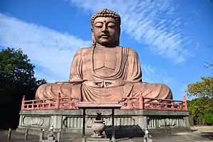 1%252C_Toyoake_2010.JPG.webp) Upper stage:Amida Buddha(Shurakuen Park) Lower stage:Nagoya iron and steel works | |
 Flag  Seal | |
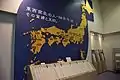
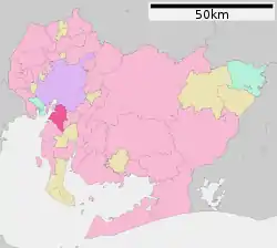 Location of Tōkai in Aichi Prefecture | |
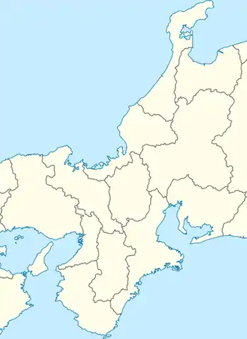 Tōkai Location in the Kansai region  Tōkai | |
| Coordinates: 35°01′23″N 136°54′7.9″E | |
| Country | Japan |
| Region | Chūbu (Tōkai) |
| Prefecture | Aichi |
| Government | |
| • Mayor | Atsuo Suzuki |
| Area | |
| • Total | 43.43 km2 (16.77 sq mi) |
| Population (October 1, 2019) | |
| • Total | 113,698 |
| • Density | 2,600/km2 (6,800/sq mi) |
| Time zone | UTC+9 (Japan Standard Time) |
| - Tree | Camphor laurel |
| - Flower | Satsuki azalea |
| Phone number | 052-603-2211, 0562-33-1111 |
| Address | 1-1, Chūōmachi, Tōkai-shi, Aichi-ken 476-8601 |
| Website | Official website |
Geography
Tōkai is located in the far northwestern neck of Chita Peninsula in southern Aichi Prefecture, and is bordered by Ise Bay to the east, and the metropolis of Nagoya to the north. It extends 8.06 kilometers from east to west and 10.97 kilometers from north to south. Much of the city is near sea level in altitude.
Demographics
Per Japanese census data,[2] the population of Tōkai greatly expanded in the 1960s, and has continued to grow at a reduced rate from that period over the past 50 years.
| Year | Pop. | ±% |
|---|---|---|
| 1940 | 22,512 | — |
| 1950 | 29,888 | +32.8% |
| 1960 | 33,965 | +13.6% |
| 1970 | 86,608 | +155.0% |
| 1980 | 96,048 | +10.9% |
| 1990 | 97,358 | +1.4% |
| 2000 | 99,921 | +2.6% |
| 2010 | 107,704 | +7.8% |
Climate
The city has a climate characterized by hot and humid summers, and relatively mild winters (Köppen climate classification Cfa). The average annual temperature in Tōkai is 15.7 °C. The average annual rainfall is 1730 mm with September as the wettest month. The temperatures are highest on average in August, at around 27.9 °C, and lowest in January, at around 4.5 °C.[3]
| Climate data for Tōkai (1981-2010) | |||||||||||||
|---|---|---|---|---|---|---|---|---|---|---|---|---|---|
| Month | Jan | Feb | Mar | Apr | May | Jun | Jul | Aug | Sep | Oct | Nov | Dec | Year |
| Record high °C (°F) | 16.8 (62.2) |
20.2 (68.4) |
24.9 (76.8) |
29.9 (85.8) |
32.3 (90.1) |
36.2 (97.2) |
38.7 (101.7) |
39.2 (102.6) |
38.8 (101.8) |
30.1 (86.2) |
26.1 (79.0) |
21.3 (70.3) |
39.2 (102.6) |
| Average high °C (°F) | 9.5 (49.1) |
10.5 (50.9) |
14.1 (57.4) |
20.1 (68.2) |
24.3 (75.7) |
27.4 (81.3) |
31.2 (88.2) |
32.9 (91.2) |
28.6 (83.5) |
23.3 (73.9) |
17.6 (63.7) |
12.2 (54.0) |
21.0 (69.8) |
| Daily mean °C (°F) | 4.9 (40.8) |
5.6 (42.1) |
8.9 (48.0) |
14.4 (57.9) |
18.9 (66.0) |
22.6 (72.7) |
26.4 (79.5) |
27.8 (82.0) |
24.2 (75.6) |
18.3 (64.9) |
12.5 (54.5) |
7.3 (45.1) |
16.0 (60.8) |
| Average low °C (°F) | 0.7 (33.3) |
1.2 (34.2) |
4.1 (39.4) |
9.2 (48.6) |
14.0 (57.2) |
18.6 (65.5) |
22.7 (72.9) |
23.9 (75.0) |
20.4 (68.7) |
14.1 (57.4) |
8.0 (46.4) |
2.8 (37.0) |
11.7 (53.1) |
| Record low °C (°F) | −6.3 (20.7) |
−6.2 (20.8) |
−3.5 (25.7) |
−0.2 (31.6) |
5.8 (42.4) |
11.9 (53.4) |
16.6 (61.9) |
16.6 (61.9) |
11.1 (52.0) |
4.0 (39.2) |
−0.8 (30.6) |
−3.7 (25.3) |
−6.3 (20.7) |
| Average precipitation mm (inches) | 45.7 (1.80) |
62.0 (2.44) |
114.5 (4.51) |
123.5 (4.86) |
149.9 (5.90) |
200.5 (7.89) |
173.9 (6.85) |
119.7 (4.71) |
236.7 (9.32) |
137.9 (5.43) |
82.2 (3.24) |
43.2 (1.70) |
1,489.6 (58.65) |
| Mean monthly sunshine hours | 157.6 | 163.6 | 186.5 | 197.0 | 183.8 | 144.4 | 164.6 | 208.9 | 158.5 | 164.8 | 156.1 | 161.9 | 2,052.1 |
| Source: Japan Meteorological Agency[4] | |||||||||||||
History
During the Edo period, the area around Tōkai consisted of a number of fishing settlements and was governed as part of Owari Domain under the Tokugawa shogunate. With the establishment of the modern municipalities system after the start of the Meiji period, the area was organized into a number of villages within Chita District, Aichi. The city of Tōkai was established on April 1, 1969 through the merger of the former towns of Yokosuka and Ueno within Chita District.
Government

Tōkai has a mayor-council form of government with a directly elected mayor and a unicameral city legislature of 22 members. The city contributes two members to the Aichi Prefectural Assembly. In terms of national politics, the city is part of Aichi District 8 of the lower house of the Diet of Japan.
Economy
Tōkai has a strong industrial base along its coastline, dominated by a large steel mill owned by Nippon Steel and by Aichi Steel, which has its headquarters and three manufacturing plants in the city.[5]
Education

Colleges and Universities
- Seijoh University
- Nihon Fukushi University – Tokai campus
Schools
- Tōkai has twelve public elementary schools and six public middle schools operated by the city government and three public high schools operated by the Aichi Prefectural Board of Education.
Transportation
Railways
Highways
.png.webp) Isewangan Expressway
Isewangan Expressway.png.webp) Chitahantō Road (no interchange)
Chitahantō Road (no interchange) Route 4 (Nagoya Expressway)
 National Route 155
 National Route 247
 National Route 302

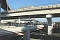 Tōkai JCT
 Tōkai-shimpo Entrance
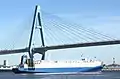 Meiko East Big Bridge
Sister city relations
 – Yonezawa, Yamagata, Japan, since October 20, 1999
- – Kamaishi, Iwate, Japan, since March 24, 2007
- – Okinawa, Okinawa, Japan, since November 20, 2009
 – Nilüfer, Turkey,[6] since May 10, 2007
.svg.png.webp) – Shire of Macedon Ranges, Victoria, Australia[6] since October 16, 2014
– Shire of Macedon Ranges, Victoria, Australia[6] since October 16, 2014
Local attractions
Tourist attraction
- Temples
- Gyokurin-ji
- Kanpuku-ji
- Miroku-ji
 Gyokurin-ji
 Kanpuku-ji
_(2016.10.02).jpg.webp) Miroku-ji
Miroku-ji
- Parks
- Shurakuen Park
- Oike Park
- Museums
- GAS ENERGY EXHIBIT HALL
- Heisyu Memorial Hall
- KAGOME Memorial Hall
- The Reverend Mr.ICHITAROU TOMATO Memorial Hall
 Heisyu Memorial Hall
 KAGOME Memorial Hall
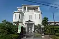 TOMATO Memorial Hall
Festivals
- Ōta Festival
- Owari-Yokosuka Matsuri
 Ōta Festival
 Owari-Yokosuka Matsuri
Notable people from Tōkai
- Kamakichi Kishinouye, biologist
- Tomohiro Kondo, professional golfer
- Dragon Kid, professional wrestler
References
- TōkaiCity official statistics (in Japanese)
- Tōkai population statistics
- Tōkai climate data
- "東海 1981-2010年". JMA. Retrieved 2016-07-14.
- "Business Locations — Production locations." Aichi Steel. Retrieved on May 25, 2018.
- "International Exchange". List of Affiliation Partners within Prefectures. Council of Local Authorities for International Relations (CLAIR). Archived from the original on 24 December 2015. Retrieved 21 November 2015.
External links
| Wikimedia Commons has media related to Tokai, Aichi. |
- Official website (in Japanese)
| Nagoya |
| |||
|---|---|---|---|---|
| Core cities | ||||
| Special cities | ||||
| Cities | ||||
| Districts | ||||
| Authority control |
|---|