Taft, Louisiana
Taft is a census-designated place (CDP) in St. Charles Parish, Louisiana, United States, located on the west bank of the Mississippi River. According to the 2000 census, Taft had a total population of zero.
Taft | |
|---|---|
 Taft Location of Taft in Louisiana | |
| Coordinates: 29°59′29″N 90°26′53″W | |
| Country | United States |
| State | Louisiana |
| Parish | St. Charles |
| Area | |
| • Total | 2.0 sq mi (5 km2) |
| • Land | 1.7 sq mi (4 km2) |
| • Water | 0.3 sq mi (0.8 km2) |
| Elevation | 13 ft (4 m) |
| Population (2000) | |
| • Total | 0 |
| • Density | 0.0/sq mi (0.0/km2) |
| Time zone | UTC-6 (CST) |
| • Summer (DST) | UTC-5 (CDT) |
| Area code(s) | 985 |
History
Taft is the location of a phosphate mining facility owned by IMC-Agrico, the Union Carbide Taft/Star Petrochemical Plant, which produces a variety of organic chemicals such as acrolein, Acrylic acid, and acetaldehyde, and part of the Waterford Nuclear Generating Station owned by Entergy Corporation.
Taft was the original site of Our Lady of the Holy Rosary Catholic Church, which served Taft, Killona and Hahnville. The church was built in 1877, and in 1963, it moved to Hahnville. The cemetery is still in Taft and is still used as a burial ground by the church.
Population was 700 when the first post office opened in 1905,which remained in operation until 1967. By 1977, only 36 people lived in Taft.[1]
A major explosion occurred at Union Carbide facility about 30 miles from New Orleans in December 1982 causing somewhere under 17,000 people to evacuate.[2][3]
Geography
According to the United States Census Bureau, the CDP has a total area of 2.0 square miles (5.2 km2), of which 1.7 square miles (4.4 km2) is land and 0.3 square miles (0.78 km2) is water. The CDP is located on the Mississippi River.
References
- "Town Histories | St. Charles Parish, LA". www.stcharlesparish-la.gov. L'Observateur. January 2000. Retrieved 2020-10-09.
- "EVACUATION BEHAVIOR: CASE STUDY OF THE TAFT, LOUISIANA CHEMICAL TANK EXPLOSION INCIDENT" (PDF). Columbus, Ohio: Defense Technical Information Center. May 1983.
- Marcus, Frances (1982-12-12). "20,000 FLEE LOUISIANA AREA AFTER CHEMICAL PLANT BLAST (Published 1982)". The New York Times. ISSN 0362-4331. Retrieved 2020-10-09.
- "U.S. Census website". United States Census Bureau. Retrieved 2008-01-31.
External links
Municipalities and communities of St. Charles Parish, Louisiana, United States | ||
|---|---|---|
| CDPs | 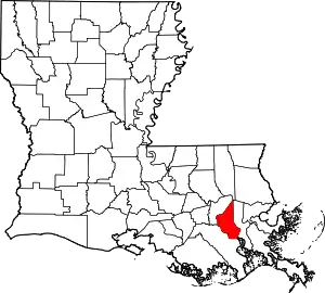 | |
| Other Unincorporated communities | ||
| Footnotes | ‡This populated place also has portions in an adjacent parish or parishes | |
| ||