Des Allemands, Louisiana
Des Allemands is an unincorporated community and census-designated place (CDP) in Lafourche and St. Charles parishes in the southeastern part of the U.S. state of Louisiana. The population was 2,505 at the 2010 census.[1] The town, known as the "Catfish Capital of the Universe", is along the Bayou des Allemands, which is the boundary of Lafourche and St. Charles parishes. Lac des Allemands is located northwest of the town. The ZIP code for Des Allemands is 70030.
Des Allemands, Louisiana
"The Germans" | |
|---|---|
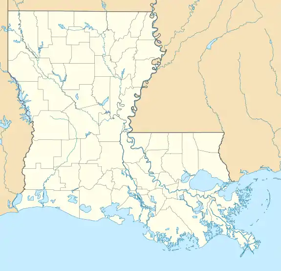
 Des Allemands on the Bayou des Allemands. View to the north. | |
| Nickname(s): "Catfish Capital of the Universe" | |
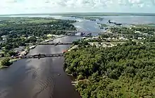
 Des Allemands Location in Louisiana  Des Allemands Location in the United States | |
| Coordinates: 29°49′32″N 90°28′09″W | |
| Country | United States |
| State | Louisiana |
| Parishes | Lafourche, St. Charles |
| Area | |
| • Total | 12.24 sq mi (31.69 km2) |
| • Land | 9.95 sq mi (25.77 km2) |
| • Water | 2.29 sq mi (5.92 km2) |
| Elevation | 3 ft (0.9 m) |
| Population (2010) | |
| • Total | 2,505 |
| • Density | 252/sq mi (97.2/km2) |
| Time zone | UTC-6 (CST) |
| • Summer (DST) | UTC-5 (CDT) |
| ZIP Code | 70030 |
| Area code(s) | 985 |
| FIPS code | 22-20680 |
The St. Charles Parish portion of Des Allemands is part of the New Orleans Metropolitan Statistical Area, while the Lafourche Parish portion is part of the Houma–Bayou Cane–Thibodaux Metropolitan Statistical Area.
History
Des Allemands was settled in 1721 by immigrants to the colony of Louisiana from Alsace and Lorraine under the control of John Law and the Company of the Indies. Des Allemands means "of the Germans" (partitive case) in French.
The German Louisiana colony was originally up the Mississippi River at the Arkansas Post. But they experienced hostility from the Native Americans in that area, and moved to a location much closer to the colonial capital of New Orleans.
Geography
Des Allemands is located in southern St. Charles Parish and northeastern Lafourche Parish at 29°49′32″N 90°28′9″W (29.825570, -90.469163).[2] It is bordered to the north by the Paradis CDP and to the southeast by the Bayou Gauche CDP.
U.S. Route 90 crosses Bayou des Allemands at this point; the four-lane highway leads northeast 34 miles (55 km) to New Orleans and west 51 miles (82 km) to Morgan City. Bayou Des Allemands runs northwest 5 miles (8 km) to Lac des Allemands and southeast 13 miles (21 km) to Lake Salvador.
According to the United States Census Bureau, the Des Allemands CDP has a total area of 12.2 square miles (31.7 km2), of which 10.0 square miles (25.8 km2) are land and 2.3 square miles (5.9 km2), or 18.68%, are water.[3]
Demographics
As of the census[4] of 2000, there were 2,500 people, 943 households, and 714 families residing in the CDP. The population density was 287.6 people per square mile (111.1/km2). There were 1,020 housing units at an average density of 117.3 per square mile (45.3/km2). The racial makeup of the CDP was 86.88% White, 10.44% African American, 0.28% Native American, 0.16% Asian, 0.04% Pacific Islander, 0.84% from other races, and 1.36% from two or more races. Hispanic or Latino of any race were 2.48% of the population.
There were 943 households, out of which 32.4% had children under the age of 18 living with them, 58.4% were married couples living together, 11.1% had a female householder with no husband present, and 24.2% were non-families. 20.1% of all households were made up of individuals, and 8.5% had someone living alone who was 65 years of age or older. The average household size was 2.65 and the average family size was 3.03.
In the CDP, the population was spread out, with 26.0% under the age of 18, 8.6% from 18 to 24, 28.4% from 25 to 44, 23.8% from 45 to 64, and 13.2% who were 65 years of age or older. The median age was 36 years. For every 100 females, there were 95.2 males. For every 100 females age 18 and over, there were 94.0 males.
The median income for a household in the CDP was $27,908, and the median income for a family was $32,946. Males had a median income of $33,125 versus $21,433 for females. The per capita income for the CDP was $15,306. About 16.2% of families and 21.4% of the population were below the poverty line, including 31.3% of those under age 18 and 21.9% of those age 65 or over.
Education
St. Charles Parish Public School System serves parts of Des Allemands east of Bayou Des Allemands. Allemands Elementary School in Des Allemands serves grades PK-2, while R.J. Vial Elementary School in Paradis serves grades 3-5; Vial opened in 1975.[5] J. B. Martin Middle School in Paradis serves grades 6-8,[6] and Hahnville High School in Boutte serves 9-12.[7]
Residents of Des Allemands west of Bayou Des Allemands attend Lafourche Parish Public Schools. People in the Bayou Des Allemands area of Lafourche Parish are zoned to Raceland Lower Elementary School, Raceland Upper Elementary School, Raceland Middle School (all in Raceland), and Central Lafourche High School in Mathews.[8][9]
Festivals
- Hosts the Louisiana Catfish Festival on the third weekend in June.
- Hosts a small parade in conjunction with Mardi Gras season.
See also
| Wikimedia Commons has media related to Des Allemands, Louisiana. |
- Live and Let Die: The motor boat chase scene in Roger Moore's debut James Bond movie was filmed in Bayou Des Allemands.
References
- "Total Population: 2010 Census DEC Summary File 1 (P1), Des Allemands CDP, Louisiana". data.census.gov. U.S. Census Bureau. Retrieved February 21, 2020.
- "US Gazetteer files: 2010, 2000, and 1990". United States Census Bureau. 2011-02-12. Retrieved 2011-04-23.
- "U.S. Gazetteer Files: 2019: Places: Louisiana". U.S. Census Bureau Geography Division. Retrieved February 21, 2020.
- "U.S. Census website". United States Census Bureau. Retrieved 2008-01-31.
- Home. R.J. Vial Elementary School. Retrieved on December 3, 2016. "R. J. Vial Elementary School, home of the Jaguars, was established in 1975 and has served the communities of Paradis, Bayou Gauche, Des Allemands, and Boutte for more than 40 years."
- "About Our School." J. B. Martin Middle School. Retrieved on December 3, 2016. "J. B. Martin Middle School is located on South Street in Paradis and services the west bank areas of Paradis, Des Allemands (Bayou Gauche), Boutte, and Luling (Mimosa/Willowdale)."
- "Hahnville High School" (Archive). AdvancED. p. 4/9. Retrieved on December 3, 2016. "Hahnville High School services all students on the west bank of the Mississippi River in St. Charles Parish, including the communities of Ama, Boutte, Hahnville, Luling, Paradis, Des Allemands and Killona."
- "SCHOOL ATTENDANCE BOUNDARIES." Lafourche Parish Public Schools. Retrieved on December 2, 2016. See text descriptions of boundaries. The page states: "Students who reside in the Des Allemands area on the west side of Bayou Des Allemands will attend Lafourche Parish schools."
- "2010 CENSUS - CENSUS BLOCK MAP (INDEX): Des Allemands CDP, LA." U.S. Census Bureau. Retrieved on November 29, 2016. Pages: 1, 2, 3.
External links
Municipalities and communities of Lafourche Parish, Louisiana, United States | ||
|---|---|---|
| City | 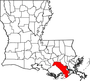 | |
| Towns | ||
| CDPs | ||
| Other Unincorporated communities | ||
| Footnotes | ‡This populated place also has portions in an adjacent parish or parishes | |
| ||
Municipalities and communities of St. Charles Parish, Louisiana, United States | ||
|---|---|---|
| CDPs | 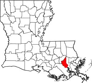 | |
| Other Unincorporated communities | ||
| Footnotes | ‡This populated place also has portions in an adjacent parish or parishes | |
| ||
| Authority control |
|---|