Tamale, Ghana
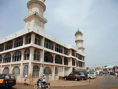
Tamale (Dagbani : [ˈtamalɛ]), officially called Tamale Metropolitan Area is the fastest growing city in West Africa. It is the capital city of the Northern Region of Ghana. The city is a current hotspot for investment in the West African sub-region. It is stable, peaceful and presents limitless opportunities for potential investors. The people of the city are known for their unique hospitality and friendliness. Tamale is Ghana's third-largest city. It has a projected population of 950,124 according to the Tamale Metropolitan Assembly Official Website. It is the fastest-growing city in West Africa.[2][3] The city is located 600 km (370 mi) north of Accra.[4] Most residents of Tamale are Muslims, as reflected by the multitude of mosques in Tamale, most notably the Central Mosque, Afa Ajura Mosque( Ambariyyah Mosque), and The Ahmadiyyah Muslim mission Mosque.
Tamale | |
|---|---|
Major City | |
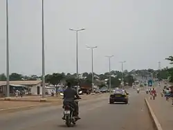
 Road in Tamale, Northern Region. | |
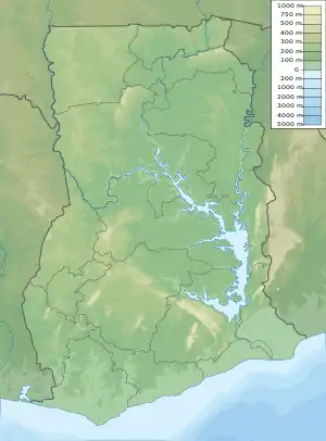 Tamale Location of Tamale in Northern region, Dagbon  Tamale Tamale (Africa) | |
| Coordinates: 09°24′27″N 00°51′12″W | |
| Country | |
| Region | Northern Region |
| District | Tamale Metropolitan District |
| Government | |
| • Type | Mayor-City Assembly |
| • Mayor–council | Musa Superior |
| Area | |
| • Total | 750 km2 (289.58 sq mi) |
| Elevation | 151 m (495 ft) |
| Population (2010) | |
| • Total | 950,124 |
| • Density | 480.77/km2 (1,245.18/sq mi) |
| Time zone | UTC |
| Postal codes | NT0000 - NT2701 |
| Area code(s) | 037 |
| Website | tamale.ghanadistricts.gov.gh |
Tamale is located in the Northern Region and more precisely in the Kingdom of Dagbon. The local (neighbourhood) chiefs and the district chief of Tamale are subservient to the Dagomba King in Yendi.The language of the people is Dagbani.
Due to its central location, Tamale serves as a hub for all administrative and commercial activities in the Northern Region, doubling as the political, economic and financial capital of the Northern Region. The centre of Tamale hosts regional branches of financial institutions and a considerable number of international nongovernmental organisations.[5]
Tamale has developed and transformed significantly in the last few years.[6] The new dimension of Tamale's development is the rush by various companies to open branches in Tamale. The hospitality industry has grown significantly, with new hotels and guest houses built around Tamale.[7] Tamale grew from a conglomeration of towns where one could find an architectural blend of traditional mud houses and more modern buildings. Tamale's new and modern facilities include the newly constructed Tamale Stadium (now Aliu Mahama sports Stadium named after late Ghana's vice-president, Alhaji Aliu Mahama), replacing the town's former principal football pitch, Kaladan Park, with a world-class venue. Indeed, many improvements to Tamale's infrastructure occurred in the period leading up to the 2008 African Cup of Nations tournament. Further improvements were made, particularly to Tamale's road system.[7] The Tamale sports stadium was renamed after the late Vice president, Alhaji Aliu Mahama in the year 2018. Upon arriving in the city, one will be quick to notice that the roads of the city are occupied with motorcycles with "mapukas" being the most patronised. This, however, does not interfere with the steady smooth flow of traffic on the major roads of the city.
History
Tamale is located on the crossing of three ancient trade routes; it started to grow as a commercial centre for the Northern region centuries ago. The north–south road from Paga and Bolgatanga to Salaga had raiders passing, whilst other merchants brought their goods into Tamale. Salt came from Daboya, to the north-west of Tamale, and followed a road that continued to Yendi. A third road linked Gushegu to the capital of the Gonja kingdom, Damongo. The present locations of the central market and the palace of the Gulkpe naa,[8] opposite Barclays Bank and near the library, mark the junctions of the ancient roads.
Around this palace, a residential neighbourhood began to grow. It is now known as Dagbangdabi-Fong (the name means "Traditional men area"). This was followed by Changli, Belipiela, and BuglanaFong ("Fetish Priest's area") further to the south. Each neighbourhood got its own local chief. As the distances to the market place grew, people started to settle elsewhere around the crossing, so the quarters of Tishigu and Abu-Abu came up. An influx of northerners from present-day Burkina Faso led to the building of Moshi Zongo. In the same time, the remote village of Vitteng came into existence.
Garden cities were brought to Tamale and at the back of Sakasaka grew Kalpohin Estates, even now a pleasant neighbourhood with plenty trees, big gardens, and small houses. In the 1970s, urban extensions such as Zogbeli, Lamakara, and Lamashegu were built, neighbourhoods characterised by checkboard planning of square house plots and orthogonal streets and alleys. Since 2000, Tamale seems to have grown more rapidly, so the whole district of Tamale is now urban agglomeration.
Climate
Tamale features a tropical wet and dry climate under the Köppen's climate classification. The metropolis experiences one rainy season from April to September or October, with a peak in July and August. The mean annual rainfall is 1100 mm within 95 days of rainfall in the form of tropical showers. Consequently, staple crop farming is highly restricted by the short rainy season.
The dry season is usually from November to early April. It is influenced by the dry north-easterly (Harmattan) winds, while the rainy season is influenced by the moist south-westerly winds. The mean daytime temperatures range from 28 (December and mid-April) to 43 (March, early April) degrees Celsius, while mean nighttime temperatures range from 18 (December) to 25 (February, March) degrees Celsius. The mean annual daily sunshine is about 7.5 hours.
| Climate data for Tamale | |||||||||||||
|---|---|---|---|---|---|---|---|---|---|---|---|---|---|
| Month | Jan | Feb | Mar | Apr | May | Jun | Jul | Aug | Sep | Oct | Nov | Dec | Year |
| Record high °C (°F) | 40.0 (104.0) |
41.5 (106.7) |
42.7 (108.9) |
42.8 (109.0) |
40.2 (104.4) |
37.8 (100.0) |
35.6 (96.1) |
35.4 (95.7) |
34.8 (94.6) |
38.2 (100.8) |
39.2 (102.6) |
38.6 (101.5) |
42.8 (109.0) |
| Average high °C (°F) | 35.4 (95.7) |
36.9 (98.4) |
37.1 (98.8) |
35.4 (95.7) |
33.6 (92.5) |
31.1 (88.0) |
29.8 (85.6) |
29.2 (84.6) |
29.9 (85.8) |
32.2 (90.0) |
34.8 (94.6) |
34.9 (94.8) |
33.4 (92.1) |
| Daily mean °C (°F) | 27.9 (82.2) |
30.1 (86.2) |
30.9 (87.6) |
29.8 (85.6) |
28.6 (83.5) |
26.8 (80.2) |
26.0 (78.8) |
25.8 (78.4) |
25.9 (78.6) |
27.3 (81.1) |
28.2 (82.8) |
27.5 (81.5) |
27.9 (82.2) |
| Average low °C (°F) | 20.4 (68.7) |
22.8 (73.0) |
24.6 (76.3) |
24.6 (76.3) |
23.6 (74.5) |
22.5 (72.5) |
22.1 (71.8) |
21.9 (71.4) |
21.8 (71.2) |
21.9 (71.4) |
21.6 (70.9) |
20.3 (68.5) |
22.3 (72.1) |
| Record low °C (°F) | 15.0 (59.0) |
16.1 (61.0) |
18.9 (66.0) |
19.4 (66.9) |
18.9 (66.0) |
18.9 (66.0) |
18.3 (64.9) |
18.9 (66.0) |
18.9 (66.0) |
18.9 (66.0) |
16.1 (61.0) |
13.9 (57.0) |
13.9 (57.0) |
| Average precipitation mm (inches) | 4 (0.2) |
12 (0.5) |
48 (1.9) |
88 (3.5) |
112 (4.4) |
146 (5.7) |
142 (5.6) |
198 (7.8) |
231 (9.1) |
92 (3.6) |
14 (0.6) |
3 (0.1) |
1,090 (42.9) |
| Average precipitation days (≥ 0.3 mm) | 1 | 1 | 4 | 7 | 10 | 12 | 13 | 15 | 19 | 12 | 2 | 1 | 97 |
| Average relative humidity (%) | 27 | 32 | 45 | 61 | 70 | 77 | 80 | 79 | 80 | 74 | 59 | 40 | 60 |
| Mean monthly sunshine hours | 266.6 | 237.3 | 251.1 | 231.0 | 248.0 | 204.0 | 161.2 | 139.5 | 156.0 | 260.4 | 282.0 | 272.8 | 2,709.9 |
| Mean daily sunshine hours | 8.6 | 8.4 | 8.1 | 7.7 | 8.0 | 6.8 | 5.2 | 4.5 | 5.2 | 8.4 | 9.4 | 8.8 | 7.4 |
| Source: Deutscher Wetterdienst[9] | |||||||||||||
Government
.jpg.webp)
Tamale has a mayor–council government system in which the mayor is vested with extensive executive powers. The mayor is appointed by the Ghana president and approved by the town council, the Tamale Metropolitan Assembly, although suggestions have been made by the residents of Tamale to increase accountability of the office by having the mayor elected. The current mayor of Tamale is Hon. Iddrisu Musah Superior. The name Tamale Metropolitan Assembly serves both for the local parliament and for the local executive. Local policies are always executed in this name, so for example, illegal constructions often show the command "remove by TMA" (meaning that the Tamale Metropolitan Assembly or its executive has ordered to remove the building as it is contrary to current urban land-use planning). As the local executive, Tamale Metropolitan Assembly is the strong arm of the mayor, his or her civil service. If mention is made of assembly women or men, however, the reference is to the elected representatives of the inhabitants of Tamale. They form the assembly properly speaking, and must decide about local by-laws before they can come into force. The name "Tamale Metropolitan District" is used in the geographical sense, to refer to the area within its borders.
Education
_in_Tamale.jpg.webp)
Tamale is the principal centre of education in Northern Ghana. Currently, a total of 742 basic schools are within the metropolis. This comprises 94 kindergartens, 304 primary, 112 junior high, and 14 senior high schools. The rest are technical/vocational institutions, two colleges of education, a technical university and two other universities – one public and the other private.[6]
In the Education Ridge neighbourhood in the north-western part of the town and covering an area around 3 km2, 20 schools ranging from kindergartens through junior high and senior high schools, teachers' training colleges, the Tamale Technical University, and a university are located. The numerous trees lining the streets in this part of the town give it a tropical rainforest outlook. The University for Development Studies (UDS) has two campuses located in Tamale and one in nearby Nyankpala. The headquarters of the UDS is also located in Tamale.[10]
List of senior high schools
- Tamale Senior High School
- Ghana Senior High School
- Northern School of Business
- Business Senior High School
- Tamale Girls Senior High School
- Viting Senior High School
- Kalpohin Senior High School
- Tamale Islamic Science Senior High School
- St Charles Senior High School
- Adventist Senior High School
- Presbyterian Senior High School
- Business College International
- Tamale Girls International School
- Ambariya Senior High School
- Dabokpa Technical and Vocational School
- T- Poly Senior High School
- Abubakar Al-sadiq Senior High School
List of Places in Tamale
- Aliu Mahama Sports Stadium
- Kaladan Sports Stadium
- The Dakpema Palace
- Cultural Centre
- Northern Regional Library
- Tamale Tindana (Buglana) Palace
Overlord of Dagbon
Naa Mahama Abubakari installed in 2019.
Transportation
Tamale is served by Tamale Airport. Located about 11 km (6 nmi; 7 mi) from downtown Tamale, the airport is mainly used by commercial airlines such as Africa World Airlines and Passion Air (the only operational companies currently) as well as Starbow Airlines and Antrak Air, which run regular flights between Tamale and Accra's Kotoka International Airport, along with other regional capitals.[12]
Public transportation in the form of taxis used to be the most convenient means of getting around Tamale for visitors to the town until the arrival of the Tri-cycles, popularly called "Mahama-Cambuu". Mahama Cambuu is a coined name by the local people from the expression "Mahama can do". This is because these Tri-cycles (mostly yellow in color) came in the era of the former president, H.E John Dramani Mahama. It is comparatively cheaper than the Taxis and usually on the move unlike the Taxis that are regularized and stationed at a points. It is however, not very safe compared to the Taxis. The popular means of travel for the locals, however, is by motorbike. This phenomenon is helped by the existence of bike paths in the town, making it one of the most bike-friendly settlements in the Northern region. Transportation out of town is facilitated by the Tamale's bus rapid transit system, tro-tro private mini-bus system, MetroMass Bus-Based Mass Transit system, and STC Bus Lines, along with a host of charter bus companies, all of which provide transport to connect Tamale with the many other surrounding towns and cities.
Gallery
Road view in Tamale 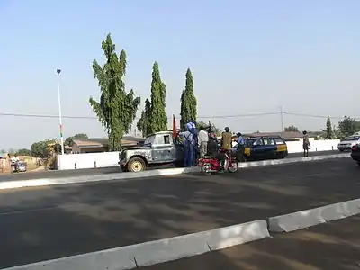
Highway view in Tamale 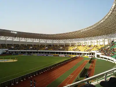
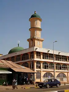
Tamale Central Mosque, downtown 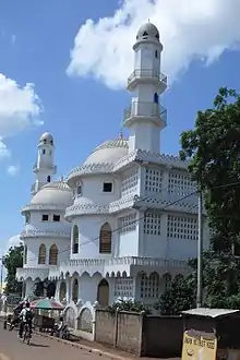
Ahmadiyya Muslim Mosque 
Agriculture Factory in Tamale 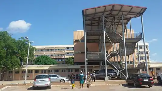
Sister cities
Tamale has sister city relations with:
| City | Country | Date | Reference |
|---|---|---|---|
| United States | 1979 | [13] | |
| Burkina Faso | 2003 | [14] | |
| Niger | 2007 | [15] |
Notable people
- Mubarak Wakaso (born 1990), professional footballer
- Haruna Iddrisu (born 1970), Member of Parliament for Tamale South and the former Minister for Employment and Labour Relations in Ghana, Minority leader of Parliament[16]
- Abdul Majeed Waris (born 1991), professional footballer[17]
- Fancy Gadam (born 1988), Afro-pop and dancehall artiste[18]
- Alhassan Yahaya Seini, barrister and director of the Legal Aid Commission
See also
- Regions of Ghana
- Kingdom of Dagbon (Northern Territories)
References
- "Location & Size". Ghanadistricts.com. Archived from the original on 11 July 2011. Retrieved 24 August 2010.
- GhanaWeb.com ghanaweb.com
- "The largest cities in Ghana, ranked by population". Mongabay.com. 2013. Retrieved 1 May 2014.
- Tamale, Northern Region (Ghana). icli.nl.
- Tamale, capital of Northern region, Ghana. ghana-net.com.
- Tamale Children's Home Tamale, Northern Region (Ghana). catointl.org
- Tamale metropolitan
- The Gulkpe naa is one of the seven district chiefs in the Dagbon; in rank directly under the Paramount Chief, he overlooks the local chiefs in and around Tamale.
- "Klimatafel von Tamales / Ghana" (PDF). Baseline climate means (1961-1990) from stations all over the world (in German). Deutscher Wetterdienst. Retrieved 18 October 2016.
- Introduction to Tamale and the Northern Region. sclou.org.
- I), Electronic Technologies Consult (Eric Robertson Yaw. "Home". NORSAAC. Retrieved 13 December 2019.
- Tamale Airport Listings. Ghanapedia.
- Sister City International Listings – Directory Search Results – Tamale, Ghana Archived 31 August 2010 at the Wayback Machine. sister-cities.org.
- Tamale establishes links with sister city in Burkina-Faso. ghanaweb.com. 31 December 2003.
- TAMALE : Sister city relations should improve trade and investments Archived 14 July 2011 at the Wayback Machine. ndn.nigeriadailynews.com. 2 July 2007.
- "Hon. Iddrisu Haruna". Parliament of Ghana.
- "Abdul Majeed Waris". Right to Dream. Retrieved 18 September 2020.
- "Fancy Gadam,". mobile.ghanaweb.com. Retrieved 18 September 2020.
External links
| Wikivoyage has a travel guide for Tamale. |
- Official website of the Tamale Metropolitan Assembly
- Official Tamale Senior High Page
- Official UDS website

