Taupiri
Taupiri is a small town of about 450 people on the eastern bank of the Waikato River in the Waikato District of New Zealand. It is overlooked by Taupiri mountain, the sacred burial ground for the Waikato tribes of the Māori people, located just to the north.
Taupiri | |
|---|---|
Town | |
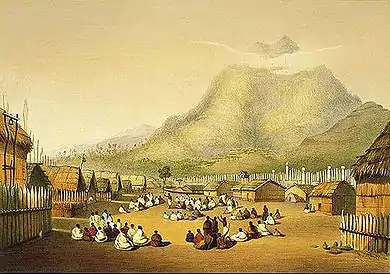
 2010 view of Taupiri and the Waikato, with Kakepuku and Mount Pirongia in the background | |

| |
| Population | |
| • Total | 450 (estimate) |
Taupiri is located near the northern end of the Waikato Basin immediately south of the junction of the Mangawara Stream (which drains the northern part of the basin) and the Waikato River. The Waikato River then flows northward through the Taupiri Gorge between the Hākarimata Range to the south and the Taupiri Range to the north, into the Lower Waikato.
The North Island Main Trunk railway line runs through the town and the gorge, linking Huntly 8 kilometres to the north and Ngāruawāhia 7 kilometres to the south. State Highway 1 also ran through the town until the Huntly Bypass opened in March 2020.[1]
Demographics
| Year | Pop. | ±% p.a. |
|---|---|---|
| 2006 | 1,752 | — |
| 2013 | 1,935 | +1.43% |
| 2018 | 2,220 | +2.79% |
| Source: [2] | ||
The statistical area of Taupiri-Lake Kainui, which at 50 square kilometres is larger than the town and extends southeast towards Horsham Downs, had a population of 2,220 at the 2018 New Zealand census, an increase of 285 people (14.7%) since the 2013 census, and an increase of 468 people (26.7%) since the 2006 census. There were 753 households. There were 1,131 males and 1,092 females, giving a sex ratio of 1.04 males per female. The median age was 38.8 years, with 492 people (22.2%) aged under 15 years, 408 (18.4%) aged 15 to 29, 1,059 (47.7%) aged 30 to 64, and 264 (11.9%) aged 65 or older.
Ethnicities were 76.9% European/Pākehā, 28.9% Māori, 3.4% Pacific peoples, 3.5% Asian, and 2.3% other ethnicities (totals add to more than 100% since people could identify with multiple ethnicities).
The proportion of people born overseas was 11.8%, compared with 27.1% nationally.
Although some people objected to giving their religion, 48.1% had no religion, 38.0% were Christian, 0.5% were Hindu, 0.5% were Buddhist and 4.5% had other religions.
Of those at least 15 years old, 237 (13.7%) people had a bachelor or higher degree, and 381 (22.0%) people had no formal qualifications. The median income was $33,600. The employment status of those at least 15 was that 912 (52.8%) people were employed full-time, 249 (14.4%) were part-time, and 96 (5.6%) were unemployed.[2]
History and culture
Pre-European history
Until sometime in the 19th century, a large Māori village or town, Kaitotehe, stood on the flat land on the other side of the river, below the Hākarimata Range.[3]
In early years it was the headquarters of Ngāti Mahuta.[4] Te Putu built Taupiri pā on the summit of a spur of Taupiri mountain, in the 17th century. When Te Putu was killed, he was buried at the pā, which thus became tapu (sacred) and was abandoned. Early European travellers in the area were obliged by Māori to cross to the other side of the Waikato River to avoid the sacred area. In the early 19th century, Kaitotehe was the home of Pōtatau Te Wherowhero, the paramount chief of Ngāti Mahuta who became the first Māori King.[5]
Post-European history
Taupiri township was settled by Europeans in the 1870s (a railway station opened in 1877),[6] and became a farming centre, with flax mills and a sawmill.[7] A dairy factory was built in 1921, then a larger one in 1930.[4]
In the 2006 census, 32 per cent of the population were Māori.[4]
Marae
Taupiri Marae is located in Taupiri. It is a meeting ground for the Waikato Tainui hapū of Ngāti Kuiaarangi, Ngāti Mahuta, Ngāti Tai and Ngāti Whāwhākia, and includes the Pani Ora and Te Puna Tangata meeting houses.[8][9]
Education
Taupiri School is a co-educational state primary school for Year 1 to 8 students,[10][11] with a roll of 71 as of March 2020.[12]
References
- "Huntly section of Waikato Expressway open to traffic". Stuff.co.nz. 9 March 2020. Retrieved 9 March 2020.
- "Statistical area 1 dataset for 2018 Census". Statistics New Zealand. March 2020. Taupiri-Lake Kainui (171900). 2018 Census place summary: Taupiri-Lake Kainui
- "Introduction". The New Zealand Railways Magazine. 9 (6). 1934. Retrieved 22 April 2012.
- "Taupiri Community Plan 2008 – 2018" (PDF). Waikato District Council. Archived from the original (PDF) on 11 February 2013. Retrieved 22 April 2012.
- Kelly, Leslie G. (1940). "Taupiri pa". The Journal of the Polynesian Society. 49 (193): 148–59.
- Juliet Scoble: Names & Opening & Closing Dates of Railway Stations in New Zealand
- Swarbrick, Nancy. "Waikato places – Ngāruawāhia". Te Ara – the Encyclopedia of New Zealand. Updated 8 December 2011.
- "Te Kāhui Māngai directory". tkm.govt.nz. Te Puni Kōkiri.
- "Māori Maps". maorimaps.com. Te Potiki National Trust.
- "Official School Website". taupiri.school.nz.
- "Ministry of Education School Profile". educationcounts.govt.nz. Ministry of Education.
- "Education Review Office Report". ero.govt.nz. Education Review Office.
