Tracy, Minnesota
Tracy is a city in Lyon County, Minnesota, United States. The population was 2,163 at the 2010 census.[7]
Tracy, Minnesota | |
|---|---|
| Motto(s): "Come Along for the Ride"[1] | |
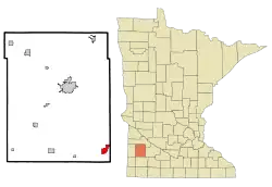 Location of Tracy, Minnesota | |
| Coordinates: 44°14′N 95°37′W | |
| Country | United States |
| State | Minnesota |
| County | Lyon |
| Government | |
| • Type | Mayor – Council |
| • Mayor | Anthony Peterson |
| Area | |
| • Total | 2.44 sq mi (6.33 km2) |
| • Land | 2.40 sq mi (6.20 km2) |
| • Water | 0.05 sq mi (0.12 km2) |
| Elevation | 1,391 ft (424 m) |
| Population | |
| • Total | 2,163 |
| • Estimate (2019)[4] | 2,077 |
| • Density | 866.86/sq mi (334.74/km2) |
| Time zone | UTC-6 (Central (CST)) |
| • Summer (DST) | UTC-5 (CDT) |
| ZIP code | 56175 |
| Area code(s) | 507 |
| FIPS code | 27-65308[5] |
| GNIS feature ID | 0653262[6] |
| Website | www |
U.S. Route 14 serves as a main arterial route in the community.
Geography
According to the United States Census Bureau, the city has a total area of 2.23 square miles (5.78 km2), of which 2.18 square miles (5.65 km2) is land and 0.05 square miles (0.13 km2) is water.[8]
History
Tracy was platted in 1875.[9] It was named for John F. Tracy, a railroad official.[9] A post office called Tracy has been in operation since 1877.[10] The city was incorporated in 1893.[11]
On June 13, 1968, Tracy was hit by an F5 tornado which killed 9 people and injured 150. Until the 1960s, Tracy was a highly active railroad town on the Chicago & Northwestern Railway as a concentration point for numerous branchlines in the area serving heavy agriculture. Today, Tracy holds an annual summer festival called "Boxcar Days," which takes place Labor Day weekend as a sign of the railroad's influence on the town. Currently, Tracy is still a division point on the Canadian Pacific Railway (formerly the Dakota, Minnesota and Eastern Railroad), where railroad crews from both east and west exchange trains.
Demographics
| Historical population | |||
|---|---|---|---|
| Census | Pop. | %± | |
| 1880 | 322 | — | |
| 1890 | 1,400 | 334.8% | |
| 1900 | 1,911 | 36.5% | |
| 1910 | 1,876 | −1.8% | |
| 1920 | 2,463 | 31.3% | |
| 1930 | 2,570 | 4.3% | |
| 1940 | 3,085 | 20.0% | |
| 1950 | 3,020 | −2.1% | |
| 1960 | 2,862 | −5.2% | |
| 1970 | 2,516 | −12.1% | |
| 1980 | 2,478 | −1.5% | |
| 1990 | 2,059 | −16.9% | |
| 2000 | 2,268 | 10.2% | |
| 2010 | 2,163 | −4.6% | |
| 2019 (est.) | 2,077 | [4] | −4.0% |
| U.S. Decennial Census | |||
2010 census
As of the census[3] of 2010, there were 2,163 people, 876 households, and 549 families living in the city. The population density was 992.2 inhabitants per square mile (383.1/km2). There were 1,032 housing units at an average density of 473.4 per square mile (182.8/km2). The racial makeup of the city was 86.5% White, 0.1% African American, 0.3% Native American, 9.7% Asian, 0.1% Pacific Islander, 1.5% from other races, and 1.7% from two or more races. Hispanic or Latino of any race were 5.4% of the population.
There were 876 households, of which 30.4% had children under the age of 18 living with them, 48.5% were married couples living together, 9.9% had a female householder with no husband present, 4.2% had a male householder with no wife present, and 37.3% were non-families. 34.7% of all households were made up of individuals, and 18.3% had someone living alone who was 65 years of age or older. The average household size was 2.39 and the average family size was 3.10.
The median age in the city was 38.7 years. 26.4% of residents were under the age of 18; 7.9% were between the ages of 18 and 24; 22.5% were from 25 to 44; 23% were from 45 to 64; and 20.2% were 65 years of age or older. The gender makeup of the city was 48.2% male and 51.8% female.
2000 census
As of the census[5] of 2000, there were 2,268 people, 922 households, and 533 families living in the city. The population density was 1,045.2 people per square mile (403.5/km2). There were 1,013 housing units at an average density of 466.8 per square mile (180.2/km2). The racial makeup of the city was 87.83% White, 0.31% African American, 0.49% Native American, 8.07% Asian, 0.04% Pacific Islander, 1.72% from other races, and 1.54% from two or more races. Hispanic or Latino of any race were 2.34% of the population.
There were 922 households, out of which 28.2% had children under the age of 18 living with them, 49.2% were married couples living together, 6.8% had a female householder with no husband present, and 42.1% were non-families. 38.5% of all households were made up of individuals, and 23.2% had someone living alone who was 65 years of age or older. The average household size was 2.35 and the average family size was 3.20.
In the city, the population was spread out, with 27.6% under the age of 18, 6.4% from 18 to 24, 21.2% from 25 to 44, 19.0% from 45 to 64, and 25.9% who were 65 years of age or older. The median age was 41 years. For every 100 females, there were 82.9 males. For every 100 females age 18 and over, there were 75.5 males.
The median income for a household in the city was $31,356, and the median income for a family was $41,108. Males had a median income of $30,221 versus $19,281 for females. The per capita income for the city was $15,574. About 6.6% of families and 13.6% of the population were below the poverty line, including 23.9% of those under age 18 and 10.4% of those age 65 or over.
Notable people
- Curt Brasket, chess player
- Cal Ludeman, Minnesota state representative
- Dennis Morgan, songwriter
- Barbara Vickerman, Minnesota state representative
- Jim Vickerman, Minnesota state senator
References
- "Tracy Minnesota". City of Tracy, Minnesota. Retrieved March 25, 2020.
- "2019 U.S. Gazetteer Files". United States Census Bureau. Retrieved July 26, 2020.
- "U.S. Census website". United States Census Bureau. Retrieved November 13, 2012.
- "Population and Housing Unit Estimates". United States Census Bureau. May 24, 2020. Retrieved May 27, 2020.
- "U.S. Census website". United States Census Bureau. Retrieved January 31, 2008.
- "US Board on Geographic Names". United States Geological Survey. October 25, 2007. Retrieved January 31, 2008.
- "2010 Census Redistricting Data (Public Law 94-171) Summary File". American FactFinder. United States Census Bureau. Retrieved April 27, 2011.
- "US Gazetteer files 2010". United States Census Bureau. Archived from the original on January 12, 2012. Retrieved November 13, 2012.
- Chicago and North Western Railway Company (1908). A History of the Origin of the Place Names Connected with the Chicago & North Western and Chicago, St. Paul, Minneapolis & Omaha Railways. p. 131.
- "Lyon County". Jim Forte Postal History. Retrieved March 30, 2015.
- Upham, Warren (1920). Minnesota Geographic Names: Their Origin and Historic Significance. Minnesota Historical Society. p. 314.
External links
Municipalities and communities of Lyon County, Minnesota, United States | ||
|---|---|---|
| Cities |  Map of Minnesota highlighting Lyon County | |
| Townships | ||
| Unincorporated communities | ||
| ||
| Authority control |
|---|