Tripp, South Dakota
Tripp is a city in Hutchinson County, South Dakota, United States. The population was 647 at the 2010 census.
Tripp, South Dakota | |
|---|---|
| Motto(s): "Easy to Find, Hard to Leave" | |
 Location in Hutchinson County and the state of South Dakota | |
| Coordinates: 43°13′30″N 97°57′55″W | |
| Country | United States |
| State | South Dakota |
| County | Hutchinson |
| Incorporated | 1910[1] |
| Area | |
| • Total | 0.59 sq mi (1.54 km2) |
| • Land | 0.59 sq mi (1.54 km2) |
| • Water | 0.00 sq mi (0.00 km2) |
| Elevation | 1,558 ft (475 m) |
| Population | |
| • Total | 647 |
| • Estimate (2019)[4] | 623 |
| • Density | 1,050.59/sq mi (405.52/km2) |
| Time zone | UTC-6 (Central (CST)) |
| • Summer (DST) | UTC-5 (CDT) |
| ZIP code | 57376 |
| Area code(s) | 605 |
| FIPS code | 46-64020[5] |
| GNIS feature ID | 1258618[6] |
| Website | Tripp, South Dakota |
History
Tripp was laid out in 1886, and named in honor of Bartlett Tripp, chief justice of the Dakota Territory Supreme Court.[7] Tripp was incorporated in 1910.[8]
In 2018 Tripp's nursing home closed.
Geography
Tripp is located at 43°13′30″N 97°57′55″W (43.224966, -97.965391).[9]
According to the United States Census Bureau, the city has a total area of 0.59 square miles (1.53 km2), all land.[10]
Demographics
| Historical population | |||
|---|---|---|---|
| Census | Pop. | %± | |
| 1890 | 226 | — | |
| 1900 | 366 | 61.9% | |
| 1910 | 675 | 84.4% | |
| 1920 | 970 | 43.7% | |
| 1930 | 939 | −3.2% | |
| 1940 | 913 | −2.8% | |
| 1950 | 913 | 0.0% | |
| 1960 | 837 | −8.3% | |
| 1970 | 851 | 1.7% | |
| 1980 | 804 | −5.5% | |
| 1990 | 664 | −17.4% | |
| 2000 | 711 | 7.1% | |
| 2010 | 647 | −9.0% | |
| 2019 (est.) | 623 | [4] | −3.7% |
| U.S. Decennial Census[11] | |||
2010 census
As of the census[3] of 2010, there were 647 people, 290 households, and 167 families residing in the city. The population density was 1,096.6 inhabitants per square mile (423.4/km2). There were 360 housing units at an average density of 610.2 per square mile (235.6/km2). The racial makeup of the city was 98.5% White, 0.6% Native American, 0.2% Asian, 0.2% from other races, and 0.6% from two or more races. Hispanic or Latino of any race were 1.7% of the population.
There were 290 households, of which 19.7% had children under the age of 18 living with them, 46.2% were married couples living together, 5.5% had a female householder with no husband present, 5.9% had a male householder with no wife present, and 42.4% were non-families. 38.6% of all households were made up of individuals, and 26.2% had someone living alone who was 65 years of age or older. The average household size was 2.06 and the average family size was 2.64.
The median age in the city was 55.2 years. 16.5% of residents were under the age of 18; 3.3% were between the ages of 18 and 24; 18.3% were from 25 to 44; 24.8% were from 45 to 64; and 37.2% were 65 years of age or older. The gender makeup of the city was 48.1% male and 51.9% female.
2000 census
As of the census[5] of 2000, there were 711 people, 321 households, and 183 families residing in the city. The population density was 1,225.8 inhabitants per square mile (473.3/km2). There were 373 housing units at an average density of 643.1 per square mile (248.3/km2). The racial makeup of the city was 98.73% White, 0.42% Native American, 0.28% Asian, and 0.56% from two or more races. Hispanic or Latino of any race were 1.41% of the population.
There were 321 households, out of which 21.2% had children under the age of 18 living with them, 48.9% were married couples living together, 6.2% had a female householder with no husband present, and 42.7% were non-families. 39.3% of all households were made up of individuals, and 24.3% had someone living alone who was 65 years of age or older. The average household size was 2.02 and the average family size was 2.68.
In the city, the population was spread out, with 17.4% under the age of 18, 3.9% from 18 to 24, 19.4% from 25 to 44, 20.1% from 45 to 64, and 39.1% who were 65 years of age or older. The median age was 54 years. For every 100 females, there were 78.6 males. For every 100 females age 18 and over, there were 76.8 males.
The median income for a household in the city was $24,609, and the median income for a family was $34,531. Males had a median income of $26,500 versus $16,397 for females. The per capita income for the city was $16,231. About 13.7% of families and 18.6% of the population were below the poverty line, including 28.6% of those under age 18 and 14.3% of those age 65 or over.
Notable people
- Caleb Finck, member of the South Dakota House of Representatives
- Jared Reiner, retired NBA player
References
- "SD Towns" (PDF). South Dakota State Historical Society. Retrieved 2010-02-16.
- "2019 U.S. Gazetteer Files". United States Census Bureau. Retrieved July 30, 2020.
- "U.S. Census website". United States Census Bureau. Retrieved 2012-06-21.
- "Population and Housing Unit Estimates". United States Census Bureau. May 24, 2020. Retrieved May 27, 2020.
- "U.S. Census website". United States Census Bureau. Retrieved 2008-01-31.
- "US Board on Geographic Names". United States Geological Survey. 2007-10-25. Retrieved 2008-01-31.
- Federal Writers' Project (1940). South Dakota place-names, v.1-3. University of South Dakota. p. 63.
- "Tripp, South Dakota". City-Data.com. Retrieved August 5, 2012.
- "US Gazetteer files: 2010, 2000, and 1990". United States Census Bureau. 2011-02-12. Retrieved 2011-04-23.
- "US Gazetteer files 2010". United States Census Bureau. Archived from the original on 2012-01-25. Retrieved 2012-06-21.
- United States Census Bureau. "Census of Population and Housing". Retrieved June 13, 2016.
Municipalities and communities of Hutchinson County, South Dakota, United States | ||
|---|---|---|
| Cities | 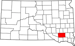 | |
| Towns | ||
| CDPs | ||
| ||
| Authority control |
|
|---|