Tuggerawong, New South Wales
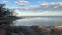
Tuggerawong, often referred to by the locals as "Gods Country" and not to be confused with Tuggeranong, is a lakeside suburb of Wyong on the NSW Central Coast and is located approximately 7 kilometres east of the Wyong CBD. It is approximately 90 km north of Sydney and 55 km south of Newcastle. Shopping, commercial facilities, schools and all normal community services are available in the district. In Wyong there is a rail connection and there is a connection to the M1 Pacific Motorway at Tuggerah.
Suburbs of Central Coast, NSW
| Tuggerawong Central Coast, New South Wales | |||||||||||||||
|---|---|---|---|---|---|---|---|---|---|---|---|---|---|---|---|
| Population | 1,204 (2011 census)[1] | ||||||||||||||
| • Density | 803/km2 (2,080/sq mi) | ||||||||||||||
| Postcode(s) | 2259 | ||||||||||||||
| Area | 1.5 km2 (0.6 sq mi) | ||||||||||||||
| Location | 7 km (4 mi) E of Wyong | ||||||||||||||
| LGA(s) | Central Coast Council | ||||||||||||||
| Parish | Munmorah | ||||||||||||||
| State electorate(s) | Wyong | ||||||||||||||
| Federal Division(s) | Dobell | ||||||||||||||
| |||||||||||||||
References
- Australian Bureau of Statistics (31 October 2012). "Tuggerawong (State Suburb)". 2011 Census QuickStats. Retrieved 24 October 2013.

This article is issued from Wikipedia. The text is licensed under Creative Commons - Attribution - Sharealike. Additional terms may apply for the media files.