Tungawan
Tungawan, officially the Municipality of Tungawan (Cebuano: Lungsod sa Tungawan; Chavacano: Municipalidad de Tungawan; Tagalog: Bayan ng Tungawan), is a 2nd class municipality in the province of Zamboanga Sibugay, Philippines. According to the 2015 census, it has a population of 42,030 people. [3]
Tungawan | |
|---|---|
| Municipality of Tungawan | |
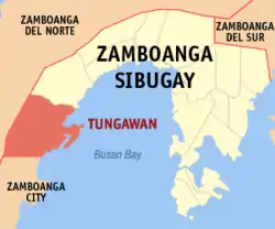 Map of Zamboanga Sibugay with Tungawan highlighted | |
OpenStreetMap 
| |
.svg.png.webp) Tungawan Location within the Philippines | |
| Coordinates: 7°36′06″N 122°25′38″E | |
| Country | |
| Region | Zamboanga Peninsula (Region IX) |
| Province | Zamboanga Sibugay |
| District | 2nd District |
| Founded | May 24, 1960 |
| Barangays | 25 (see Barangays) |
| Government | |
| • Type | Sangguniang Bayan |
| • Mayor | Carlnan C. Climaco |
| • Vice Mayor | Ivan N. Balano |
| • Representative | Dulce Ann K. Hofer |
| • Electorate | 27,602 voters (2019) |
| Area | |
| • Total | 473.28 km2 (182.73 sq mi) |
| Elevation | 47 m (154 ft) |
| Population | |
| • Total | 42,030 |
| • Density | 89/km2 (230/sq mi) |
| • Households | 9,418 |
| Economy | |
| • Income class | 2nd municipal income class |
| • Poverty incidence | 52.21% (2015)[4] |
| • Revenue | ₱144,121,238.02 (2016) |
| Time zone | UTC+8 (PST) |
| ZIP code | 7018 |
| PSGC | |
| IDD : area code | +63 (0)62 |
| Climate type | tropical climate |
| Native languages | Subanon Cebuano Chavacano Tagalog |
| Website | www |
It has an area of 47,328 hectares (116,950 acres) of land, the largest in the province, as well as 15,236 hectares (37,650 acres) of coastal waters.
It was declared as a municipality on May 24, 1959, and started functioning as a Local Government Unit (LGU) on January 29, 1961, by virtue of Executive Order No. 395.[5] Its name was coined from the minute leech generally known as “tungaw” of the Hirudo family.
Tungawan's economy is primarily based on agriculture, producing rubber, coconut, corn, rice, and seaweeds. It is home to the 880 hectares Bangaan Marine Sanctuary at Barangays Linguisan and Tigbucay.
Barangays
Tungawan is politically subdivided into 25 barangays.
- Baluran
- Batungan
- Cayamcam
- Datu Tumanggong
- Gaycon
- Langon
- Libertad (Poblacion)
- Linguisan
- Little Margos
- Loboc
- Looc-labuan
- Lower Tungawan
- Malungon
- Masao
- San Isidro
- San Pedro
- San Vicente
- Santo Niño
- Sisay
- Taglibas
- Tigbanuang
- Tigbucay
- Tigpalay
- Timbabauan
- Upper Tungawan
Climate
| Climate data for Tungawan, Zamboanga Sibugay | |||||||||||||
|---|---|---|---|---|---|---|---|---|---|---|---|---|---|
| Month | Jan | Feb | Mar | Apr | May | Jun | Jul | Aug | Sep | Oct | Nov | Dec | Year |
| Average high °C (°F) | 30 (86) |
30 (86) |
31 (88) |
31 (88) |
30 (86) |
29 (84) |
29 (84) |
29 (84) |
29 (84) |
29 (84) |
30 (86) |
30 (86) |
30 (86) |
| Average low °C (°F) | 23 (73) |
23 (73) |
24 (75) |
25 (77) |
25 (77) |
25 (77) |
24 (75) |
24 (75) |
25 (77) |
25 (77) |
24 (75) |
24 (75) |
24 (76) |
| Average precipitation mm (inches) | 98 (3.9) |
78 (3.1) |
116 (4.6) |
115 (4.5) |
222 (8.7) |
281 (11.1) |
272 (10.7) |
282 (11.1) |
237 (9.3) |
258 (10.2) |
180 (7.1) |
108 (4.3) |
2,247 (88.6) |
| Average rainy days | 19.6 | 18.6 | 21.8 | 22.9 | 29.0 | 28.6 | 28.7 | 28.3 | 27.0 | 28.6 | 25.9 | 22.1 | 301.1 |
| Source: Meteoblue [6] | |||||||||||||
Demographics
| Year | Pop. | ±% p.a. |
|---|---|---|
| 1970 | 11,838 | — |
| 1975 | 9,573 | −4.17% |
| 1980 | 10,679 | +2.21% |
| 1990 | 26,005 | +9.31% |
| 1995 | 28,552 | +1.77% |
| 2000 | 33,194 | +3.28% |
| 2007 | 37,588 | +1.73% |
| 2010 | 40,552 | +2.80% |
| 2015 | 42,030 | +0.68% |
| Source: Philippine Statistics Authority [3] [7] [8][9] | ||
References
- Municipality of Tungawan | (DILG)
- "Province: Zamboanga Sibugay". PSGC Interactive. Quezon City, Philippines: Philippine Statistics Authority. Retrieved 12 November 2016.
- Census of Population (2015). "Region IX (Zamboanga Peninsula)". Total Population by Province, City, Municipality and Barangay. PSA. Retrieved 20 June 2016.
- "PSA releases the 2015 Municipal and City Level Poverty Estimates". Quezon City, Philippines. Retrieved 12 October 2019.
- "Executive Order No. 395: Creating the Municipalities of Tungawan and Titay in the Province of Zamboanga Del Sur". Official Gazette of the Republic of the Philippines. Presidential Communications Development and Strategic Planning Office. May 24, 1959. Archived from the original on August 12, 2014. Retrieved 6 August 2014.
- "Tungawan: Average Temperatures and Rainfall". Meteoblue. Retrieved 1 May 2020.
- Census of Population and Housing (2010). "Region IX (Zamboanga Peninsula)". Total Population by Province, City, Municipality and Barangay. NSO. Retrieved 29 June 2016.
- Censuses of Population (1903–2007). "Region IX (Zamboanga Peninsula)". Table 1. Population Enumerated in Various Censuses by Province/Highly Urbanized City: 1903 to 2007. NSO.
- "Province of Zamboanga Sibugay". Municipality Population Data. Local Water Utilities Administration Research Division. Retrieved 17 December 2016.
External links
Places adjacent to Tungawan | |
|---|---|
Ipil (capital) | |
| Municipalities | |