Union Township, Floyd County, Iowa
Union Township is one of twelve townships in Floyd County, Iowa, USA. As of the 2000 census, its population was 682.[1]
Union Township | |
|---|---|
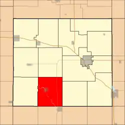 Location in Floyd County | |
| Coordinates: 42°57′28″N 92°51′12″W | |
| Country | |
| State | |
| County | Floyd |
| Area | |
| • Total | 41.16 sq mi (106.59 km2) |
| • Land | 40.78 sq mi (105.63 km2) |
| • Water | 0.37 sq mi (0.97 km2) 0.91% |
| Elevation | 1,007 ft (307 m) |
| Population (2000) | |
| • Total | 682 |
| • Density | 16.7/sq mi (6.5/km2) |
| Time zone | UTC-6 (CST) |
| • Summer (DST) | UTC-5 (CDT) |
| ZIP codes | 50636, 50653 |
| GNIS feature ID | 0468821 |
Geography
According to the United States Census Bureau, Union Township covers an area of 41.16 square miles (106.59 square kilometers); of this, 40.78 square miles (105.63 square kilometers, 99.1 percent) is land and 0.37 square miles (0.97 square kilometers, 0.91 percent) is water.
Cities, towns, villages
Unincorporated towns
- Aureola at 42.968304°N 92.877972°W
(This list is based on USGS data and may include former settlements.)
Adjacent townships
- Ulster Township (north)
- Saint Charles Township (northeast)
- Pleasant Grove Township (east)
- Dayton Township, Butler County (southeast)
- Coldwater Township, Butler County (south)
- Bennezette Township, Butler County (southwest)
- Scott Township (west)
- Rockford Township (northwest)
Cemeteries
The township contains these three cemeteries: Hillside, Westside and St. Mary's Catholic, Roseville, Iowa.
Major highways
Rivers
School districts
- Greene Community School District
- Rudd-Rockford-Marble Rock Community School District
Political districts
- Iowa's 4th congressional district
- State House District 14
- State Senate District 7
References
External links
Places adjacent to Union Township, Floyd County, Iowa | |
|---|---|
Municipalities and communities of Floyd County, Iowa, United States | ||
|---|---|---|
| Cities | Map of Iowa highlighting Floyd County | |
| Townships | ||
| CDP | ||
| Other unincorporated communities | ||
| Footnotes | ‡This populated place also has portions in an adjacent county or counties | |
| ||
This article is issued from Wikipedia. The text is licensed under Creative Commons - Attribution - Sharealike. Additional terms may apply for the media files.