Nora Springs, Iowa
Nora Springs is a city that is partially in Cerro Gordo and Floyd counties in the U.S. state of Iowa, along the Shell Rock River. The population was 1,431 at the 2010 census.
Nora Springs, Iowa | |
|---|---|
 Location of Nora Springs, Iowa | |
| Coordinates: 43°8′38″N 93°0′32″W | |
| Country | |
| State | |
| Counties | Floyd, Cerro Gordo |
| Area | |
| • Total | 2.22 sq mi (5.74 km2) |
| • Land | 2.19 sq mi (5.67 km2) |
| • Water | 0.03 sq mi (0.07 km2) |
| Elevation | 1,086 ft (331 m) |
| Population | |
| • Total | 1,431 |
| • Estimate (2019)[3] | 1,354 |
| • Density | 618.83/sq mi (238.97/km2) |
| Time zone | UTC-6 (Central (CST)) |
| • Summer (DST) | UTC-5 (CDT) |
| ZIP code | 50458 |
| Area code(s) | 641 |
| FIPS code | 19-56910 |
| GNIS feature ID | 0459546 |
| Website | http://www.citynorasprings.com |
The Cerro Gordo County portion of Nora Springs is part of the Mason City Micropolitan Statistical Area.
History
Nora Springs was founded in 1857 and was incorporated in 1875.
Geography
Nora Springs is located at 43°8′38″N 93°0′32″W (43.144010, −93.008929).[4]
According to the United States Census Bureau, the city has a total area of 2.22 square miles (5.75 km2), of which 2.19 square miles (5.67 km2) is land and 0.03 square miles (0.08 km2) is water.[5]
Demographics

| Year | Pop. | ±% |
|---|---|---|
| 1880 | 617 | — |
| 1890 | 846 | +37.1% |
| 1900 | 1,209 | +42.9% |
| 1910 | 985 | −18.5% |
| 1920 | 1,055 | +7.1% |
| 1930 | 1,070 | +1.4% |
| 1940 | 1,198 | +12.0% |
| 1950 | 1,257 | +4.9% |
| 1960 | 1,275 | +1.4% |
| 1970 | 1,337 | +4.9% |
| 1980 | 1,572 | +17.6% |
| 1990 | 1,505 | −4.3% |
| 2000 | 1,532 | +1.8% |
| 2010 | 1,431 | −6.6% |
| 2019 | 1,354 | −5.4% |
| Source:"U.S. Census website". United States Census Bureau. Retrieved 2020-03-29. and Iowa Data Center Source: | ||
2010 Census
As of the census[2] of 2010, there were 1,431 people, 577 households, and 388 families residing in the city. The population density was 653.4 inhabitants per square mile (252.3/km2). There were 636 housing units at an average density of 290.4 per square mile (112.1/km2). The racial makeup of the city was 99.1% White, 0.1% African American, 0.2% Asian, 0.1% from other races, and 0.6% from two or more races. Hispanic or Latino of any race were 1.4% of the population.
There were 577 households, of which 32.2% had children under the age of 18 living with them, 54.9% were married couples living together, 9.9% had a female householder with no husband present, 2.4% had a male householder with no wife present, and 32.8% were non-families. 28.4% of all households were made up of individuals, and 13.4% had someone living alone who was 65 years of age or older. The average household size was 2.37 and the average family size was 2.91.
The median age in the city was 41.2 years. 24% of residents were under the age of 18; 7.1% were between the ages of 18 and 24; 23.3% were from 25 to 44; 27.5% were from 45 to 64; and 18% were 65 years of age or older. The gender makeup of the city was 49.0% male and 51.0% female.
2000 Census
As of the census[7] of 2000, there were 1,532 people, 597 households, and 401 families residing in the city. The population density was 700.5 people per square mile (270.1/km2). There were 629 housing units at an average density of 287.6 per square mile (110.9/km2). The racial makeup of the city was 99.54% White, 0.07% African American, 0.13% Native American, 0.07% from other races, and 0.20% from two or more races. Hispanic or Latino of any race were 0.85% of the population.
There were 597 households, out of which 31.8% had children under the age of 18 living with them, 55.9% were married couples living together, 7.9% had a female householder with no husband present, and 32.8% were non-families. 29.6% of all households were made up of individuals, and 14.1% had someone living alone who was 65 years of age or older. The average household size was 2.39 and the average family size was 2.95.
24.0% are under the age of 18, 7.8% from 18 to 24, 26.6% from 25 to 44, 23.2% from 45 to 64, and 18.4% who were 65 years of age or older. The median age was 40 years. For every 100 females, there were 95.2 males. For every 100 females age 18 and over, there were 89.7 males.
The median income for a household in the city was $34,926, and the median income for a family was $43,516. Males had a median income of $28,043 versus $21,536 for females. The per capita income for the city was $16,246. About 3.0% of families and 5.3% of the population were below the poverty line, including 3.9% of those under age 18 and 7.5% of those age 65 or over.
Nora Springs Buffalo Days
The last week of June always marks Nora Springs Buffalo Days. Festivities include a parade, entertainment at Boulder Park such as food vendors, and inflatable rides. Other activities include a 5K Run/Walk and Bingo. At the Fire Department the Fireman's Ball is held from 9 p.m. to 1 a.m.[8]
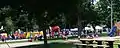 Buffalo Days at Boulder Park
Education
Its public schools are operated by the Central Springs Community School District,[9] established on July 1, 2011, by the merger of North Central Community School District and Nora Springs–Rock Falls Community School District.[10] The athletic teams are the Central Springs Panthers.[11]
The high school, and half of the elementary students originating in the Manly, Hanlontown, and Plymouth region go to school in Manly from preschool to 3rd grade. While the middle schoolers, from Manly, Nora Springs, and the other half of the elementary kids originating near the Nora Springs, Rock Falls, and Portland area go to school in the Nora Springs building. Until 8th grade then they go to Manly where the High School is located.[12] The school colors are black and blue, the mascot being a panther.[13]
Notable people
- Louis Bauman Brethren, minister, writer, and Bible conference speaker, and was born in Nora Springs.
- Arthur Gratias, Iowa State Senator, farmer, and educator, was born in Nora Springs.[14]
- John P. Gregg LSU college football coach, Wisconsin quarterback, and died in Nora Springs.
References
- "2019 U.S. Gazetteer Files". United States Census Bureau. Retrieved July 17, 2020.
- "U.S. Census website". United States Census Bureau. Retrieved 2012-05-11.
- "Population and Housing Unit Estimates". United States Census Bureau. May 24, 2020. Retrieved May 27, 2020.
- "US Gazetteer files: 2010, 2000, and 1990". United States Census Bureau. 2011-02-12. Retrieved 2011-04-23.
- "US Gazetteer files 2010". United States Census Bureau. Archived from the original on 2013-01-31. Retrieved 2012-05-11.
- "Census of Population and Housing". Census.gov. Retrieved June 4, 2015.
- "U.S. Census website". United States Census Bureau. Retrieved 2008-01-31.
- http://globegazette.com/entertainment/local_entertainment/buffalo-days-set-for-saturday-in-nora-springs/article_3d4f0ff8-bb68-11e1-acb2-001a4bcf887a.html
- "Central Springs." Iowa Department of Education. Retrieved on January 6, 2019.
- "REORGANIZATION & DISSOLUTION ACTIONS SINCE 1965-66." Iowa Department of Education. Retrieved on January 6, 2019.
- Central Springs School District Archived 2010-09-05 at the Wayback Machine
- Miller, Ashley (January 16, 2015). "Central Springs considers building changes". Globe Gazette.
- "Central Springs looks like a winner already (Globe Gazette Editorial)". Globe Gazette. January 26, 2007.
- Iowa General Assembly-Arthur L. Gratias
External links
| Wikimedia Commons has media related to Nora Springs, Iowa. |
- Nora Springs Homepage
- City-Data Comprehensive statistical data and more about Nora Springs
- History of Iowa From the Earliest Times to the Beginning of the Twentieth Century – Floyd County
Municipalities and communities of Cerro Gordo County, Iowa, United States | ||
|---|---|---|
| Cities | Map of Iowa highlighting Cerro Gordo County | |
| Townships | ||
| CDPs | ||
| Unincorporated communities | ||
| Footnotes | ‡This populated place also has portions in an adjacent county or counties | |
| ||
Municipalities and communities of Floyd County, Iowa, United States | ||
|---|---|---|
| Cities | Map of Iowa highlighting Floyd County | |
| Townships | ||
| CDP | ||
| Other unincorporated communities | ||
| Footnotes | ‡This populated place also has portions in an adjacent county or counties | |
| ||
| Authority control |
|---|
