Nashua, Iowa
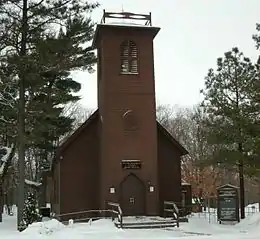
Nashua is a city in Chickasaw and only partly in Floyd counties in the U.S. state of Iowa. As of the 2010 census, the city's population was 1,663 an increase of 45, or 2.8%, from 1,618 reported at the 2000 census. The famed Little Brown Church featured in the song "The Church in the Wildwood" is located in Nashua.
Nashua, Iowa | |
|---|---|
City | |
 | |
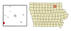 Location of Nashua, Iowa | |
| Coordinates: 42°57′8″N 92°32′17″W | |
| Country | |
| State | |
| Counties | Chickasaw, Floyd |
| Area | |
| • Total | 3.14 sq mi (8.14 km2) |
| • Land | 2.88 sq mi (7.47 km2) |
| • Water | 0.26 sq mi (0.67 km2) |
| Elevation | 974 ft (297 m) |
| Population | |
| • Total | 1,663 |
| • Estimate (2019)[3] | 1,589 |
| • Density | 550.97/sq mi (212.73/km2) |
| Time zone | UTC-6 (Central (CST)) |
| • Summer (DST) | UTC-5 (CDT) |
| ZIP code | 50658 |
| Area code(s) | 641 |
| FIPS code | 19-55335 |
| GNIS feature ID | 0459437 |
| Website | www |
History
Nashua was incorporated as a city in 1869. It is named after Nashua, New Hampshire, the native town of one of its founders.[4]
Geography
Nashua is located at 42°57′8″N 92°32′17″W (42.952231, -92.537944).[5]
According to the United States Census Bureau, the city has a total area of 3.14 square miles (8.13 km2), of which 2.88 square miles (7.46 km2) is land and 0.26 square miles (0.67 km2) is water.[6]
Demographics
| Year | Pop. | ±% |
|---|---|---|
| 1870 | 817 | — |
| 1880 | 1,116 | +36.6% |
| 1890 | 1,240 | +11.1% |
| 1900 | 1,268 | +2.3% |
| 1910 | 1,102 | −13.1% |
| 1920 | 1,317 | +19.5% |
| 1930 | 1,363 | +3.5% |
| 1940 | 1,439 | +5.6% |
| 1950 | 1,609 | +11.8% |
| 1960 | 1,737 | +8.0% |
| 1970 | 1,712 | −1.4% |
| 1980 | 1,846 | +7.8% |
| 1990 | 1,476 | −20.0% |
| 2000 | 1,618 | +9.6% |
| 2010 | 1,663 | +2.8% |
| 2019 | 1,589 | −4.4% |
| Source:"U.S. Census website". United States Census Bureau. Retrieved 2020-03-29. and Iowa Data Center Source: | ||
2010 census
As of the census[2] of 2010, there were 1,663 people, 712 households, and 456 families living in the city. The population density was 577.4 inhabitants per square mile (222.9/km2). There were 787 housing units at an average density of 273.3 per square mile (105.5/km2). The racial makeup of the city was 98.6% White, 0.4% African American, 0.5% Asian, and 0.5% from two or more races. Hispanic or Latino of any race were 0.1% of the population.
There were 712 households, of which 29.6% had children under the age of 18 living with them, 51.5% were married couples living together, 9.0% had a female householder with no husband present, 3.5% had a male householder with no wife present, and 36.0% were non-families. 31.5% of all households were made up of individuals, and 17.7% had someone living alone who was 65 years of age or older. The average household size was 2.34 and the average family size was 2.95.
The median age in the city was 38.4 years. 26% of residents were under the age of 18; 8% were between the ages of 18 and 24; 22.6% were from 25 to 44; 23.5% were from 45 to 64; and 20% were 65 years of age or older. The gender makeup of the city was 49.1% male and 50.9% female.
2000 census
As of the census[8] of 2000, there were 1,618 people, 691 households, and 469 families living in the city. The population density was 658.2 people per square mile (253.9/km2). There were 739 housing units at an average density of 300.6 per square mile (116.0/km2). The racial makeup of the city was 99.26% White, 0.06% African American, 0.06% Native American, 0.19% Asian, 0.06% from other races, and 0.37% from two or more races. Hispanic or Latino of any race were 0.31% of the population.
There were 691 households, out of which 28.2% had children under the age of 18 living with them, 56.0% were married couples living together, 8.4% had a female householder with no husband present, and 32.1% were non-families. 27.1% of all households were made up of individuals, and 16.8% had someone living alone who was 65 years of age or older. The average household size was 2.34 and the average family size was 2.83.
25.2% are under the age of 18, 7.8% from 18 to 24, 23.5% from 25 to 44, 22.6% from 45 to 64, and 20.9% who were 65 years of age or older. The median age was 40 years. For every 100 females, there were 97.8 males. For every 100 females age 18 and over, there were 92.4 males.
The median income for a household in the city was $31,713, and the median income for a family was $37,284. Males had a median income of $27,969 versus $20,547 for females. The per capita income for the city was $16,031. About 5.7% of families and 9.0% of the population were below the poverty line, including 9.3% of those under age 18 and 8.7% of those age 65 or over.
Education
Nashua-Plainfield Community School District operates area public schools.[9] It was established on July 1, 1997 by the merger of the Nashua and Plainfield school districts.[10] It operates the following schools:[11]
- Nashua-Plainfield Jr./Sr. High School
- Nashua-Plainfield Intermediate School in Plainfield
- Nashua-Plainfield Elementalary School
Notable people
- Waldo Flint (1820–1900), politician
- A. J. Hinch (1974- ), American baseball catcher, former manager of the Houston Astros
- Charlton Laird (1901–1984), American linguist, created the 1971 Webster's New World Thesaurus and autobiography of Walter Clark[12]
- Kent Taylor (1907–1987), American actor[13]
Music
On September 8, 2019 A youtuber named catHORSE made a song listing random places in Nashua.
References
- "2019 U.S. Gazetteer Files". United States Census Bureau. Retrieved July 17, 2020.
- "U.S. Census website". United States Census Bureau. Retrieved 2012-05-11.
- "Population and Housing Unit Estimates". United States Census Bureau. May 24, 2020. Retrieved May 27, 2020.
- Fairbairn, Robert Herd (1919). History of Chickasaw and Howard Counties, Iowa, Volume 1. S. J. Clarke Publishing Company. p. 291.
- "US Gazetteer files: 2010, 2000, and 1990". United States Census Bureau. 2011-02-12. Retrieved 2011-04-23.
- "US Gazetteer files 2010". United States Census Bureau. Archived from the original on 2012-07-02. Retrieved 2012-05-11.
- "Census of Population and Housing". Census.gov. Retrieved June 4, 2015.
- "U.S. Census website". United States Census Bureau. Retrieved 2008-01-31.
- "Nashua-Plainfield" (PDF). Iowa Department of Education. Retrieved 2020-03-27.
- "REORGANIZATION & DISSOLUTION ACTIONS SINCE 1965-66" (PDF). Iowa Department of Education. Archived from the original (PDF) on 2019-02-09. Retrieved 2019-08-01.
- https://www.nashua-plainfield.k12.ia.us/page/2475
- "PAPERS OF CHARLTON LAIRD". University of Iowa Libraries. Retrieved 2011-01-09.
- "Kent Taylor". Internet Movie Data Base. Retrieved March 5, 2013.
External links
| Wikimedia Commons has media related to Nashua, Iowa. |
- City of Nashua
- Nashua-Plainfield Schools
- City-Data Comprehensive Statistical Data and more about Nashua
Municipalities and communities of Chickasaw County, Iowa, United States | ||
|---|---|---|
| Cities | Map of Iowa highlighting Chickasaw County | |
| Townships | ||
| Unincorporated communities | ||
| Footnotes | ‡This populated place also has portions in an adjacent county or counties | |
| ||
Municipalities and communities of Floyd County, Iowa, United States | ||
|---|---|---|
| Cities | Map of Iowa highlighting Floyd County | |
| Townships | ||
| CDP | ||
| Other unincorporated communities | ||
| Footnotes | ‡This populated place also has portions in an adjacent county or counties | |
| ||
