Victor, Idaho
Victor is the largest city in Teton County, Idaho, United States. The population was 1,928 at the 2010 census, up from 840 at 2000.[6] It is part of the Jackson, WY–ID Micropolitan Statistical Area.
Victor, Idaho | |
|---|---|
 Post Office at Victor, Idaho, United States | |
| Motto(s): "A Town to Come Home To"[1] | |
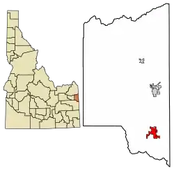 Location of Victor in Teton County, Idaho. | |
| Coordinates: 43°36′11″N 111°6′44″W | |
| Country | United States |
| State | Idaho |
| County | Teton |
| Government | |
| • Mayor | Will Frohlich |
| Area | |
| • Total | 2.65 sq mi (6.85 km2) |
| • Land | 2.65 sq mi (6.85 km2) |
| • Water | 0.00 sq mi (0.00 km2) |
| Elevation | 6,214 ft (1,894 m) |
| Population | |
| • Total | 1,928 |
| • Estimate (2019)[4] | 2,503 |
| • Density | 946.31/sq mi (365.34/km2) |
| Time zone | UTC-7 (Mountain (MST)) |
| • Summer (DST) | UTC-6 (MDT) |
| ZIP code | 83455 |
| Area code(s) | 208, 986 |
| FIPS code | 16-84250 |
| GNIS feature ID | 0398304 |
| Website | www |
| Historical population | |||
|---|---|---|---|
| Census | Pop. | %± | |
| 1920 | 277 | — | |
| 1930 | 250 | −9.7% | |
| 1940 | 294 | 17.6% | |
| 1950 | 431 | 46.6% | |
| 1960 | 240 | −44.3% | |
| 1970 | 241 | 0.4% | |
| 1980 | 323 | 34.0% | |
| 1990 | 292 | −9.6% | |
| 2000 | 840 | 187.7% | |
| 2010 | 1,928 | 129.5% | |
| 2019 (est.) | 2,503 | [4] | 29.8% |
| U.S. Decennial Census[5] | |||
The city, as well as other surrounding communities, has become a bedroom community for the nearby resort area of Jackson Hole, accessed over Teton Pass in Wyoming at 8,431 feet (2,570 m) above sea level. The pass is accessed from Victor on State Highway 33, which continues east of the state border as Wyoming Highway 22 to Jackson.
History
Victor was established in 1889 from four existing settlements, namely Trail Creek, Fox Creek, Chapin and Cedron.[1] It was named for George Victor Sherwood, a dedicated mail carrier who delivered the mail despite threats of Indian attacks.[7]
Geography
Victor is located at 43°36′11″N 111°6′44″W (43.602945, -111.112343),[8] at an elevation of 6,214 feet (1,894 m) above sea level.
According to the United States Census Bureau, the city has a total area of 3.44 square miles (8.91 km2), all land.[9] The zip code for Victor is 83455.
Demographics
2010 census
At the 2010 census there were 1,928 people in 683 households, including 433 families, in the city. The population density was 560.5 inhabitants per square mile (216.4/km2). There were 853 housing units at an average density of 248.0 per square mile (95.8/km2). The racial makup of the city was 79.3% White, 0.5% Black (U.S. Census), 1.0% Native American, 0.5% Asian, 0.1% Pacific Islander, 16.9% from other races, and 1.9% from two or more races. Hispanic or Latino of any race were 22.6%.[3]
Of the 683 households 41.9% had children under the age of 18 living with them, 53.7% were married couples living together, 6.1% had a female householder with no husband present, 3.5% had a male householder with no wife present, and 36.6% were non-families. 24.0% of households were one person and 4.1% were one person aged 65 or older. The average household size was 2.82 and the average family size was 3.51.
The median age was 30.6 years. 31.5% of residents were under the age of 18; 6.5% were between the ages of 18 and 24; 43.3% were from 25 to 44; 15.1% were from 45 to 64; and 3.7% were 65 or older. The gender makeup of the city was 52.4% male and 47.6% female.
2000 census
At the 2000 census there were 840 people in 293 households, including 205 families, in the city. The population density was 648.5 people per square mile (249.5/km2). There were 330 housing units at an average density of 254.8 per square mile (98.0/km2). The racial makup of the city was 91.31% White, 0.71% Black (U.S. Census), 1.55% Native American, 4.76% from other races, and 1.67% from two or more races. Hispanic or Latino of any race were 10.71%.[10]
Of the 293 households 39.6% had children under the age of 18 living with them, 57.3% were married couples living together, 7.5% had a female householder with no husband present, and 29.7% were non-families. 22.2% of households were one person and 6.5% were one person aged 65 or older. The average household size was 2.87 and the average family size was 3.43.
The age distribution was 31.5% under the age of 18, 6.9% from 18 to 24, 37.5% from 25 to 44, 16.3% from 45 to 64, and 7.7% 65 or older. The median age was 31 years. For every 100 females, there were 105.9 males. For every 100 females age 18 and over, there were 104.6 males.
The median household income was $42,500 and the median family income was $49,750. Males had a median income of $37,159 versus $25,250 for females. The per capita income for the city was $16,740. About 7.0% of families and 8.4% of the population were below the poverty line, including 11.2% of those under age 18 and 7.0% of those age 65 or over.
Education
The public schools in the county are operated by Teton School District #401, headquartered in Driggs. The only traditional high school is Teton High School, also in Driggs. A lower elementary school (K–3) is in Victor, but the district's upper elementary (4–5) and middle school (6–8) are located in Driggs.
Gallery
 Theatre Building in Victor
 Library in Victor
References
- "City of Victor, Idaho". City of Victor, Idaho. Retrieved September 2, 2012.
- "2019 U.S. Gazetteer Files". United States Census Bureau. Retrieved July 9, 2020.
- "U.S. Census website". United States Census Bureau. Retrieved 2012-12-18.
- "Population and Housing Unit Estimates". United States Census Bureau. May 24, 2020. Retrieved May 27, 2020.
- "Census of Population and Housing". Census.gov. Retrieved June 4, 2015.
- Spokesman-Review - 2010 census - Victor, Idaho - accessed 2011-12-23
- "Profile for Victor, Idaho, ID". ePodunk. Retrieved September 2, 2012.
- "US Gazetteer files: 2010, 2000, and 1990". United States Census Bureau. 2011-02-12. Retrieved 2011-04-23.
- "US Gazetteer files 2010". United States Census Bureau. Archived from the original on 2011-02-20. Retrieved 2012-12-18.
- "U.S. Census website". United States Census Bureau. Retrieved 2008-01-31.
External links
| Wikimedia Commons has media related to Victor, Idaho. |
- Official website
- Teton Valley Chamber of Commerce
- Teton School District #401
- City-Data.com - Victor, Idaho
Municipalities and communities of Teton County, Idaho, United States | ||
|---|---|---|
| Cities | Map of Idaho highlighting Teton County | |
| Unincorporated communities | ||
| Ghost town | ||
| ||
| Authority control |
|---|