Teton County, Idaho
Teton County is a county located in the U.S. state of Idaho. As of the 2010 census, the population was 10,170.[1] The county seat is Driggs,[2] and the largest city is Victor. The county was established in 1915 and was named after the Teton Mountains to the east.[3]
Teton County | |
|---|---|
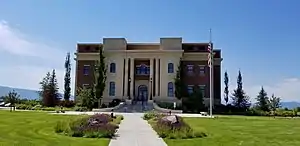 Teton County Courthouse | |
 Seal | |
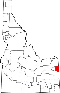 Location within the U.S. state of Idaho | |
 Idaho's location within the U.S. | |
| Coordinates: 43°45′N 111°13′W | |
| Country | |
| State | |
| Founded | January 26, 1915 |
| Named for | The Teton Mountains |
| Seat | Driggs |
| Largest city | Victor |
| Area | |
| • Total | 451 sq mi (1,170 km2) |
| • Land | 449 sq mi (1,160 km2) |
| • Water | 1.1 sq mi (3 km2) 0.2% |
| Population (2010) | |
| • Total | 10,170 |
| • Estimate (2018) | 11,640 |
| • Density | 23/sq mi (8.7/km2) |
| Time zone | UTC−7 (Mountain) |
| • Summer (DST) | UTC−6 (MDT) |
| Congressional district | 2nd |
| Website | tetoncountyidaho |
Teton County is part of the Jackson, WY-ID Micropolitan Statistical Area.
The Teton Valley was discovered by John Colter in 1808, a member of the Lewis and Clark Expedition (1804–06). It became known as Pierre's Hole, and it hosted the well-attended 1832 Rendezvous, which was followed by the Battle of Pierre's Hole.
Geography
According to the U.S. Census Bureau, the county has a total area of 451 square miles (1,170 km2), of which 449 square miles (1,160 km2) is land and 1.1 square miles (2.8 km2) (0.2%) is water.[4] It is the second-smallest county in Idaho by area.
Adjacent counties
- Fremont County - north
- Madison County - west
- Bonneville County - south
- Teton County, Wyoming - east
National protected area
- Targhee National Forest (part)
Demographics
| Historical population | |||
|---|---|---|---|
| Census | Pop. | %± | |
| 1920 | 3,921 | — | |
| 1930 | 3,573 | −8.9% | |
| 1940 | 3,601 | 0.8% | |
| 1950 | 3,204 | −11.0% | |
| 1960 | 2,639 | −17.6% | |
| 1970 | 2,351 | −10.9% | |
| 1980 | 2,897 | 23.2% | |
| 1990 | 3,439 | 18.7% | |
| 2000 | 5,999 | 74.4% | |
| 2010 | 10,170 | 69.5% | |
| 2018 (est.) | 11,640 | [5] | 14.5% |
| U.S. Decennial Census[6] 1790-1960[7] 1900-1990[8] 1990-2000[9] 2010-2018[1] | |||
2000 census
As of the census[10] of 2000, there were 5,999 people, 2,078 households, and 1,464 families living in the county. The population density was 13 people per square mile (5/km2). There were 2,632 housing units at an average density of 6 per square mile (2/km2). The racial makeup of the county was 91.32% White, 0.17% Black or African American, 0.55% Native American, 0.18% Asian, 0.23% Pacific Islander, 6.73% from other races, and 0.82% from two or more races. 11.75% of the population were Hispanic or Latino of any race. 25.5% were of English, 15.8% German, 7.6% American and 5.1% Irish ancestry.
There were 2,078 households, out of which 39.70% had children under the age of 18 living with them, 60.30% were married couples living together, 5.80% had a female householder with no husband present, and 29.50% were non-families. 21.30% of all households were made up of individuals, and 5.30% had someone living alone who was 65 years of age or older. The average household size was 2.87 and the average family size was 3.43.
In the county, the population was spread out, with 31.80% under the age of 18, 8.10% from 18 to 24, 33.80% from 25 to 44, 18.90% from 45 to 64, and 7.50% who were 65 years of age or older. The median age was 31 years. For every 100 females, there were 112.70 males. For every 100 females age 18 and over, there were 114.50 males.
The median income for a household in the county was $41,968, and the median income for a family was $45,848. Males had a median income of $32,309 versus $22,243 for females. The per capita income for the county was $17,778. About 9.70% of families and 12.90% of the population were below the poverty line, including 18.10% of those under age 18 and 7.90% of those age 65 or over.
2010 census
As of the 2010 United States Census, there were 10,170 people, 3,651 households, and 2,509 families living in the county.[11] The population density was 22.6 inhabitants per square mile (8.7/km2). There were 5,478 housing units at an average density of 12.2 per square mile (4.7/km2).[12] The racial makeup of the county was 85.6% white, 0.5% Asian, 0.3% American Indian, 0.2% black or African American, 0.1% Pacific islander, 11.7% from other races, and 1.5% from two or more races. Those of Hispanic or Latino origin made up 16.9% of the population.[11] In terms of ancestry, 29.9% were English, 20.3% were German, 13.0% were Irish, and 4.2% were American.[13]
Of the 3,651 households, 39.3% had children under the age of 18 living with them, 58.9% were married couples living together, 5.9% had a female householder with no husband present, 31.3% were non-families, and 21.9% of all households were made up of individuals. The average household size was 2.78 and the average family size was 3.33. The median age was 33.2 years.[11]
The median income for a household in the county was $53,364 and the median income for a family was $56,791. Males had a median income of $39,865 versus $31,966 for females. The per capita income for the county was $23,633. About 5.4% of families and 7.4% of the population were below the poverty line, including 7.8% of those under age 18 and 2.2% of those age 65 or over.[14]
Government and politics
Similar to other Idaho counties, an elected three-member county commission heads the county government. Other elected officials include clerk, treasurer, sheriff, assessor, coroner, and prosecutor.[15]
Until quite recently Teton County voted Republican along with most other Eastern Idaho counties. However, since 2004, the county has strongly trended towards toss-up status. In 2008, it was one of three Idaho counties to favor Barack Obama,[16] despite giving George W. Bush a 23-point victory only four years earlier.[17] The margin was narrow (39 votes) and Obama lost the county to Mitt Romney in 2012 by over five hundred votes; Donald Trump outpolled Hillary Clinton by just eight votes in 2016, the smallest numerical margin in the country. In 2020, Teton County backed Democratic candidate Joe Biden, leading by a wider margin than Obama in 2008.
Teton County is one of only twelve counties to have voted for Obama in 2008, Romney in 2012, Trump in 2016, and Biden in 2020, a pattern that was particularly evident elsewhere in the Mountain West.[lower-alpha 1]
At the state level, Teton County is in District 32 of the Idaho Legislature.[18] As neighboring counties are still strongly Republican, Republicans currently control the district.[19] In Idaho gubernatorial elections, the county has voted for the Democratic nominee in every election since 2006.
| Year | Republican | Democratic | Third parties |
|---|---|---|---|
| 2020 | 44.9% 2,858 | 52.2% 3,318 | 2.9% 186 |
| 2016 | 43.6% 2,167 | 43.4% 2,159 | 13.1% 650 |
| 2012 | 54.3% 2,458 | 42.6% 1,926 | 3.1% 139 |
| 2008 | 48.6% 2,263 | 49.4% 2,302 | 2.0% 94 |
| 2004 | 60.6% 2,235 | 38.4% 1,416 | 1.1% 39 |
| 2000 | 65.3% 1,745 | 27.0% 720 | 7.7% 206 |
| 1996 | 50.3% 1,251 | 34.8% 866 | 14.9% 371 |
| 1992 | 39.7% 762 | 24.6% 472 | 35.7% 684 |
| 1988 | 64.3% 982 | 34.8% 531 | 0.9% 14 |
| 1984 | 76.5% 1,242 | 22.8% 370 | 0.7% 12 |
| 1980 | 72.8% 1,227 | 21.4% 360 | 5.9% 99 |
| 1976 | 63.0% 904 | 35.8% 514 | 1.1% 16 |
| 1972 | 68.6% 932 | 21.9% 298 | 9.5% 129 |
| 1968 | 57.9% 694 | 31.4% 376 | 10.7% 128 |
| 1964 | 53.0% 675 | 47.0% 598 | |
| 1960 | 55.7% 714 | 44.4% 569 | |
| 1956 | 65.1% 842 | 34.9% 451 | |
| 1952 | 66.3% 964 | 33.8% 491 | |
| 1948 | 46.6% 593 | 52.8% 672 | 0.6% 7 |
| 1944 | 46.3% 552 | 53.7% 641 | |
| 1940 | 44.1% 667 | 55.9% 844 | |
| 1936 | 38.5% 542 | 59.2% 834 | 2.3% 33 |
| 1932 | 43.7% 674 | 55.8% 860 | 0.5% 7 |
| 1928 | 68.3% 753 | 31.6% 348 | 0.2% 2 |
| 1924 | 55.7% 665 | 15.6% 186 | 28.7% 343 |
| 1920 | 68.9% 906 | 31.1% 409 | |
| 1916 | 46.4% 650 | 51.9% 726 | 1.7% 24 |
Education
The public schools are operated by Teton School District #401, led by the county's only traditional high school, Teton High School, in Driggs.
Notes
- The other eleven are Butte County, California; Kendall County, Illinois; McLean County, Illinois; Tippecanoe County, Indiana; Kent County, Michigan; Leelanau County, Michigan; Carroll County, New Hampshire; Rockingham County, New Hampshire; Marion County, Oregon; Grand County, Utah; and Albany County, Wyoming.
References
- "State & County QuickFacts". United States Census Bureau. Retrieved July 1, 2014.
- "Find a County". National Association of Counties. Retrieved 2011-06-07.
- "Teton County". State of Idaho. Archived from the original on August 15, 2009. Retrieved May 29, 2009.
- "US Gazetteer files: 2010, 2000, and 1990". United States Census Bureau. February 12, 2011. Retrieved April 23, 2011.
- "Population and Housing Unit Estimates". Retrieved September 6, 2019.
- "U.S. Decennial Census". United States Census Bureau. Retrieved July 1, 2014.
- "Historical Census Browser". University of Virginia Library. Retrieved July 1, 2014.
- "Population of Counties by Decennial Census: 1900 to 1990". United States Census Bureau. Retrieved July 1, 2014.
- "Census 2000 PHC-T-4. Ranking Tables for Counties: 1990 and 2000" (PDF). United States Census Bureau. Retrieved July 1, 2014.
- "U.S. Census website". United States Census Bureau. Retrieved January 31, 2008.
- "DP-1 Profile of General Population and Housing Characteristics: 2010 Demographic Profile Data". United States Census Bureau. Archived from the original on February 13, 2020. Retrieved January 9, 2016.
- "Population, Housing Units, Area, and Density: 2010 - County". United States Census Bureau. Archived from the original on February 13, 2020. Retrieved January 9, 2016.
- "DP02 SELECTED SOCIAL CHARACTERISTICS IN THE UNITED STATES – 2006-2010 American Community Survey 5-Year Estimates". United States Census Bureau. Archived from the original on February 13, 2020. Retrieved January 9, 2016.
- "DP03 SELECTED ECONOMIC CHARACTERISTICS – 2006-2010 American Community Survey 5-Year Estimates". United States Census Bureau. Archived from the original on February 13, 2020. Retrieved January 9, 2016.
- Teton County Idaho
- 2008 - General Election Teton CountyArchived 2008-11-06 at the Wayback Machine
- 2004 Presidential General Election Data Graphs - Idaho
- Idaho Legislative District Map Archived November 17, 2011, at the Wayback Machine
- Idaho Legislative Districts Archived November 10, 2008, at the Wayback Machine
- Leip, David. "Dave Leip's Atlas of U.S. Presidential Elections". uselectionatlas.org. Retrieved April 4, 2018.
External links
Places adjacent to Teton County, Idaho | ||||||||||
|---|---|---|---|---|---|---|---|---|---|---|
| ||||||||||
Municipalities and communities of Teton County, Idaho, United States | ||
|---|---|---|
| Cities | Map of Idaho highlighting Teton County | |
| Unincorporated communities | ||
| Ghost town | ||
| ||
Boise (capital) | ||
| Topics |
| |
| Society | ||
| Regions | ||
| Larger cities | ||
| Smaller cities | ||
| Counties |
| |
| Authority control |
|---|