Villavieja de Yeltes
Villavieja de Yeltes is a municipality in Salamanca, Castile and León, Spain.
Villavieja de Yeltes | |
|---|---|
 Flag  Seal | |
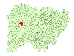 Location in Salamanca | |
| Coordinates: 40°52′1″N 6°28′0″W | |
| Country | Spain |
| Autonomous community | Castile and León |
| Province | Salamanca |
| Comarca | El Abadengo |
| Government | |
| • Mayor | Jorge Rodríguez Martín (PSOE) |
| Area | |
| • Total | 50.84 km2 (19.63 sq mi) |
| Elevation | 740 m (2,430 ft) |
| Population (2018)[2] | |
| • Total | 785 |
| • Density | 15/km2 (40/sq mi) |
| Time zone | UTC+1 (CET) |
| • Summer (DST) | UTC+2 (CEST) |
| Postal code | 37260 |
Geography
The municipality is in the western portion of Castile and León, about 290 km from Madrid, at 738 meters above sea level. Its northern and eastern borders are formed by the Yeltes river, and its entire area is in the river's drainage basin. Its highest point is 828 meters above sea level, in La Berzosa.
History
The shores of the Yeltes river have been inhabited since prehistoric times, as indicated by artifacts found there. Megalithic-stage structures were scattered throughout the area, and many remains have been discovered from the medieval period.
Demographics
The population has fallen inexorably since 2001.
| Year | 2001 | 2002 | 2003 | 2004 | 2005 | 2006 | 2007 |
|---|---|---|---|---|---|---|---|
| Population | 1119 | 1113 | 1082 | 1029 | 1041 | 1022 | 989 |
| Men | 558 | 553 | 541 | 514 | 518 | 511 | 498 |
| Women | 561 | 560 | 541 | 515 | 523 | 511 | 491 |
| Wikimedia Commons has media related to Villavieja de Yeltes. |
References
- "Municipio:Villavieja de Yeltes". www.lasalina.es. Retrieved 2017-11-05.
- Municipal Register of Spain 2018. National Statistics Institute.
| Authority control |
|
|---|
This article is issued from Wikipedia. The text is licensed under Creative Commons - Attribution - Sharealike. Additional terms may apply for the media files.