Vlăhița
Vlăhița (![]() listen) (Hungarian: Szentegyháza, pronounced [ˈsɛntɛchaːzɒ] (
listen) (Hungarian: Szentegyháza, pronounced [ˈsɛntɛchaːzɒ] (![]() listen), until 1899 Szentegyházas-Oláhfalu) is a town in Harghita County, Romania. It lies in the Székely Land, an ethno-cultural region in eastern Transylvania.
listen), until 1899 Szentegyházas-Oláhfalu) is a town in Harghita County, Romania. It lies in the Székely Land, an ethno-cultural region in eastern Transylvania.
Vlăhița
Szentegyháza | |
|---|---|
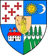
 Coat of arms | |
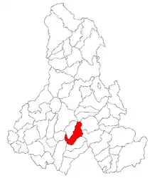 Location in Harghita County | |
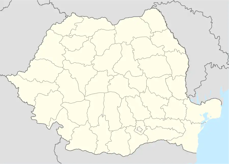 Vlăhița Location in Romania | |
| Coordinates: 46°21′0″N 25°31′48″E | |
| Country | |
| County | Harghita |
| Government | |
| • Mayor | Tibor Molnár[1] (PCM) |
| Area | 98.48 km2 (38.02 sq mi) |
| Population (2011)[2] | 6,898 |
| • Density | 70/km2 (180/sq mi) |
| Time zone | EET/EEST (UTC+2/+3) |
| Vehicle reg. | HR |
| Website | www.primariavlahita.ro |
The town administers two villages:
- Băile Homorod / Homoródfürdő
- Minele Lueta / Szentkeresztbánya
Its Romanian name is of Slavic origin, meaning "little Vlach", while its Hungarian name means "Church of the Saint".
History
In Roman times a Roman fort was functioning in nearby Băile Homorod.
Vlăhița (Oláhfalu) was first mentioned as a Romanian settlement (Villa Olachalis).[3] The town was part of the Székely Land area of the historical Transylvania province. It belonged to Udvarhelyszék until the administrative reform of Transylvania in 1876, when it fell within the Udvarhely County of the Austria-Hungary. After the Treaty of Trianon of 1920, it became part of Romania and fell within Odorhei County during the interwar period. In 1940, the second Vienna Award granted the Northern Transylvania to Hungary and it was held by Hungary until 1944. After Soviet occupation, the Romanian administration returned and the settlement became officially part of Romania in 1947. Between 1952 and 1960, the town fell within the Magyar Autonomous Region, between 1960 and 1968 the Mureș-Magyar Autonomous Region. In 1968, the province was abolished, and since then, the town has been part of Harghita County.
Demographics
| Year | Pop. | ±% |
|---|---|---|
| 1977 | 6,636 | — |
| 1992 | 7,667 | +15.5% |
| 2002 | 7,392 | −3.6% |
| 2011 | 6,820 | −7.7% |
| Source: Census data | ||
The town has a total population of 6,820 of which 6,749 (98.96%) are Székely Hungarians, making it the town with the highest proportion of Hungarians in Romania (2011 census).
Location
The town is situated between Odorheiu Secuiesc and Miercurea-Ciuc. Its 860 m altitude makes it the highest town in Harghita County.
Culture
The town is famous for its Children's Orchestra (Filarmonica de copii/Gyermekfilharmónia), in which more than 140 youngsters sing and play instruments.
References
| Wikimedia Commons has media related to Vlăhița. |
- "Results of the 2016 local elections". Central Electoral Bureau. Retrieved 3 April 2020.
- "Populaţia stabilă pe judeţe, municipii, oraşe şi localităti componenete la RPL_2011" (in Romanian). National Institute of Statistics. Retrieved 4 February 2014.
- G. Popa Lisseanu, Originea secuilor și secuizarea românilor. Ed. Pur și Simplu, Bucharest, 2003, p. 69, ISBN 973-86261-4-5