Toplița
Toplița (Romanian pronunciation: [ˈtoplit͡sa]; Hungarian: Maroshévíz, Hungarian pronunciation: [ˈmɒroʃheːviːz] (![]() listen)) is a municipality in Harghita County, Transylvania, Romania.
listen)) is a municipality in Harghita County, Transylvania, Romania.
Toplița
Maroshévíz | |
|---|---|
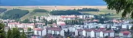 General view of Toplița | |
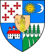
 Coat of arms | |
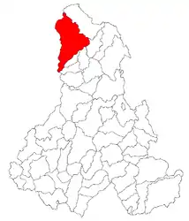 Location of Toplița in Harghita County | |
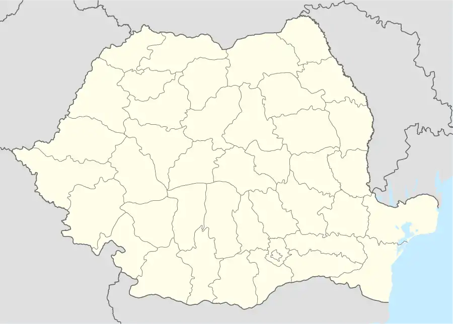 Toplița Location in Romania | |
| Coordinates: 46°55′25″N 25°20′45″E | |
| Country | |
| County | Harghita |
| Government | |
| • Mayor | Dumitru Olariu (PSD) |
| Area | 338.3 km2 (130.6 sq mi) |
| Population (2011)[1] | 13,929 |
| • Density | 41/km2 (110/sq mi) |
| Time zone | EET/EEST (UTC+2/+3) |
| Vehicle reg. | HR |
| Website | Toplița Town hall |
The settlement has had multiple name changes: Taplócza, Toplicza, Gyergyó-Toplicza, from February 3, 1861 Oláh-Toplicza, or "Romanian Toplița", then from January 1, 1907 Maroshévíz, until 1918, when it received the Romanian name Toplița Română. Both the Romanian and the Hungarian name mean "hot water spring"; the first is a Romanian word of Slavic origin.
The city administers eight villages: Călimănel (Kelemenpatak), Luncani (Lunkány), Măgheruș (Magyaros), Moglănești (Moglán), Secu (Székpatak), Vâgani (Vugány), Vale (Válya) and Zencani (Zsákhegy).
Demographics
| Year | Pop. | ±% |
|---|---|---|
| 1956 | 8,944 | — |
| 1966 | 10,993 | +22.9% |
| 1977 | 13,618 | +23.9% |
| 1992 | 17,212 | +26.4% |
| 2002 | 16,839 | −2.2% |
| 2011 | 13,282 | −21.1% |
| Source: Census data | ||
According to the last census from 2011 there were 13,282 people living in the city.
Of this population, 9688 (72.94%) are ethnic Romanians, while 3031 (22,82%)[2] are ethnic Hungarians (primarily Székelys), 513 ethnic Romani. This information is from Toplița's unofficial site: www.toplita.info.
Among the villages which are the part of this municipality, there are large ethnic Hungarian minorities in Măgheruș (34%), Moglănești (21.5%), Secu (29.7%) and Zencani (23.7%).
Geography
Topliţa is located in eastern Transylvania on the upper reaches of the Mureș, more precisely in the northwestern corner of Harghita County. It is situated at an altitude of 650 m above sea level, on the Giurgiului plain between the mountains of Giurgiului, Gurghiului and Călimani. The nearest towns are Borsec (26 km), Gheorgheni (38 km) and Reghin (69 km).
History
The region was Simon Bán's property until 1228, then passed on to the Bánffy family, who managed to keep their enormous properties until 1945.[3] As a feudal domain, the area was not part of any of the Székely seats (sedes judiciaria).
The settlement was founded in 1567 by Petrichevitch Horváth Kozma on land owned by Bánffy Pál. He gave the land to three Moldavian peasant families and named the place Taplócza.
In 1658, Gyergyó-Toplicza was entirely destroyed by Moldavian units led by Pintea. After 1660, the Bánffys brought 391 Romanian peasant families from Deda onto these lands. Around 1710, rafting started on the Mureș river. Due to this profitable enterprise, Toplicza and its inhabitants started growing and evolving in both wealth and numbers. The first European census, ordered by Joseph II, took place in Toplicza on 20 November 1785. Census results showed 227 farms, 23 free and 231 thrall families who belonged to 22 lords. Baron Bornemissza János owned 52 of these families, while Baron Kemény Simon owned 30 and Count Teleki Mihály 18.
In 1868, eight "praedia" belonged to Oláh-Toplicza: Kelemenpatak, Nyírmező, Csobotány, Mănăstirea, Vugány, Moglán, Plopiș and Magyarós; at the time Válya was already part of the settlement. Nowadays, it comprises Valea, Zencani, Vâgani, Secu, Moglănești, Măgheruș and Luncani.[4]
During World War I, Toplița and its periphery witnessed cruel fighting. The Romanian monument in Secu is the tomb of 771 Romanian soldiers, while in the Hungarian Soldiers Cemetery 450 Hungarian soldiers were buried.
Until the Treaty of Trianon of 1920, it was part of Maros-Torda County in the Austria-Hungary. In 1920, it became part of Romania. In 1940, the second Vienna Award granted Northern Transylvania to Hungary and the town formed part of Hungary until 1944. After Soviet occupation, the Romanian administration returned and the town officially returned to Romanian control in 1947.
In 1952 Toplița was declared a town, and in 2002 it was declared a municipality.
Buildings
- 1658 Mănăstirea Doamnei
- 1847 Sf. Ilie monastery
- Sept. 22 1867-Aug. 21 1869 a Roman Catholic church in the vicinity of an old wooden church
- 1867-1903 Orthodox Church
- 1870 Roman Catholic Denominational School
- 1895 Calvinist Church
- 1896 Hungarian State School, founded in the Valea section
- 1903-1907 Urmánczy castle, today the town's Ethnographic Museum
- 1928-1929 Greek Catholic Church in the Cornişa section, built to replace the 1777 wooden church which was moved to the nearby Gălăuțaș village.
Natives
- Miron Cristea (1868–1939), the first Patriarch of the Romanian Orthodox Church, and the Prime Minister of Romania between 1938 and 1939.
- Gunther Philipp (Placheta) (1918-2003), actor
References
| Wikimedia Commons has media related to Toplița. |
- "Populaţia stabilă pe judeţe, municipii, oraşe şi localităti componenete la RPL_2011" (in Romanian). National Institute of Statistics. Retrieved 4 February 2014.
- "Archived copy" (PDF). Archived from the original (PDF) on 2013-11-13. Retrieved 2013-11-13.CS1 maint: archived copy as title (link)
- Toplita Info Archived 2011-06-07 at the Wayback Machine
- Orbán Balázs, «A Székelyföld leírása történelmi, régészeti, természetrajzi s népismei szempontból», Pest, 1868, XXVIII.Átrándulás Gyergyó-Topliczára, «Magyar Elektronikus Könyvtár»