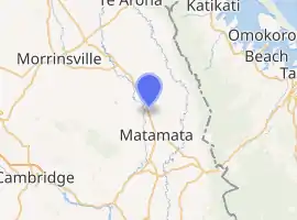
Waharoa
Waharoa is a rural community in the Waikato region of New Zealand's North Island. It is located 7 km north of Matamata, and is part of the Matamata-Piako District. It is located at the railway junction of the Kinleith Branch railway with the East Coast Main Trunk Railway. State Highway 27 runs through the town,[2] serviced by several shops, cafes and a petrol station.[3]
Waharoa | |
|---|---|
| |
| Coordinates: 37°46′S 175°46′E | |
| Country | New Zealand |
| Region | Waikato |
| Territorial authority | Matamata-Piako District |
| Ward | Matamata Ward |
| Electorate | Waikato |
| Population (2018)[1] | |
| • Total | 1,521 |
| Time zone | UTC+12 (NZST) |
| • Summer (DST) | UTC+13 (NZDT) |
| Postcode | 3401 |
| Area code(s) | 07 |
Matamata Airport is just over 3 km (1.9 mi) north of Waharoa.
To the north of Waharoa is the community of Tamihana, where the Raungaiti marae is located.[4] Nearby the marae is the Matamata Airport and remnants of the original Matamata pā. To the east lie the communities of Wardville and Turanga-o-moana, to the west the community of Walton, and to the south is the town of Matamata.
History
Early history
Prior to colonisation, the area surrounding and including present-day Waharoa was held by Ngāti Hauā. In 1830, the Ngāti Hauā chief Te Waharoa established the Matamata pā a few kilometers north of the current settlement.
Reverend Alfred Nesbit Brown first visited the area in 1833, and founded the nearby Matamata Mission Station in 1835.[5] A year later, it was abandoned due to a war breaking out between Ngāti Hauā and neighbouring tribes. In 1841, a Catholic mission was started nearby, but by 1844 had moved to Rangiaowhia.[6]
Land in the surrounding area began to be purchased by Josiah Firth from Te Waharoa's son, Wiremu Tamihana, in 1865. Firth gradually converted the land to freehold sections. It began to be called the Matamata estate, a portion of which forms the present-day settlement of Waharoa.[6][7]
Establishment
The township of Waharoa was built in 1886 around the new railway station, Waharoa Station. Firth established a church, school, dairy factory and ¼ acre-sections.[8]
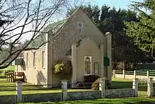
A new butter factory was built in 1921.[9] Another industry was the flax mill.[10] St Davids Presbyterian Church was dedicated on Sunday 18 October 1925. Meeting halls were built in 1916[5] and 1954.[11]
Marae
The community of Waharoa is very close, with most people belonging to the Ngāti Hauā iwi.
The local Raungaiti Marae is affiliated with the Ngāti Hauā hapū of Ngāti Rangi Tawhaki and Ngāti Te Oro, and with the iwi of Waikato Tainui. It includes Te Oro meeting house.[16][17]
In October 2020, the Government committed $734,311 from the Provincial Growth Fund to upgrade the marae and 4 other Ngāti Hauā marae, creating 7 jobs.[18]
Demographics
Waharoa township
In 2013 77.1% of the population was Māori.[19]
| Year | Population | Households | Average income | National average |
|---|---|---|---|---|
| 1886 | 3[20] | |||
| 1891 | 29[21] | |||
| 1896 | 131[22] | |||
| 1901 | 121[23] | |||
| 1906 | 188[24] | |||
| 1911 | 199[25] | |||
| 1916 | 258[26] | |||
| 1991 | 645[27] | |||
| 1996 | 558[27] | |||
| 2001 | 534 | 153 | $11,300 | $18,500 |
| 2006 | 507 | 150 | $14,400 | $24,100 |
| 2013 | 465 | 147 | $19,300 | $27,900[28] |
Waharoa-Peria
| Year | Pop. | ±% p.a. |
|---|---|---|
| 2006 | 1,314 | — |
| 2013 | 1,263 | −0.56% |
| 2018 | 1,521 | +3.79% |
| Source: [1] | ||
The statistical area of Waharoa-Peria, which at 74 square kilometres is larger than the settlement, had a population of 1,521 at the 2018 New Zealand census, an increase of 258 people (20.4%) since the 2013 census, and an increase of 207 people (15.8%) since the 2006 census. There were 471 households. There were 771 males and 747 females, giving a sex ratio of 1.03 males per female. The median age was 35.9 years, with 360 people (23.7%) aged under 15 years, 309 (20.3%) aged 15 to 29, 702 (46.2%) aged 30 to 64, and 150 (9.9%) aged 65 or older.
Ethnicities were 67.7% European/Pākehā, 36.3% Māori, 2.6% Pacific peoples, 4.1% Asian, and 1.0% other ethnicities (totals add to more than 100% since people could identify with multiple ethnicities).
The proportion of people born overseas was 11.0%, compared with 27.1% nationally.
Although some people objected to giving their religion, 50.1% had no religion, 37.1% were Christian, 1.4% were Hindu, 0.2% were Muslim, 0.2% were Buddhist and 2.4% had other religions.
Of those at least 15 years old, 141 (12.1%) people had a bachelor or higher degree, and 297 (25.6%) people had no formal qualifications. The median income was $35,200. The employment status of those at least 15 was that 642 (55.3%) people were employed full-time, 192 (16.5%) were part-time, and 84 (7.2%) were unemployed.[1]
Education
Te Kura o Waharoa is the township's state primary school, teaching Year 1 to 6 students in the Māori language.[29] It opened in 1887, with the current buildings dating from 1949, 1957, 1965 and 1967.[5] It has a roll of 25 as of March 2020.[30]
Wairere School is a co-educational state primary school located in the Wardville area north-west of Waharoa.[31] with a roll of 39 as of March 2020.[32]
See also
References
- "Statistical area 1 dataset for 2018 Census". Statistics New Zealand. March 2020. Waharoa-Peria (174600). 2018 Census place summary: Waharoa-Peria
- "Map of Wahora". Wises (via. Google). 2012. Retrieved 9 June 2012.
- "PostShop/Kiwibank Locator". www.nzpost.co.nz. Retrieved 16 November 2018.
- "Raungaiti | Maori Maps". maorimaps.com. Retrieved 30 September 2019.
- "Matamata-Piako District Heritage Trail" (PDF). 2009.
- Taonga, New Zealand Ministry for Culture and Heritage Te Manatu. "15. – Waikato places – Te Ara: The Encyclopedia of New Zealand". teara.govt.nz. Retrieved 30 September 2019.
- Waterson, D. B. "Firth, Josiah Clifton". The Encyclopedia of New Zealand. Retrieved 1 July 2019.
- "The Special Settlement at Matamata". New Zealand Herald. 15 September 1886. p. 6. Retrieved 14 May 2018.
- "Milk Powder Industry". Waikato Times. 25 June 1921. p. 6. Retrieved 14 May 2018.
- "Waharoa". Waikato Times. 29 May 1906. p. 2. Retrieved 14 May 2018.
- "Waharoa Hall of Remembrance". nzhistory.govt.nz. Retrieved 16 November 2018.
- "Current and historical topographic maps (topomaps) of New Zealand". www.mapspast.org.nz. 1944. Retrieved 14 May 2018.
- Scoble, Juliet (2010). "Names & Opening & Closing Dates of Railway Stations" (PDF). Rail Heritage Trust of New Zealand.
- "Appendix to the Journals of the House of Representatives — 1923 Session I-II — D-02 Page XXII". atojs.natlib.govt.nz. Retrieved 14 May 2018.
- "Appendix to the Journals of the House of Representatives — 1924 Session I — D-02 Page XLI". atojs.natlib.govt.nz. Retrieved 14 May 2018.
- "Te Kāhui Māngai directory". tkm.govt.nz. Te Puni Kōkiri.
- "Māori Maps". maorimaps.com. Te Potiki National Trust.
- "Marae Announcements" (Excel). growregions.govt.nz. Provincial Growth Fund. 9 October 2020.
- "2013 Census QuickStats about a place". Retrieved 14 May 2018.
- "RESULTS OF A CENSUS OF THE COLONY OF NEW ZEALAND taken for the night of the 28th March 1886".
- "RESULTS OF A CENSUS OF THE COLONY OF NEW ZEALAND".
- "RESULTS OF A CENSUS OF THE COLONY OF NEW ZEALAND taken for the night of 12th April 1896".
- https://www3.stats.govt.nz/historic_publications/1901-census/1901-results-census/1901-results-census.htm
- "RESULTS OF A CENSUS OF THE COLONY OF NEW ZEALAND TAKEN FOR THE NIGHT OF THE 29th APRIL, 1906".
- "RESULTS OF A CENSUS OF THE DOMINION OF NEW ZEALAND".
- "REPORT ON THE RESULTS OF A CENSUS OF THE POPULATION OF THE DOMINION OF NEW ZEALAND TAKEN FOR THE NIGHT OF THE 15th OCTOBER, 1916". Retrieved 30 September 2019.
- "Waikato Region". cdm20045.contentdm.oclc.org. Retrieved 30 September 2019.
- "2013 Census map – QuickStats about a place". archive.stats.govt.nz. Retrieved 14 May 2018.
- "Ministry of Education School Profile". educationcounts.govt.nz. Ministry of Education.
- "Education Review Office Report". ero.govt.nz. Education Review Office.
- "Ministry of Education School Profile". educationcounts.govt.nz. Ministry of Education.
- "Education Review Office Report". ero.govt.nz. Education Review Office.
