Wakpala, South Dakota
Wakpala is an unincorporated community in Corson County, South Dakota, United States, on the west side of the Missouri River, north-northwest of Mobridge. Although not tracked by the Census Bureau, Wakpala has been assigned the ZIP code of 57658. Wakpala is within the boundaries of the Standing Rock Indian Reservation, and its name loosely translates to "creek" in the Lakota language,[3] with Oak Creek running south on its eastern edge.
Wakpala, South Dakota | |
|---|---|
 Wakpala  Wakpala | |
| Coordinates: 45°40′36″N 100°32′18″W | |
| Country | United States |
| State | South Dakota |
| County | Corson |
| Area | |
| • Total | 18.7 sq mi (48.5 km2) |
| • Land | 18.7 sq mi (48.5 km2) |
| • Water | 0.0 sq mi (0.1 km2) |
| Elevation | 1,726 ft (526 m) |
| Population (2000) | |
| • Total | 234 |
| • Density | 12.5/sq mi (4.8/km2) |
| Time zone | UTC-7 (Mountain (MST)) |
| • Summer (DST) | UTC-6 (MDT) |
| ZIP code | 57658 |
| Area code(s) | 605 |
| FIPS code | 46-68180[1] |
| GNIS feature ID | 1269112[2] |
Chief Gall (Piji, Pizhi) is buried at Saint Elizabeth Episcopal Cemetery here and Chief Sitting Bull (Tatanka Iyotake) is possibly buried under a concrete bust bearing his name a few miles south of town in the Mobridge area. Sitting Bull was originally buried at Fort Yates, North Dakota but an effort was made to exhume his bones and rebury him at the present site, but some individuals assert that the bones moved are not his.
The annual Wakpala Wacipi (dance or powwow) is held on the last weekend in August.
References
- "U.S. Census website". United States Census Bureau. Retrieved 2008-01-31.
- "US Board on Geographic Names". United States Geological Survey. 2007-10-25. Retrieved 2008-01-31.
- Federal Writers' Project (1940). South Dakota place-names, v.1-3. University of South Dakota. p. 66.
Municipalities and communities of Corson County, South Dakota, United States | ||
|---|---|---|
| Cities | 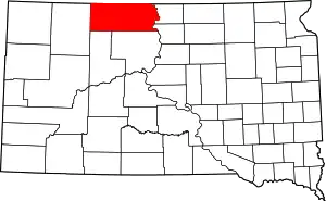 | |
| Town | ||
| CDPs | ||
| Unincorporated communities | ||
| Indian reservation | ||
| Ghost town | ||
| Footnotes | ‡This populated place also has portions in an adjacent county or counties | |
| ||