Wallowa, Oregon
Wallowa (/wəˈlaʊwə/) is a city in Wallowa County, Oregon, United States. The population was 808 at the 2010 census.
Wallowa, Oregon | |
|---|---|
 Wallowa Public Library | |
 Location in Oregon | |
| Coordinates: 45°34′17″N 117°31′55″W | |
| Country | United States |
| State | Oregon |
| County | Wallowa |
| Incorporated | 1899 |
| Government | |
| • Mayor | Gary Hulse |
| Area | |
| • Total | 0.61 sq mi (1.58 km2) |
| • Land | 0.61 sq mi (1.58 km2) |
| • Water | 0.00 sq mi (0.00 km2) |
| Elevation | 2,950 ft (899.2 m) |
| Population | |
| • Total | 808 |
| • Estimate (2019)[3] | 837 |
| • Density | 1,369.89/sq mi (528.96/km2) |
| Time zone | UTC-8 (Pacific) |
| • Summer (DST) | UTC-7 (Pacific) |
| ZIP code | 97885 |
| Area code(s) | 541 |
| FIPS code | 41-78150[2] |
| GNIS feature ID | 1151858[4] |
History
Wallowa was platted in 1889.[5] Wallowa is a Nez Perce word describing a triangular structure of stakes that in turn supported a network of sticks called lacallas to form a fish trap.[6] The Nez Perce put these traps in the Wallowa River below the outlet of Wallowa Lake.[6] The author of Oregon Geographic Names, Lewis A. McArthur, said that although the origin of this name is disputed, he puts great weight in Levi Ankeny who supplied this information as he was "thoroughly familiar with the early history and tradition of the Wallowa Valley" and "on intimate terms with many Indians who knew the facts of the matter".[6]
Geography
According to the United States Census Bureau, the city has a total area of 0.61 square miles (1.58 km2), all of it land.[7]
Climate
This region experiences warm (but not hot) and dry summers, with no average monthly temperatures above 71.6 °F (22.0 °C). According to the Köppen Climate Classification system, Wallowa has a dry-summer humid continental climate, abbreviated "Dsb" on climate maps.
| Climate data for Wallowa | |||||||||||||
|---|---|---|---|---|---|---|---|---|---|---|---|---|---|
| Month | Jan | Feb | Mar | Apr | May | Jun | Jul | Aug | Sep | Oct | Nov | Dec | Year |
| Record high °F (°C) | 64 (18) |
67 (19) |
79 (26) |
90 (32) |
98 (37) |
102 (39) |
108 (42) |
110 (43) |
102 (39) |
92 (33) |
74 (23) |
67 (19) |
110 (43) |
| Average high °F (°C) | 34.2 (1.2) |
40.6 (4.8) |
50.3 (10.2) |
59.7 (15.4) |
67.8 (19.9) |
75.4 (24.1) |
85.8 (29.9) |
84.9 (29.4) |
76.3 (24.6) |
62.8 (17.1) |
45.7 (7.6) |
35.8 (2.1) |
59.9 (15.5) |
| Average low °F (°C) | 17.1 (−8.3) |
20.9 (−6.2) |
26.6 (−3.0) |
31.4 (−0.3) |
37 (3) |
42.5 (5.8) |
45.3 (7.4) |
43.1 (6.2) |
37.1 (2.8) |
30.7 (−0.7) |
25.6 (−3.6) |
19.6 (−6.9) |
31.4 (−0.3) |
| Record low °F (°C) | −34 (−37) |
−33 (−36) |
−14 (−26) |
5 (−15) |
16 (−9) |
26 (−3) |
19 (−7) |
22 (−6) |
16 (−9) |
5 (−15) |
−22 (−30) |
−38 (−39) |
−38 (−39) |
| Average precipitation inches (mm) | 1.79 (45) |
1.42 (36) |
1.46 (37) |
1.42 (36) |
1.76 (45) |
1.64 (42) |
0.67 (17) |
0.78 (20) |
1.08 (27) |
1.49 (38) |
2 (51) |
1.9 (48) |
17.4 (440) |
| Average snowfall inches (cm) | 13.1 (33) |
8.8 (22) |
4.5 (11) |
1.4 (3.6) |
0.1 (0.25) |
0 (0) |
0 (0) |
0 (0) |
0 (0) |
0.4 (1.0) |
5.1 (13) |
11.9 (30) |
45.3 (115) |
| Average precipitation days | 12 | 10 | 11 | 9 | 10 | 9 | 4 | 4 | 5 | 8 | 12 | 12 | 106 |
| Source: [8] | |||||||||||||
Demographics
| Historical population | |||
|---|---|---|---|
| Census | Pop. | %± | |
| 1900 | 243 | — | |
| 1910 | 793 | 226.3% | |
| 1920 | 894 | 12.7% | |
| 1930 | 749 | −16.2% | |
| 1940 | 838 | 11.9% | |
| 1950 | 1,055 | 25.9% | |
| 1960 | 989 | −6.3% | |
| 1970 | 811 | −18.0% | |
| 1980 | 847 | 4.4% | |
| 1990 | 748 | −11.7% | |
| 2000 | 869 | 16.2% | |
| 2010 | 808 | −7.0% | |
| 2019 (est.) | 837 | [3] | 3.6% |
| U.S. Decennial Census[9] | |||
2010 census
As of the census of 2010, there were 808 people, 352 households, and 222 families residing in the city. The population density was 1,324.6 inhabitants per square mile (511.4/km2). There were 394 housing units at an average density of 645.9 per square mile (249.4/km2). The racial makeup of the city was 95.9% White, 0.5% African American, 0.4% Native American, 0.4% from other races, and 2.8% from two or more races. Hispanic or Latino of any race were 2.0% of the population.[2]
There were 352 households, of which 25.3% had children under the age of 18 living with them, 50.0% were married couples living together, 9.7% had a female householder with no husband present, 3.4% had a male householder with no wife present, and 36.9% were non-families. 31.8% of all households were made up of individuals, and 16.5% had someone living alone who was 65 years of age or older. The average household size was 2.24 and the average family size was 2.82.[2]
The median age in the city was 48.2 years. 20.7% of residents were under the age of 18; 5.8% were between the ages of 18 and 24; 18.4% were from 25 to 44; 34.2% were from 45 to 64; and 21% were 65 years of age or older. The gender makeup of the city was 49.3% male and 50.7% female.[2]
2000 census
As of the census of 2000, there were 869 people, 350 households, and 248 families residing in the city. The population density was 1,414.7 people per square mile (550.0/km2). There were 396 housing units at an average density of 644.7 per square mile (250.6/km2). The racial makeup of the city was 95.51% White, 0.12% African American, 0.46% Native American, 0.12% Asian, 1.73% from other races, and 2.07% from two or more races. Hispanic or Latino of any race were 2.99% of the population.[2]
There were 350 households, out of which 34.6% had children under the age of 18 living with them, 56.9% were married couples living together, 10.9% had a female householder with no husband present, and 28.9% were non-families. 26.9% of all households were made up of individuals, and 14.9% had someone living alone who was 65 years of age or older. The average household size was 2.48 and the average family size was 3.00.[2]

In the city, the population was spread out, with 29.8% under the age of 18, 4.3% from 18 to 24, 23.1% from 25 to 44, 23.9% from 45 to 64, and 18.9% who were 65 years of age or older. The median age was 41 years. For every 100 females, there were 101.6 males. For every 100 females age 18 and over, there were 92.4 males.[2]
The median income for a household in the city was $28,603, and the median income for a family was $31,964. Males had a median income of $30,313 versus $15,417 for females. The per capita income for the city was $14,203. About 19.5% of families and 22.0% of the population were below the poverty line, including 33.1% of those under age 18 and 13.6% of those age 65 or over.[2]
Notable people
Schools
These schools reside in Wallowa School District #12 which is located in Wallowa, OR, which is in the Wallowa Valley, which is located in Wallowa County, OR. "The district is home to about 195 students and 35 staff. The elementary school and high school reside on the same campus which provides a unique opportunity for collaboration and a unity between students and staff. The small class sizes provide students with a high level of support from staff. Wallowa staff pride themselves on knowing their students and families well."[10] Their mission statement is "Through Student learning, Strategic Teaching, teamwork, and flexibility, all Wallowa School District students will become successful and positive contributors to society."[10]
Wallowa Elementary School[11]
Wallowa Elementary School educates grades preschool through six. They have approximately 100 students. 62% of their student population is economically disadvantaged. 11% of their student population have a disability.[12] The school also has a student-run newspaper called the Cougar Club Chronicle; it is run by the fifth-grade class under the leadership of Jennifer Gibbs.
Wallowa Jr./Sr. High School[13]
Wallowa High School currently educates grades seven through twelve. They have had a 100% graduation rate since 2012.[14] The high school used to house all K-12 students, until their student population grew large enough to require the building of their elementary school. Their mascot is the cougar and their school colors are orange and black. Their current principal, Rebecca Nordvedt has been their principal for three years. Their choir program was restarted in 2015 by Heleene Hipple and placed at state the same year. There is a strong FFA (Future Farmers of America) program that many students take part in. As of the fall of 2017, they have added six new electives to their previous three being shop, choir, and band.
References
- "2019 U.S. Gazetteer Files". United States Census Bureau. Retrieved July 28, 2020.
- "U.S. Census website". United States Census Bureau. Retrieved 2012-12-21.
- "Population and Housing Unit Estimates". United States Census Bureau. May 24, 2020. Retrieved May 27, 2020.
- "US Board on Geographic Names". United States Geological Survey. 2007-10-25. Retrieved 2008-01-31.
- Bailey, Barbara Ruth (1982). Main Street: Northeastern Oregon. Oregon Historical Society. p. 29. ISBN 0-87595-073-6.
- McArthur, Lewis A.; McArthur, Lewis L. (2003) [1928]. Oregon Geographic Names (7th ed.). Portland, Oregon: Oregon Historical Society Press. p. 1006. ISBN 978-0875952772.
- "US Gazetteer files 2010". United States Census Bureau. Retrieved 2012-12-21.
- "WALLOWA, OR (358997)". Western Regional Climate Center. Retrieved November 26, 2015.
- "Census of Population and Housing". Census.gov. Retrieved June 4, 2015.
- http://www.wallowa.k12.or.us/about
- http://www.wallowa.k12.or.us/elementary-school
- https://schools.oregonlive.com/school/Wallowa/Wallowa-Elementary-School/
- http://www.wallowa.k12.or.us/jr-sr-high-school
- http://www.oregonlive.com/education/index.ssf/2009/06/high_school_dropout_rates.html
External links
| Wikimedia Commons has media related to Wallowa, Oregon. |
Municipalities and communities of Wallowa County, Oregon, United States | ||
|---|---|---|
| Cities | 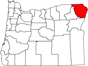 Wallowa County map | |
| CDP | ||
| Other unincorporated communities | ||
| Ghost towns | ||
| ||
| Authority control |
|---|