Welcome, Minnesota
Welcome is a city in Martin County, Minnesota, United States. The population was 686 at the 2010 census.[5] The U.S. Census Bureau estimated 2018 population is 649.[6]
Welcome | |
|---|---|
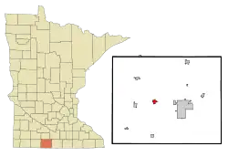 Location of Welcome, Minnesota | |
| Coordinates: 43°40′2″N 94°37′8″W | |
| Country | United States |
| State | Minnesota |
| County | Martin |
| Government | |
| • City Council | Mayor Jack Newville |
| Area | |
| • Total | 1.46 sq mi (3.77 km2) |
| • Land | 1.46 sq mi (3.77 km2) |
| • Water | 0.00 sq mi (0.00 km2) |
| Elevation | 1,243 ft (379 m) |
| Population | |
| • Total | 686 |
| • Estimate (2019)[3] | 649 |
| • Density | 445.74/sq mi (172.15/km2) |
| Time zone | UTC-6 (Central (CST)) |
| • Summer (DST) | UTC-5 (CDT) |
| ZIP code | 56181 |
| Area code(s) | 507 |
| FIPS code | 27-69070 |
| GNIS feature ID | 0653899[4] |
In 1988, Welcome combined with nearby Sherburn and Trimont schools to form the Martin County West School District.
In 1999, Welcome combined its Police Department, with nearby Sherburn. The Department is currently known as the "Sherburn/Welcome Police Department".
History
A post office called Welcome has been in operation since 1881.[7] The city was named after Alfred M. Welcome, who owned a farm on what became the city's southwest side.[8]
Geography
According to the United States Census Bureau, the city has a total area of 1.47 square miles (3.81 km2), all of it land.[9] The original description of the site was "Section 1, Township 102, Range 32."[10]
Demographics
| Historical population | |||
|---|---|---|---|
| Census | Pop. | %± | |
| 1890 | 140 | — | |
| 1900 | 549 | 292.1% | |
| 1910 | 543 | −1.1% | |
| 1920 | 612 | 12.7% | |
| 1930 | 519 | −15.2% | |
| 1940 | 630 | 21.4% | |
| 1950 | 712 | 13.0% | |
| 1960 | 733 | 2.9% | |
| 1970 | 694 | −5.3% | |
| 1980 | 855 | 23.2% | |
| 1990 | 790 | −7.6% | |
| 2000 | 721 | −8.7% | |
| 2010 | 686 | −4.9% | |
| 2019 (est.) | 649 | [3] | −5.4% |
| U.S. Decennial Census[11] | |||
2010 census
As of the census[2] of 2010, there were 686 people, 310 households, and 193 families living in the city. The population density was 466.7 inhabitants per square mile (180.2/km2). There were 341 housing units at an average density of 232.0 per square mile (89.6/km2). The racial makeup of the city was 99.9% White and 0.1% African American. Hispanic or Latino of any race were 2.9% of the population.
There were 310 households, of which 23.9% had children under the age of 18 living with them, 47.4% were married couples living together, 9.0% had a female householder with no husband present, 5.8% had a male householder with no wife present, and 37.7% were non-families. 32.6% of all households were made up of individuals, and 14.8% had someone living alone who was 65 years of age or older. The average household size was 2.21 and the average family size was 2.77.
The median age in the city was 44.3 years. 22% of residents were under the age of 18; 7% were between the ages of 18 and 24; 21.7% were from 25 to 44; 31% were from 45 to 64; and 18.4% were 65 years of age or older. The gender makeup of the city was 49.7% male and 50.3% female.
2000 census
As of the census of 2000, there were 721 people, 310 households, and 200 families living in the city. The population density was 792.4 people per square mile (305.9/km2). There were 347 housing units at an average density of 381.3 per square mile (147.2/km2). The racial makeup of the city was 99.17% White, 0.14% from other races, and 0.69% from two or more races. Hispanic or Latino of any race were 0.97% of the population.
There were 310 households, out of which 28.7% had children under the age of 18 living with them, 54.8% were married couples living together, 6.5% had a female householder with no husband present, and 35.2% were non-families. 31.0% of all households were made up of individuals, and 16.1% had someone living alone who was 65 years of age or older. The average household size was 2.33 and the average family size was 2.90.
In the city, the population was spread out, with 25.4% under the age of 18, 6.2% from 18 to 24, 24.5% from 25 to 44, 24.1% from 45 to 64, and 19.7% who were 65 years of age or older. The median age was 41 years. For every 100 females, there were 107.2 males. For every 100 females age 18 and over, there were 99.3 males.
The median income for a household in the city was $32,125, and the median income for a family was $38,438. Males had a median income of $30,875 versus $20,536 for females. The per capita income for the city was $16,539. About 3.9% of families and 6.9% of the population were below the poverty line, including 7.4% of those under age 18 and 6.7% of those age 65 or over.
References
- "2019 U.S. Gazetteer Files". United States Census Bureau. Retrieved July 26, 2020.
- "U.S. Census website". United States Census Bureau. Retrieved 2012-11-13.
- "Population and Housing Unit Estimates". United States Census Bureau. May 24, 2020. Retrieved May 27, 2020.
- "US Board on Geographic Names". United States Geological Survey. 2007-10-25. Retrieved 2008-01-31.
- "2010 Census Redistricting Data (Public Law 94-171) Summary File". American FactFinder. United States Census Bureau. Retrieved 27 April 2011.
- "Population and Housing Unit Estimates". Retrieved March 7, 2020.
- "Martin County". Jim Forte Postal History. Retrieved 21 July 2015.
- "Minnesota Place Names - Township and Village Information". Minnesota Historical Society. Retrieved 30 April 2011.
- "US Gazetteer files 2010". United States Census Bureau. Retrieved 2012-11-13.
- "Memorial Record of The Counties of Faribault, Martin, Watowan and Jackson, Minnesota (Illustrated)," Chicago, The Lewis Publishing Company, 1895, page 330
- United States Census Bureau. "Census of Population and Housing". Retrieved September 12, 2013.
Municipalities and communities of Martin County, Minnesota, United States | ||
|---|---|---|
| Cities | 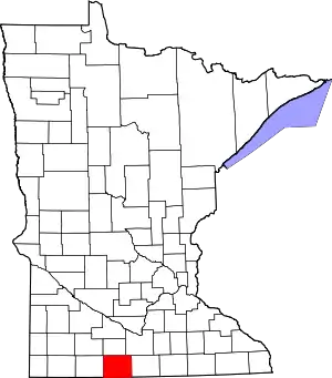 Map of Minnesota highlighting Martin County | |
| Townships | ||
| Unincorporated communities | ||
| Footnotes | ‡This populated place also has portions in an adjacent county or counties | |
| ||
| Authority control |
|---|