Truman, Minnesota
Truman is a city in Martin County, Minnesota, United States. The population was 1,115 at the 2010 census.[6] The U.S. Census Bureau estimated 2018 population is 1,053.[7]
Truman | |
|---|---|
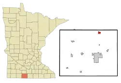 Location of Truman, Minnesota | |
| Coordinates: 43°49′41″N 94°26′1″W | |
| Country | United States |
| State | Minnesota |
| County | Martin |
| Area | |
| • Total | 1.10 sq mi (2.85 km2) |
| • Land | 1.10 sq mi (2.85 km2) |
| • Water | 0.00 sq mi (0.00 km2) |
| Elevation | 1,109 ft (338 m) |
| Population | |
| • Total | 1,115 |
| • Estimate (2019)[3] | 1,042 |
| • Density | 948.13/sq mi (366.09/km2) |
| Time zone | UTC-6 (Central (CST)) |
| • Summer (DST) | UTC-5 (CDT) |
| ZIP code | 56088 |
| Area code(s) | 507 |
| FIPS code | 27-65668[4] |
| GNIS feature ID | 0653356[5] |
| Website | www.trumanmn.us |
History
Truman was platted in 1899.[8] It was named for Truman Clark, the son of a railroad official.[9] A post office has been in operation in Truman since 1899.[10][11]
Geography
According to the United States Census Bureau, the city has a total area of 1.09 square miles (2.82 km2), all of it land.[12]
Minnesota State Highway 15 serves as a main route in the city.
Demographics
| Historical population | |||
|---|---|---|---|
| Census | Pop. | %± | |
| 1900 | 261 | — | |
| 1910 | 451 | 72.8% | |
| 1920 | 752 | 66.7% | |
| 1930 | 730 | −2.9% | |
| 1940 | 984 | 34.8% | |
| 1950 | 1,106 | 12.4% | |
| 1960 | 1,256 | 13.6% | |
| 1970 | 1,137 | −9.5% | |
| 1980 | 1,392 | 22.4% | |
| 1990 | 1,292 | −7.2% | |
| 2000 | 1,259 | −2.6% | |
| 2010 | 1,115 | −11.4% | |
| 2019 (est.) | 1,042 | [3] | −6.5% |
| U.S. Decennial Census | |||
2010 census
As of the census[2] of 2010, there were 1,115 people, 479 households, and 298 families living in the city. The population density was 1,022.9 inhabitants per square mile (394.9/km2). There were 541 housing units at an average density of 496.3 per square mile (191.6/km2). The racial makeup of the city was 97.6% White, 0.2% African American, 0.2% Native American, 0.6% Asian, 0.4% from other races, and 1.0% from two or more races. Hispanic or Latino of any race were 2.4% of the population.
There were 479 households, of which 29.4% had children under the age of 18 living with them, 48.9% were married couples living together, 9.2% had a female householder with no husband present, 4.2% had a male householder with no wife present, and 37.8% were non-families. 32.6% of all households were made up of individuals, and 18.2% had someone living alone who was 65 years of age or older. The average household size was 2.23 and the average family size was 2.79.
The median age in the city was 47.4 years. 23.5% of residents were under the age of 18; 5% were between the ages of 18 and 24; 19.3% were from 25 to 44; 26.8% were from 45 to 64; and 25.5% were 65 years of age or older. The gender makeup of the city was 48.6% male and 51.4% female.
2000 census
As of the census[4] of 2000, there were 1,259 people, 510 households, and 318 families living in the city. The population density was 1,160.1 people per square mile (446.0/km2). There were 542 housing units at an average density of 499.4 per square mile (192.0/km2). The racial makeup of the city was 99.21% White, 0.16% African American, 0.32% Native American, 0.08% Asian, and 0.24% from two or more races. Hispanic or Latino of any race were 0.56% of the population.
There were 510 households, out of which 26.3% had children under the age of 18 living with them, 52.5% were married couples living together, 7.6% had a female householder with no husband present, and 37.6% were non-families. 33.3% of all households were made up of individuals, and 20.0% had someone living alone who was 65 years of age or older. The average household size was 2.25 and the average family size was 2.90.
In the city, the population was spread out, with 22.9% under the age of 18, 5.2% from 18 to 24, 22.8% from 25 to 44, 21.1% from 45 to 64, and 28.0% who were 65 years of age or older. The median age was 44 years. For every 100 females, there were 86.2 males. For every 100 females age 18 and over, there were 75.6 males.
The median income for a household in the city was $35,000, and the median income for a family was $46,750. Males had a median income of $31,292 versus $20,850 for females. The per capita income for the city was $18,305. About 5.6% of families and 9.2% of the population were below the poverty line, including 13.5% of those under age 18 and 10.2% of those age 65 or over.
Notable people
- William A. Hinton, Minnesota state senator, lived in Truman.[13]
References
- "2019 U.S. Gazetteer Files". United States Census Bureau. Retrieved July 26, 2020.
- "U.S. Census website". United States Census Bureau. Retrieved 2012-11-13.
- "Population and Housing Unit Estimates". United States Census Bureau. May 24, 2020. Retrieved May 27, 2020.
- "U.S. Census website". United States Census Bureau. Retrieved 2008-01-31.
- "US Board on Geographic Names". United States Geological Survey. 2007-10-25. Retrieved 2008-01-31.
- "2010 Census Redistricting Data (Public Law 94-171) Summary File". American FactFinder. United States Census Bureau. Retrieved 27 April 2011.
- "Population and Housing Unit Estimates". Retrieved February 15, 2020.
- Upham, Warren (1920). Minnesota Geographic Names: Their Origin and Historic Significance. Minnesota Historical Society. p. 335.
- Chicago and North Western Railway Company (1908). A History of the Origin of the Place Names Connected with the Chicago & North Western and Chicago, St. Paul, Minneapolis & Omaha Railways. p. 195.
- "Martin County". Jim Forte Postal History. Retrieved 5 April 2015.
- "City of Truman Minnesota | A great place to call home!". trumanmn.us. Retrieved 2016-07-20.
- "US Gazetteer files 2010". United States Census Bureau. Archived from the original on 2012-01-25. Retrieved 2012-11-13.
- 'The Legislative Manual of the State of Minnesota 1907,' Minnesota Legislature, Biographical Sketch of William A. Hinton, pg. 650
External links
Municipalities and communities of Martin County, Minnesota, United States | ||
|---|---|---|
| Cities |  Map of Minnesota highlighting Martin County | |
| Townships | ||
| Unincorporated communities | ||
| Footnotes | ‡This populated place also has portions in an adjacent county or counties | |
| ||
| Authority control |
|
|---|
