Martin County, Minnesota
Martin County is a county in Minnesota, United States. As of the 2010 United States Census, the population was 20,840.[1] Its county seat is Fairmont.[2]
Martin County | |
|---|---|
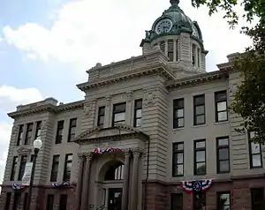 Martin County Courthouse in Fairmont | |
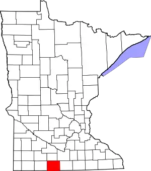 Location within the U.S. state of Minnesota | |
 Minnesota's location within the U.S. | |
| Coordinates: 43°41′N 94°34′W | |
| Country | |
| State | |
| Founded | May 23, 1857 |
| Named for | Henry Martin |
| Seat | Fairmont |
| Largest city | Fairmont |
| Area | |
| • Total | 730 sq mi (1,900 km2) |
| • Land | 712 sq mi (1,840 km2) |
| • Water | 17 sq mi (40 km2) 2.4%% |
| Population (2010) | |
| • Total | 20,840 |
| • Estimate (2019) | 19,683 |
| • Density | 27.9/sq mi (10.8/km2) |
| Time zone | UTC−6 (Central) |
| • Summer (DST) | UTC−5 (CDT) |
| Congressional district | 1st |
| Website | www |
History
The county was created by the Minnesota Territory legislature on May 23, 1857, with Fair Mount (which was also platted in 1857) designated as county seat. The town's name was later shortened to Fairmont. Two explanations have been advanced for the county's name. A delegate to the US congress from the Wisconsin Territory introduced the legislative act to organize the Minnesota Territory; his name was Morgan Lewis Martin. However, in 1904 the county's oldest residents attested that the name referred to Henry Martin, an early settler from Connecticut who ran several businesses during the pre-territory era.[3][4]
Geography
Martin County lies on the south side of Minnesota. Its south border abuts the north border of the state of Iowa. The East Fork of the Des Moines River flows southeastward through the lower western part of the county. The county terrain consists of low rolling hills, dotted with lakes and ponds, completely devoted to agriculture where possible.[5] The terrain slopes to the east and north, with its highest point near its southwest corner, at 1,407' (429m) ASL.[6] The county has a total area of 730 square miles (1,900 km2), of which 712 square miles (1,840 km2) is land and 17 square miles (44 km2) (2.4%) is water.[7]
Major highways
Airports
Adjacent counties
- Watonwan County - north
- Blue Earth County - northeast
- Faribault County - east
- Kossuth County, Iowa - southeast
- Emmet County, Iowa - southwest
- Jackson County - west
Protected areas[5]
- Ceylon State Wildlife Management Area
- Fox Lake Refuge
- Luedtke State Wildlife Management Area
- Perch Creek State Wildlife Management Area
- State Wildlife Management Area
- Truman Wildlife Area
Lakes[5]
- Amber Lake
- Big Twin Lake
- Bright Lake
- Budd Lake
- Buffalo Lake (Cedar Township)
- Buffalo Lake (Rutland Township)
- Canright Lake
- Cedar Lake
- Clam Lake
- Clayton Lake
- Clear Lake
- Creek Lake
- Eagle Lake
- East Chain Lake
- Fish Lake (Cedar Township)
- Fish Lake (Lake Belt Township)
- Fox Lake
- Hall Lake
- High Lake
- Iowa Lake (part)
- Kiester Lake
- Lake Charlotte
- Lake George
- Lake Imogene
- Lake Seymour
- Little Hat Lake
- Little Twin Lake
- Martin Lake
- Mud Lake
- Murphy Lake
- North Lake
- North Silver Lake
- Okamanpeedan Lake (part)
- Perch Lake
- Pierce Lake
- Rose Lake
- Round Lake (Fox Lake Township)
- Round Lake (Waverly Township)
- Sager Lakes
- Sisseton Lake
- South Silver Lake
- Susan Lake
- Temperance Lake
- Tuttle Lake
- Watkins Lake
- Wilmert Lake
Demographics
| Historical population | |||
|---|---|---|---|
| Census | Pop. | %± | |
| 1860 | 151 | — | |
| 1870 | 3,867 | 2,460.9% | |
| 1880 | 5,249 | 35.7% | |
| 1890 | 9,408 | 79.2% | |
| 1900 | 16,936 | 80.0% | |
| 1910 | 17,518 | 3.4% | |
| 1920 | 21,085 | 20.4% | |
| 1930 | 22,401 | 6.2% | |
| 1940 | 24,656 | 10.1% | |
| 1950 | 25,655 | 4.1% | |
| 1960 | 26,986 | 5.2% | |
| 1970 | 24,316 | −9.9% | |
| 1980 | 24,687 | 1.5% | |
| 1990 | 22,914 | −7.2% | |
| 2000 | 21,802 | −4.9% | |
| 2010 | 20,840 | −4.4% | |
| 2019 (est.) | 19,683 | [9] | −5.6% |
| US Decennial Census[10] 1790-1960[11] 1900-1990[12] 1990-2000[13] 2010-2019[1] | |||
2000 census
As of the 2000 United States Census, there were 21,802 people, 9,067 households, and 6,047 families in the county. The population density was 30.6/sqmi (11.8/km2). There were 9,800 housing units at an average density of 13.8/sqmi (5.31/km2). The racial makeup of the county was 97.22% White, 0.25% Black or African American, 0.10% Native American, 0.42% Asian, 0.02% Pacific Islander, 1.26% from other races, and 0.73% from two or more races. 1.93% of the population were Hispanic or Latino of any race. 51.6% were of German, 11.9% Norwegian, 5.9% Swedish and 5.0% English ancestry.
There were 9,067 households, out of which 29.80% had children under the age of 18 living with them, 56.60% were married couples living together, 7.20% had a female householder with no husband present, and 33.30% were non-families. 30.00% of all households were made up of individuals, and 15.20% had someone living alone who was 65 years of age or older. The average household size was 2.35 and the average family size was 2.92.
The county population contained 24.80% under the age of 18, 6.40% from 18 to 24, 24.90% from 25 to 44, 24.00% from 45 to 64, and 19.90% who were 65 years of age or older. The median age was 42 years. For every 100 females there were 95.30 males. For every 100 females age 18 and over, there were 91.50 males.
The median income for a household in the county was $34,810, and the median income for a family was $44,541. Males had a median income of $30,467 versus $21,780 for females. The per capita income for the county was $18,529. About 7.10% of families and 10.50% of the population were below the poverty line, including 15.10% of those under age 18 and 9.00% of those age 65 or over.
Communities
Cities
Unincorporated communities
Townships
- Cedar Township
- Center Creek Township
- East Chain Township
- Elm Creek Township
- Fairmont Township
- Fox Lake Township
- Fraser Township
- Galena Township
- Jay Township
- Lake Belt Township
- Lake Fremont Township
- Manyaska Township
- Nashville Township
- Pleasant Prairie Township
- Rolling Green Township
- Rutland Township
- Silver Lake Township
- Tenhassen Township
- Waverly Township
- Westford Township
Government and Politics
Martin County voters have been reliably Republican for decades. In only one national election since 1980 has the county selected the Democratic Party candidate (as of 2016).
| Year | Republican | Democratic | Third parties |
|---|---|---|---|
| 2016 | 67.1% 7,062 | 26.0% 2,733 | 7.0% 736 |
| 2012 | 60.7% 6,657 | 37.0% 4,054 | 2.3% 257 |
| 2008 | 56.3% 6,053 | 41.0% 4,413 | 2.7% 288 |
| 2004 | 57.1% 6,311 | 41.6% 4,590 | 1.3% 146 |
| 2000 | 54.8% 5,686 | 40.2% 4,166 | 5.0% 519 |
| 1996 | 40.9% 4,303 | 44.9% 4,718 | 14.2% 1,496 |
| 1992 | 38.2% 4,438 | 34.6% 4,019 | 27.2% 3,152 |
| 1988 | 53.3% 5,724 | 45.9% 4,922 | 0.8% 85 |
| 1984 | 60.7% 7,308 | 38.8% 4,673 | 0.5% 64 |
| 1980 | 57.4% 7,057 | 35.0% 4,301 | 7.6% 936 |
| 1976 | 51.9% 6,484 | 45.4% 5,672 | 2.7% 332 |
| 1972 | 64.6% 7,569 | 32.6% 3,816 | 2.8% 333 |
| 1968 | 59.4% 7,115 | 35.7% 4,271 | 4.9% 587 |
| 1964 | 53.8% 6,529 | 46.0% 5,575 | 0.2% 22 |
| 1960 | 66.8% 8,479 | 33.0% 4,194 | 0.2% 19 |
| 1956 | 71.2% 8,152 | 28.7% 3,289 | 0.1% 15 |
| 1952 | 77.6% 9,411 | 22.1% 2,673 | 0.3% 39 |
| 1948 | 43.3% 4,662 | 55.9% 6,015 | 0.8% 87 |
| 1944 | 53.7% 5,182 | 46.0% 4,443 | 0.3% 29 |
| 1940 | 59.8% 6,409 | 40.0% 4,290 | 0.2% 21 |
| 1936 | 31.5% 3,090 | 66.1% 6,492 | 2.5% 243 |
| 1932 | 38.3% 3,004 | 60.3% 4,731 | 1.5% 116 |
| 1928 | 64.1% 5,110 | 35.4% 2,822 | 0.5% 40 |
| 1924 | 56.2% 4,238 | 10.0% 751 | 33.8% 2,546 |
| 1920 | 78.5% 5,142 | 18.6% 1,221 | 2.9% 191 |
| 1916 | 47.2% 1,741 | 47.6% 1,756 | 5.3% 195 |
| 1912 | 17.5% 578 | 34.5% 1,141 | 48.1% 1,591 |
| 1908 | 59.1% 1,922 | 32.4% 1,054 | 8.6% 279 |
| 1904 | 70.7% 2,167 | 21.4% 656 | 8.0% 244 |
| 1900 | 54.7% 1,819 | 37.1% 1,233 | 8.2% 274 |
| 1896 | 54.3% 1,739 | 41.4% 1,327 | 4.3% 136 |
| 1892 | 57.2% 1,189 | 31.8% 661 | 11.0% 228 |
| Position | Name | District | Next Election | |
|---|---|---|---|---|
| Commissioner and Vice Chair | Elliot Belgard | District 1 | 2020 | |
| Commissioner | Tom Mahoney | District 2 | 2022 | |
| Commissioner | Kathy Smith | District 3 | 2020 | |
| Commissioner | Richard Coons | District 4 | 2022 | |
| Commissioner and Chairperson | Steven Flohrs | District 5 | 2020 | |
| Position | Name | Affiliation | District | |
|---|---|---|---|---|
| Senate | Julie Rosen[16] | Republican | District 23 | |
| House of Representatives | Bob Gunther[17] | Republican | District 23A | |
| Position | Name | Affiliation | District | |
|---|---|---|---|---|
| House of Representatives | Jim Hagedorn[18] | Republican | 1st | |
| Senate | Amy Klobuchar[19] | Democrat | N/A | |
| Senate | Tina Smith[20] | Democrat | N/A | |
References
- "State & County QuickFacts". United States Census Bureau. Archived from the original on June 7, 2011. Retrieved September 1, 2013.
- "Find a County". National Association of Counties. Retrieved June 7, 2011.
- Upham, Warren. Minnesota Geographic Names (1920), pp. 332-3 (accessed April 18, 2019)
- Chicago and North Western Railway Company (1908). A History of the Origin of the Place Names Connected with the Chicago & North Western and Chicago, St. Paul, Minneapolis & Omaha Railways. p. 162.
- Martin County MN Google Maps (accessed April 18, 2019)
- ""Find an Altitude/Martin County MN" Google Maps (accessed April 18, 2019)". Archived from the original on 21 May 2019. Retrieved April 19, 2019.
- "2010 Census Gazetteer Files". US Census Bureau. August 22, 2012. Archived from the original on September 21, 2013. Retrieved October 21, 2014.
- Nelson, Steven (2011). Savanna Soils of Minnesota. Minnesota: Self. pp. 65-67. ISBN 978-0-615-50320-2.
- "Population and Housing Unit Estimates". Retrieved March 26, 2020.
- "US Decennial Census". US Census Bureau. Retrieved October 21, 2014.
- "Historical Census Browser". University of Virginia Library. Retrieved October 21, 2014.
- "Population of Counties by Decennial Census: 1900 to 1990". US Census Bureau. Retrieved October 21, 2014.
- "Census 2000 PHC-T-4. Ranking Tables for Counties: 1990 and 2000" (PDF). US Census Bureau. Retrieved October 21, 2014.
- Leip, David. "Atlas of US Presidential Elections". uselectionatlas.org. Retrieved October 9, 2018.
- "Commissioners". www.co.martin.mn.us. Retrieved 2020-06-26.
- "MN State Senate". www.senate.mn. Retrieved 2020-06-26.
- "Rep. Bob Gunther (23A) - Minnesota House of Representatives". www.house.leg.state.mn.us. Retrieved 2020-06-26.
- "Representative Jim Hagedorn". Representative Jim Hagedorn. Retrieved 2020-06-25.
- "U.S. Senator Amy Klobuchar". www.klobuchar.senate.gov. Retrieved 2020-06-24.
- "Home". Senator Tina Smith. Retrieved 2020-06-24.
Further reading
- William H. Budd, History of Martin County: A True and Complete History of the County from its Earliest Settlement Down to 1880. Fairmont, MN: The Independent, 1897.
- Roscoe C. Hunt, "Pioneer Physicians of Martin County Prior to 1900," Minnesota Medicine, vol. 25, no. 10 (Oct. 1942) and vol. 25, no. 11 (Nov. 1942).
- Ray F. Kesler, Service Record Book of Men and Women of World War II, Martin County. Fairmont, MN: n.p., n.d. [1950s].
- Martin County Historical Society, Martin County, 1857-1932: Diamond Jubilee Celebration and Homecoming, Fairmont, Minnesota, June 26 to July 4, 1932. Fairmont, MN: Martin County Historical Society, 1932.
- Martin County Home Council, Martin County's Heritage. Fairmont, MN.: Martin County Extension Home Council, 1972–1976.
- Allen L Moore, Historical Narrative of Martin County, Before 1850. Fairmont, MN: Martin County Historical Society, 1932.
- Arthur M. Nelson, Know Your Own County: A History of Martin County, Minnesota. Fairmont, MN: Martin County Historical Society, 1947.
- Arthur M. Nelson, Martin County Men in the Great War, 1917-1919. Fairmont, MN: Sentinel Publishing Co., 1920.
- Sentinel, A Pictorial History of Martin County, MN. Marceline, MO: Heritage House, 1992.
External links
Places adjacent to Martin County, Minnesota | ||||||||||
|---|---|---|---|---|---|---|---|---|---|---|
| ||||||||||
Municipalities and communities of Martin County, Minnesota, United States | ||
|---|---|---|
| Cities | Map of Minnesota highlighting Martin County | |
| Townships | ||
| Unincorporated communities | ||
| Footnotes | ‡This populated place also has portions in an adjacent county or counties | |
| ||

| Authority control |
|---|