Winchmore Hill railway station
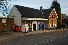
Winchmore Hill railway station is in Station Road (which, before the arrival of the railway, was known as "Middle Lane"), Winchmore Hill in the London Borough of Enfield in North London, England, in Travelcard Zone 4. It is 7 miles 63 chains (12.53 km) down the line from London King's Cross[2] on the Hertford Loop Line. The station, and all trains serving it are operated by Great Northern. Originally, upon opening in 1871, the station building was almost identical to that at neighbouring Palmers Green. However, in 1965 the northbound side of the building was demolished due to subsidence.[3] In the 1970s the station boasted, on its southbound platform, a small newsagent and sweet shop, just beyond the base of the stairs down to the platform, but by 1980 this shop had been dismantled.
| Winchmore Hill | |
|---|---|
 | |
 Winchmore Hill Location of Winchmore Hill in Greater London | |
| Location | Winchmore Hill |
| Local authority | London Borough of Enfield |
| Managed by | Great Northern |
| Station code | WIH |
| DfT category | D |
| Number of platforms | 2 |
| Fare zone | 4 |
| National Rail annual entry and exit | |
| 2015–16 | |
| 2016–17 | |
| 2017–18 | |
| 2018–19 | |
| 2019–20 | |
| Key dates | |
| 1871 | Opened |
| Other information | |
| External links | |
| WGS84 | 51.6341°N 0.1013°W |
Services
The service runs to Moorgate via Highbury & Islington. The service uses Class 717 EMUs.
The typical off-peak weekday service is 4 trains per hour to Moorgate and to Hertford North; two of the latter each hour are extended to Watton-at-Stone, one of which continues to Stevenage.[4]
At weekends, the service is a half-hourly service to Moorgate and Watton-at-Stone and an hourly service to Stevenage. Southbound trains at this time (and after 22.00 on weekdays) used to run to King's Cross, but now use the Moorgate branch throughout until the end of the service.
Developments
- Oyster pay and go arrived at this station on 2 January 2010.[5]
Connections
London Buses route W9 serve the station.
References
- "Station usage estimates". Rail statistics. Office of Rail Regulation. Please note: Some methodology may vary year on year.
- Padgett, David (October 2016) [1988]. Brailsford, Martyn (ed.). Railway Track Diagrams 2: Eastern (4th ed.). Frome: Trackmaps. map 24A. ISBN 978-0-9549866-8-1.
- Jackson, Alan A (1999). London's Local Railways. Capital Transport. p. 335. ISBN 1-85414-209-7.
- Table 24 National Rail timetable, May 2016
- Oyster Card and National Rail, National Rail Enquiries Website Archived 10 January 2008 at the Wayback Machine
External links
| Wikimedia Commons has media related to Winchmore Hill railway station. |
- Train times and station information for Winchmore Hill railway station from National Rail
| Preceding station | Following station | |||
|---|---|---|---|---|
| Palmers Green | Great Northern Hertford Loop Line |
Grange Park | ||