Woody, California
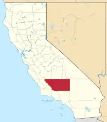
Woody (formerly, Weringdale)[3] is an unincorporated community in Kern County, California, in the United States.[1] It is located in the foothills of the Greenhorn Mountains, 25 miles (40 km) north-northeast of Bakersfield[3] at an elevation of 1,654 feet (504 m).[1]
Woody | |
|---|---|
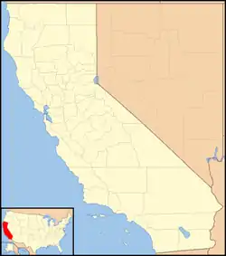
 Woody Location in California  Woody Woody (the United States) | |
| Coordinates: 35°42′15″N 118°50′03″W | |
| Country | United States |
| State | California |
| County | Kern County |
| Elevation | 1,654 ft (504 m) |
| Population (2008) | |
| • Total | 135 |
| Time zone | UTC-8 (PST) |
| • Summer (DST) | UTC-7 (PDT) |
| ZIP codes | 93287 |
| Website | [2] |
History
Woody was named after Dr. Sparrell Walter Woody, who homesteaded with his wife at the foot of Blue Mountain in 1862.[3] The Woody School District was founded in 1873 and a post office opened in 1889.[3] Copper was discovered near Woody in 1891 by Joseph Weringer, who founded the Greenback Mine and built the nine-room Weringdale Hotel. Quartz gold was found on Blue Mountain in 1894, and the population of the town, then known as Weringdale, grew to over a hundred. By the time the townsite was subdivided by Weringer in 1909, the community's name had reverted to Woody.[3]
A small ranch town, the total population of Woody has changed little since the mid-1890s. The post office, fire department, and Blue Mountain Graveyard are situated on the outskirts of town. There is also an elementary school and a community hall where the Woody residents have gatherings and events. There used to be a restaurant/ bar in Woody, but financial problems caused it to close.
A local legend states that the outlaw Joaquin Murrieta once had a cave/hideout in the area that he used while on the run.
California Historical Landmark
| Mountain House Station | |
|---|---|
| Location | 7977 Highway 155, Woody, California, in Kern County, California |
| Official name | Mountain House Station |
| Designated | May 22, 1957 |
| Reference no. | 589 |
Just outside of Woody is California Historical Landmark number 589, the Mountain House Station signed May 22, 1957. The spot was a Butterfield Overland Mail Stagecoach stop and station from 1858 to 1861. The location of the Mountain House Station was on Dry Creek, on Bakersfield-Glenville Roads about 6.3 miles from Woody.[4]
Mountain House Station California Historical Landmark reads:
- NO. 589 MOUNTAIN HOUSE - One and one-half miles north of this point stood the Mountain House Station on the route of the Butterfield Stage. Operating through present Kern County during 1858-1861, this famous line ran from St. Louis, Missouri to San Francisco until the outbreak of the Civil War.[5]
See also
- Glennville Adobe a California Historical Landmark in Woody
- California Historical Landmarks in Kern County
- California Historical Landmark
References
- U.S. Geological Survey Geographic Names Information System: Woody, California
- "Info on Woody (zip 93287), California". analyzed data. Retrieved 2009-03-17.
- Durham, David L. (1998). California's Geographic Names: A Gazetteer of Historic and Modern Names of the State. Clovis, Calif.: Word Dancer Press. p. 1129. ISBN 1-884995-14-4.
- California parks, Mountain House Station
- californiahistoricallandmarks.com Landmark chl-589
