California City, California
California City, officially the City of California City, occasionally abbreviated to Cal City, is a city incorporated in 1965 located in the northern Antelope Valley in Kern County, California, United States, 100 miles (160 km) north of the city of Los Angeles. The population was 14,120 at the 2010 census. Covering 203.63 square miles (527.4 km2), California City has the third-largest land area of any city in the state of California.
California City, California | |
|---|---|
City | |
| City of California City | |
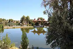 West Side of California City Central Park | |
 Seal | |
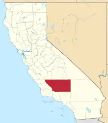
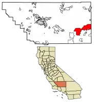 Location of California City in Kern County, California. | |
 California City, California Location in the United States | |
| Coordinates: 35°07′33″N 117°59′09″W | |
| Country | United States |
| State | California |
| County | Kern |
| Incorporated | December 10, 1965[1] |
| Government | |
| • Mayor | Charles McGuire[2] |
| • State Senator | Shannon Grove (R)[3] |
| • State Assembly | Tom Lackey (R)[4] |
| • U. S. Congress | Kevin McCarthy (R)[5] |
| Area | |
| • Total | 203.70 sq mi (527.57 km2) |
| • Land | 203.61 sq mi (527.35 km2) |
| • Water | 0.09 sq mi (0.22 km2) 0.04% |
| Elevation | 2,405 ft (733 m) |
| Population (2010) | |
| • Total | 14,120 |
| • Estimate (2019)[8] | 14,198 |
| • Density | 69.73/sq mi (26.92/km2) |
| Time zone | UTC−08:00 (PST) |
| • Summer (DST) | UTC−07:00 (PDT) |
| ZIP Codes | 93504-93505 |
| Area codes | 442/760 and 661 |
| FIPS code | 06-09780 |
| GNIS feature IDs | 1660418, 2409960 |
| Website | www |
Much of the workforce of Edwards Air Force Base, which is located 18 miles (29 km) southeast of the city, is made up of city residents. Other major sources of employment include California City Correctional Center (California Department of Corrections and Rehabilitation); Mojave Air and Space Port and its flight test operations; and the Hyundai/Kia Proving Grounds located in the rural southwestern part of the city. California City has a Park, a PGA golf course, one municipal airport, and was home to the California City Whiptails, a now-defunct professional independent baseball league team associated with the Pecos League.[9]
History
Early
Padre Francisco Garcés, a Franciscan missionary, camped at Castle Butte in what is now California City in 1776 during the Juan Bautista de Anza expedition of Alta California.
In the late 19th century, the Twenty Mule Team Trail, which carried loads of borax to the railhead in Mojave from Harmony Borax Works mines in the east, ran through the California City area.[10]
Military
The Mojave Gunnery Range "C" was used from August 1944 until January 1959, when it became part of the California City land. It included bomb targets and strafing targets such as a vehicle convoy. It was also used for pilotless aircraft just after World War II. Unexploded ordnance and toxic waste are associated with the site, and the Army Corps of Engineers began surveying the site in 1999, and by 2001 the range was described as containing 20,908 acres (8,461 ha) southwest of the California City center.[11][12][13][14]
Site surveys beginning in 1999 found MK 23 3-pound practice bombs with unfired signal cartridges, 20-millimeter Target Practice projectiles, 2.25, 2.75, and 5-inch practice rockets, high explosive bombs, and small arms ammunition from .22 to .50 caliber were found. The largest fuzed and unexploded bombs found were two 100-pound general purpose bombs.[14]
Town
In 1958, Czech-born Columbia University sociology professor and real estate developer Nathan "Nat" K. Mendelsohn purchased 82,000 acres (33,000 ha) of Mojave Desert land with the aim of making California's next great city. California City Development Company (CCDC) was aggressively marketing the city by running a "real estate school" to license and train a large salesforce, and a quarter-page Los Angeles Times advertorial described it as a "giant venture" and "inevitable growth".[15][16]
Mendelsohn hoped it would one day rival Los Angeles in population, and CCDC had the Smith and Williams architects master plan the community in 1961; Garrett Eckbo also contributed. Mendelsohn built a Central Park with a 26-acre (11 ha) artificial lake, two golf courses and a four-story Holiday Inn[17] were built next to the park. Ultimately the actions of CCDC caused the town to become known for land speculation through CCDC and successors. Mendelsohn was advertising the city for land speculation by 1962; 175 homes had been built by then. The city has a rich history of promotion, including hiring Erik Estrada to advocate for the city;[18] in the 2000s land was sold through infomercials.[19][1][20][21][22]
The Italian-American civil engineer Olindo R. Angelillo surveyed the city's aquifer on behalf of CCDC in 1959, stating it was on top of a "virtual underground lake" of 1 million acre-feet of water per year. This was quickly rebutted by the chief of a US Geological Survey office, a hydraulic engineer at the state's water department and California's Association of Engineering Geologists.[23][24][25]
The first post office opened in 1960.[26]
California City was incorporated on December 10, 1965, partly to shift municipal infrastructure responsibility to the city, rather than CCDC. It was described as having 158 square miles (410 km2) of land, 5900 landowners, 817 residents, and 232 homes.[1][19][27]
Growth fell well short of his expectations and by the time Mendelsohn sold his shares in CCDC in 1969 to Great Western United Corporation, only 1,300 people had moved in; CCDC was described as having a 1300-person salesforce at that time, with ads for "real estate salesmen" describing it as "A whole new successful way of selling California real estate!!!"[28][19][29][30]
The Federal Trade Commission also began inspecting the company in 1969, and Ralph Nader's 25-person California task force (part of "Nader's Raiders") published "Power and Land in California" in late 1971. The book accused various individuals and agencies of ineptitude and corruption, as well as focusing on California City, calling it a fraud and "a particularly stark study of government failure." By that time Mendelsohn had sold over $100 million in land.[31][19][29][30]
By the 1970s over 50,000 lots had been sold and the market dried up. The FTC filed a cease and desist against the company for misleading advertising, with a consent order coming in 1972 from FTC's Richard Lavine. Charges (which White effectively agreed with in 1971[32]) included the real estate school was primarily geared towards selling land, not providing training; enrollees were required to bring in land prospects; the property was encumbered, not fee simple, advertised improvements (e.g. roads) did not exist; it failed to meet the Truth in Lending Act. In 1974 The New York Times described Great Western City Corporation as "the troubled land development subsidiary" of Great Western United. After taking CCDC to court, the Federal Trade Commission's Ken Donney reached a settlement in 1977, with over 14,000 landowners receiving partial refunds from a $4 million pool, the largest FTC settlement to date. CCDC was also required to invest $16 million in long-promised infrastructure developments at CCDC's three cities.[19][29][33][30][34]
Although areas of California City have not developed as expected, California City has grown from 3,200 people in 1985 to over 14,000 in 2018, clustered around the west end.[19] Cerro Coso Community College closed escrow on 22 acres (8.9 ha) in the heart of California City for a community college to serve Edwards AFB, California City, Mojave, Boron, North Edwards and the entire high desert in the Antelope Valley.
Geography
Although one of California's smaller cities in terms of population, California City is the third largest city in California by land area.[35] Satellite photos underscore its claim to being California's third-largest city by land area (40th largest in the United States).[36][19] Located in the northern Antelope Valley in Kern County, California, the city is 18 miles (29 km) northwest of Edwards Air Force Base, 28 miles (45 km) east of Tehachapi, 40 miles (64 km) north of Lancaster, 49 miles (79 km) southwest of Ridgecrest, 67 miles (108 km) east of the city of Bakersfield, and 101 miles (163 km) north of the city of Los Angeles.
Geology
In 2000, the depth to groundwater was 370 feet (110 m).[14]
The Garlock Fault runs nearby.
Climate
| Climate data for California City, CA | |||||||||||||
|---|---|---|---|---|---|---|---|---|---|---|---|---|---|
| Month | Jan | Feb | Mar | Apr | May | Jun | Jul | Aug | Sep | Oct | Nov | Dec | Year |
| Average high °F (°C) | 58 (14) |
62 (17) |
66 (19) |
72 (22) |
81 (27) |
91 (33) |
97 (36) |
96 (36) |
90 (32) |
79 (26) |
66 (19) |
58 (14) |
76 (25) |
| Average low °F (°C) | 34 (1) |
37 (3) |
41 (5) |
46 (8) |
54 (12) |
62 (17) |
67 (19) |
66 (19) |
59 (15) |
49 (9) |
39 (4) |
33 (1) |
49 (9) |
| Average precipitation inches (mm) | 1.34 (34) |
1.51 (38) |
1.13 (29) |
0.22 (5.6) |
0.15 (3.8) |
0.05 (1.3) |
0.16 (4.1) |
0.27 (6.9) |
0.28 (7.1) |
0.28 (7.1) |
0.43 (11) |
0.81 (21) |
6.63 (168.9) |
| Source: The Weather Channel[37] | |||||||||||||
Demographics
| Historical population | |||
|---|---|---|---|
| Census | Pop. | %± | |
| 1970 | 1,309 | — | |
| 1980 | 2,743 | 109.5% | |
| 1990 | 5,955 | 117.1% | |
| 2000 | 8,385 | 40.8% | |
| 2010 | 14,120 | 68.4% | |
| 2019 (est.) | 14,198 | [8] | 0.6% |
| U.S. Decennial Census[38] | |||
2000
According to the census[39] of 2000, there were 8,385 people in 3,067 households, including 2,257 families, in the city. As of 2006, the city's population grew 8.9% from 12,106 to 13,219. California City outpaced rivals Palmdale and Lancaster, making the city the 12th fastest growing city in California. This also made California City the fastest growing city in the Antelope Valley. The population density was 41.2 inhabitants per square mile (15.9/km2). There were 3,560 housing units at an average density of 17.5/sq mi (6.8/km2). The racial makeup of the city was 68.19% White, 12.82% Black or African American, 1.56% Native American, 3.73% Asian, 0.32% Pacific Islander, 7.43% from other races, and 5.94% from two or more races. 16.96% of the population were Hispanic or Latino of any race.
Of the 3,067 households, 39.0% had children under the age of 18 living with them, 55.8% were married couples living together, 13.0% had a female householder with no husband present, and 26.4% were non-families. 21.2% of households were one person and 7.2% were one person aged 65 or older. The average household size was 2.72 and the average family size was 3.15.
The age distribution was 30.7% under the age of 18, 7.3% from 18 to 24, 27.7% from 25 to 44, 23.5% from 45 to 64, and 10.7% 65 or older. The median age was 36 years. For every 100 females, there were 99.5 males. For every 100 females age 18 and over, there were 99.0 males.
The median income for a household in the city was $45,735, and the median family income was $51,402. Males had a median income of $44,657 versus $28,152 for females. The per capita income for the city was $19,902. About 12.5% of families and 17.3% of the population were below the poverty line, including 28.0% of those under age 18 and 12.4% of those age 65 or over.
31% of the male population were public administrators in 2006. Public administration is the most common job in California City.
Although the growth of the city has not met its founders' expectations, California City has seen substantial population growth over the past several years. The Demographic Research Unit of the California Department of Finance estimated California City's population at 12,048 as of January 1, 2006. California City's population increased an estimated 4.2% in 2005, over three times the growth rate of the state as a whole. California City currently ranks 345th out of 478 incorporated cities in California, up from 348th in 2005.[40]
In the 2004 Presidential election, 66% voted for the Republican candidate, and 32% voted for the Democratic candidate. In 2016 the vote for president was 53% Republican and 40% Democratic.
2010
At the 2010 census California City had a population of 14,120. The population density was 69.3 people per square mile (26.8/km2). The racial makeup of California City was 9,188 (65.1%) White (39.9% were non-Hispanic whites), 2,150 (15.2%) African American, 132 (0.9%) Native American, 367 (2.6%) Asian, 59 (0.4%) Pacific Islander, 1,431 (10.1%) from other races, and 793 (5.6%) from two or more races. Hispanic or Latino of any race were 5,385 persons (38.1%).[41]
The census reported that 11,506 people (81.5% of the population) lived in households, no one lived in non-institutionalized group quarters and 2,614 (18.5%) were institutionalized.
There were 4,102 households, 1,611 (39.3%) had children under the age of 18 living in them, 1,980 (48.3%) were opposite-sex married couples living together, 630 (15.4%) had a female householder with no husband present, 287 (7.0%) had a male householder with no wife present. There were 335 (8.2%) unmarried opposite-sex partnerships, and 22 (0.5%) same-sex married couples or partnerships. 949 households (23.1%) were one person and 312 (7.6%) had someone living alone who was 65 or older. The average household size was 2.80. There were 2,897 families (70.6% of households); the average family size was 3.30.
The age distribution was 3,449 people (24.4%) under the age of 18, 1,294 people (9.2%) aged 18 to 24, 4,617 people (32.7%) aged 25 to 44, 3,570 people (25.3%) aged 45 to 64, and 1,190 people (8.4%) who were 65 or older. The median age was 34.8 years. For every 100 females, there were 144.0 males. For every 100 females age 18 and over, there were 160.1 males.
There were 5,210 housing units at an average density of 25.6 per square mile, of the occupied units 2,474 (60.3%) were owner-occupied and 1,628 (39.7%) were rented. The homeowner vacancy rate was 8.3%; the rental vacancy rate was 22.5%. 6,584 people (46.6% of the population) lived in owner-occupied housing units and 4,922 people (34.9%) lived in rental housing units.
Crime
.jpg.webp)
The crime index (City-Data.com crime index)
for 2006 was 267.1[42]
Infrastructure
Schools
Mojave Unified School District serves California City:
- California City Jr/Sr High
- California City Middle
- Hacienda Elementary school
- Robert P. Ulrich Elementary School (1966)
Private prison
Studies for a privately built and owned 2000-4000-bed prison on the east side of town began in 1995, and an environmental impact statement on a 550-bed facility was completed in 1996.[43] Contracts were signed between the city and Corrections Corporation of America and it was built in 1999.[44] The 2304-bed California City Correctional Facility prison housed federal inmates for the U.S. Marshal Service and U.S. Immigration and Customs Enforcement from 2006 to 2013, then was leased to the California Department of Corrections and Rehabilitation in 2013 for $28.5 million yearly in response to a federal order to reduce overcrowding at the state's prison facilities.[45][46][47][48][49]
Transportation
California City is served by Highway 14 to the west and Highway 58 to the south. Kern Transit provides direct bus service to Mojave, Lancaster, and Ridgecrest with connections to Tehachapi and Bakersfield. The direct line to Lancaster also provides a direct connection with Metrolink's Antelope Valley Line, with service into Los Angeles. Within the city, California City Dial-A-Ride (DAR) Transit provides transportation on a demand-response basis on weekdays (except on holidays when City Hall is closed).
Business
The 3,967 acres (1,605 ha) Hyundai-Kia proving grounds are in the city boundaries. 640 acres (260 ha) are in use.[14]
Public safety
As an incorporated city that does not contract with Kern County, California City has its own police and fire departments.
Sports
The California City Whiptails were a professional baseball team competing in the unaffiliated Pecos League. The team folded in 2019. Their home games were played at Balsitis Park.[9]
References
- "California Cities by Incorporation Date". California Association of Local Agency Formation Commissions. Archived from the original (Word) on November 3, 2014. Retrieved April 12, 2013.
- "City Government". City of California City. Retrieved August 28, 2015.
- "Senators". State of California. Retrieved April 12, 2013.
- "Members Assembly". State of California. Retrieved April 12, 2013.
- "California's 23rd Congressional District - Representatives & District Map". Civic Impulse, LLC. Retrieved April 12, 2013.
- "2019 U.S. Gazetteer Files". United States Census Bureau. Retrieved July 1, 2020.
- "California City". Geographic Names Information System. United States Geological Survey.
- "Population and Housing Unit Estimates". United States Census Bureau. May 24, 2020. Retrieved May 27, 2020.
- "California City Whiptails". Official Website of the California City Whiptails. Retrieved September 6, 2019.
- Deaver, W. "Mojave's History". Mojave Chamber of Commerce. Archived from the original on September 25, 2006. Retrieved September 6, 2019.
- "Bombs in Your Backyard: MOJAVE GUNNERY RANGE: CA99799FA26200". ProPublica. Retrieved August 7, 2020.
- "Bombing Range #73". spl.usace.army.mil. Retrieved August 7, 2020.
- "Mojave Gunnery Range "C"". spl.usace.army.mil. Retrieved August 7, 2020.
- "PROPOSED PLAN FOR REMEDIAL ACTION FORMER MOJAVE GUNNERY RANGE "C" MUNITIONS RESPONSE SITES/AREAS OF INTEREST, KERN COUNTY, CALIFORNIA" (PDF). spl.usace.army.mil. February 2013. Retrieved August 7, 2020.
- "Classifieds, Page 37". The San Bernardino County Sun. May 17, 1958. p. 37. Retrieved August 10, 2020.
- "California City Advertorial". Los Angeles Times. April 6, 1958. Retrieved August 14, 2020.
- Jack Phinney (March 8, 1972). "GWU Stock Plunge Linked to Huge Debt" (PDF). Denver Post. Retrieved August 15, 2020.
- "California City". BLDGBLOG. November 2009. Retrieved August 8, 2020.
- Anton, Mike (August 14, 2010). "A desert city that didn't fan out". Los Angeles Times. Retrieved September 6, 2019.
- "California City- Water resources · UCSB ADC Omeka". adc-exhibits.museum.ucsb.edu. Retrieved August 8, 2020.
- "Page 23 - Independent". Long Beach Independent. May 13, 1958. Retrieved August 10, 2020.
- "Classifieds". The San Francisco Examiner. February 7, 1973. Retrieved August 10, 2020.
- Warren Walters (March 22, 1959). "Desert Water Claim Contested". Independent Press-Telegram. Long Beach, California.
- Warren Walters (March 8, 1959). "Sufficient Water Under Desert to Serve All, Engineer Believes". Independent Press-Telegram. Long Beach, California.
- "Mixed-Use Developments · Outside In: The Architecture of Smith and Williams · UCSB ADC Omeka". adc-exhibits.museum.ucsb.edu. Retrieved August 8, 2020.
California City was chosen as a building site because of its proximity to highways, railroads, military bases, and mining. It also was purported to sit on top of an underground aquifer that would never run dry.
- Durham, David L. (1998). California's Geographic Names: A Gazetteer of Historic and Modern Names of the State. Clovis, Calif.: Word Dancer Press. p. 1010. ISBN 1-884995-14-4.
- "Big 'City' Seeking to Incorporate". Santa Maria Times. September 13, 1965. Retrieved August 14, 2020.
- "3 Nov 1969, 87 - The Los Angeles Times at Newspapers.com". Newspapers.com. Retrieved August 14, 2020.
- Robert A. Wright (November 24, 1974). "The Hunts, Sugar and Great Western United; Earnings Soar and Troubles Multiply". timesmachine.nytimes.com. Retrieved August 8, 2020.
- Paul Lewis (January 27, 1977). "Land firm ordered to refund $4 million". The Morning News (Wilmington). Retrieved August 13, 2020.
- Ron Taylor (August 26, 1971). "Nader Charges Speculators Carve Up Wilds Uselessly". The Sacramento Bee. p. D1. Retrieved August 14, 2020.
- "A sugar company 'love story'" (PDF). Scottsbluff Star-Herald. November 18, 1971. Retrieved August 15, 2020.
- "GREAT WESTERN UNITED CORPORATION Background Report" (PDF). mountainscholar.org. January 1969. Retrieved August 8, 2020.
- Phil Hilts (September 7, 1972). "7 land sales subsidiaries told to alter recruiting, ads" (PDF). Rocky Mountain News. Retrieved August 15, 2020.
- "California City: How A Developer's Failed Dream Became The State's Biggest Water Waster". CBS Sacramento. July 28, 2015.
- Hardy, Michael (September 5, 2019). "The Unbuilt Streets of California's Ghost Metropolis". Wired. Retrieved September 6, 2019.
- "Monthly Averages for California City, CA". The Weather Channel. 2011. Retrieved January 5, 2011.
- "Census of Population and Housing". United States Census Bureau. Retrieved June 4, 2015.
- "U.S. Census website". United States Census Bureau. Retrieved January 31, 2008.
- "E-1 Population Estimates for Cities, Counties and the State with Annual Percent Change — January 1, 2005 and 2006". California Department of Finance. May 2006. Archived from the original on September 23, 2006. Retrieved September 3, 2006.
- "2010 Census Interactive Population Search: CA - California City city". U.S. Census Bureau. Retrieved July 12, 2014.
- "Crime in California City, California (CA): murders, rapes, robberies, assaults, burglaries, thefts, auto thefts, arson, law enforcement employees, police officers, crime map". City-Data.com. Retrieved January 14, 2017.
- "96 EIS" (PDF). cdn.muckrock.com. June 1996. Retrieved August 7, 2020.
- "Intergovernmental Agreement between California City and the Bureau" (PDF). cdn.muckrock.com. 1999. Retrieved August 7, 2020.
- Bedell, Christine (October 25, 2013). "Cal City prison to house state inmates". Bakersfield.com. Retrieved August 21, 2016.
- California Department of Corrections and Rehabilitation. "California City Correctional Facility (CAC)". Retrieved May 2, 2020.
- "CCA Facilities". CCA. Archived from the original on January 23, 2013. Retrieved September 6, 2019.
- "Southwest Ranches letters" (PDF). cdn.muckrock.com. March 5, 2012. Retrieved August 7, 2020.
- "Detention Services - Operational Contract - California City" (PDF). cdn.muckrock.com. 2010. Retrieved August 7, 2020.
External links
| Authority control |
|---|