Wyarno, Wyoming
Wyarno is an unincorporated community in central Sheridan County, Wyoming, United States. It lies along Wyoming Highway 336, approximately 10 miles (16 km) east of the city of Sheridan, the county seat of Sheridan County.[2] Although Wyarno is unincorporated, it has a post office, with the ZIP code of 82845.[3] Public education in the community of Wyarno is provided by Sheridan County School District #2.
Wyarno, Wyoming | |
|---|---|
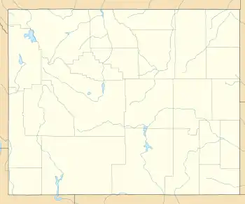 Wyarno, Wyoming Location within the state of Wyoming  Wyarno, Wyoming Wyarno, Wyoming (the United States) | |
| Coordinates: 44°48′48″N 106°46′26″W | |
| Country | United States |
| State | Wyoming |
| County | Sheridan |
| Elevation | 3,786 ft (1,154 m) |
| Time zone | UTC-7 (Mountain (MST)) |
| • Summer (DST) | UTC-6 (MDT) |
| ZIP codes | 82845 |
| GNIS feature ID | 1597548[1] |
Geography
Wyarno lies on the high plains about 12.5 miles (20.1 km) south of Montana, in the small Dutch Creek valley. The town is about 25 miles (40 km) east of the Big Horn Mountains and Bighorn National Forest. There are few populated places to the east of Wyarno. South of town about 25 miles (40 km) is Ucross, Wyoming, at the intersection of U.S. Route 14 and U.S. Route 16. Wyarno's elevation is 3,786 feet (1,154 m).[1] The BNSF Railway line between Sheridan and Gillette passes by town.[4]
References
- "Wyarno, Wyoming". Geographic Names Information System. United States Geological Survey.
- Rand McNally. The Road Atlas '08. Chicago: Rand McNally, 2008, p. 116.
- Zip Code Lookup
- Official State Highway Map of Wyoming (Map). Wyoming Department of Transportation. 2014.
|access-date=requires|url=(help)
Municipalities and communities of Sheridan County, Wyoming, United States | ||
|---|---|---|
| City | 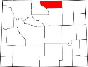 | |
| Towns | ||
| CDPs | ||
| Unincorporated communities | ||
| ||