Wyoming Highway 136
Wyoming Highway 136 (WYO 136) is a 42.70-mile-long (68.72 km) long east–west Wyoming State Road in Fremont County.
| ||||
|---|---|---|---|---|
| Gas Hills Road | ||||
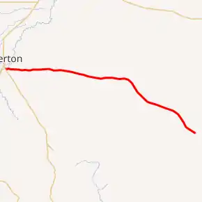
WYO 136 highlighted in red | ||||
| Route information | ||||
| Maintained by WYDOT | ||||
| Length | 42.70 mi[1] (68.72 km) | |||
| Major junctions | ||||
| West end | ||||
| East end | ||||
| Location | ||||
| Counties | Fremont | |||
| Highway system | ||||
State highways in Wyoming
| ||||

Route description
Wyoming Highway 136, named Gas Hills Road, begins at Wyoming Highway 135 south of Riverton. From there, Highway 136 travels east, crosses into the Wind River Indian Reservation and on into the Gas Hills Uranium Mining District.[2] WYO 136 reaches its eastern end at a T-intersection with Fremont CR 5 (Dry Creek Road).[3][4] Highway 136 provides access to Castle Gardens Prehistoric Site where hundreds of prehistoric carvings can be viewed on the sandstone rock.[5]
Major intersections
The entire route is in Fremont County. [6]
| Location[6] | mi | km | Destinations | Notes | |
|---|---|---|---|---|---|
| | 0.00 | 0.00 | |||
| | 42.70 | 68.72 | |||
| 1.000 mi = 1.609 km; 1.000 km = 0.621 mi | |||||
References
- Wyoming Department of Transportation Reference Marker Book - November 2004 (PDF) (Map). WYDOT. Archived from the original (PDF) on July 17, 2011. Retrieved 2011-10-20.
- Wyoming @ AARoads.com - Wyoming Routes 100-199
- Google (6 November 2011). "Overview Map of Wyoming Highway 136" (Map). Google Maps. Google. Retrieved 6 November 2011.
- Wyoming Highway 136
- Castle Gardens Prehistoric Site
- Geography Division (2016). "Wyoming Governmental Unit Reference Map". United States Census Bureau. Retrieved January 23, 2017.
This article is issued from Wikipedia. The text is licensed under Creative Commons - Attribution - Sharealike. Additional terms may apply for the media files.
