Wyoming Highway 255
Wyoming Highway 255 (WYO 255) is a short 0.48-mile-long (0.77 km) unsigned[2] Wyoming state road in the City of Casper known as N. Center Street. This route provides a connection between US 20 Business/US 26 Business and I-25/US 20/US 26/US 87 and runs concurrent with the I-25/US 87 Business route.[3]
| ||||
|---|---|---|---|---|
| N. Center Street | ||||
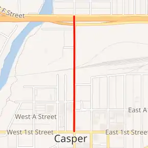
WYO 255 highlighted in red | ||||
| Route information | ||||
| Maintained by WYDOT | ||||
| Length | 0.48 mi[1] (0.77 km) | |||
| Major junctions | ||||
| South end | ||||
| North end | ||||
| Location | ||||
| Counties | Natrona | |||
| Highway system | ||||
State highways in Wyoming
| ||||

Route description
Wyoming Highway 255 begins its southern end at US 20 Business/US 26 Business (E 1st St./W 1st St.) in Casper and I-25 Business/US 87 Business which will join 255 from the east.[4] Highway 255 travels north for just under a half-mile as N. Center Street for 0.48 miles (0.77 km) to an end at I-25/US 20/US 26/US 87 at Exit 188A.[3] This route is signed as I-25 Business and US 87 Business its whole length from its southern to northern terminus.[5] WYO 255 is also not signed from the interstate.[2] However, I-25 BUS and US 87 BUS continue after Wyoming Highway 255 ends at its southern terminus by joining US 20 BUS/US 26 BUS eastbound. [4]
Major intersections
The entire route is in Casper, Natrona County.
| mi | km | Destinations | Notes | ||
|---|---|---|---|---|---|
| 0.00 | 0.00 | Southern end of I-25 Bus./US 87 Bus. concurrency; southern terminus | |||
| 0.48 | 0.77 | Northern end of I-25 Bus./US 87 Bus. concurrency; northern terminus; I-25 exit 118A; I-25 west via W. F Street | |||
1.000 mi = 1.609 km; 1.000 km = 0.621 mi
| |||||
References
- Wyoming Department of Transportation Reference Marker Book - November 2004 (PDF) (Map). WYDOT. Archived from the original (PDF) on July 17, 2011. Retrieved 2011-03-04.
- Streetview of I-25/US 87 Business - Exit 118A (WYO 255 not signed) (Map). Google Maps. Retrieved 2011-04-02.
- aaroads.com - Wyoming Routes 200-299
- Google (21 December 2016). "Wyoming Highway 255" (Map). Google Maps. Google. Retrieved 21 December 2016.
- Streetview of Center St (unsigned WYO 255) (Map). Google Maps. Retrieved 2011-04-02.
- Official 2003 State Highway Map of Wyoming
