Wyoming Highway 430
Wyoming Highway 430 (WYO 430) is a 53.52-mile-long (86.13 km) state road in south-central Sweetwater County, Wyoming, USA that runs from the Wyoming-Colorado State Line to Rock Springs.
| ||||
|---|---|---|---|---|
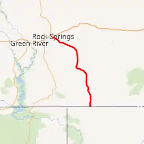
WYO 430 highlighted in red | ||||
| Route information | ||||
| Maintained by WYDOT | ||||
| Length | 53.52 mi[1] (86.13 km) | |||
| Major junctions | ||||
| South end | ||||
| North end | ||||
| Location | ||||
| Counties | Sweetwater | |||
| Highway system | ||||
State highways in Wyoming
| ||||

Route description
Wyoming Highway 430 begins its south end at the Wyoming-Colorado State Line near Hiawatha Camp, Colorado. The roadway continues south into Colorado as Moffat County Route 10N,[2] an unimproved highway all the way to Colorado State Highway 318 near Dinosaur National Monument. WYO 430 heads north-northwest from the state line towards Rock Springs. Once WYO 430 enters Rock Springs, it intersects Wyoming Highway 376 (Rock Springs Beltway) at approximately 53 miles (85 km) via Marchant Street. Here WYO 430 comes to its northern end.[3]
Major intersections
The entire route is in Sweetwater County. [4]
| Location[4] | mi | km | Destinations | Notes | |
|---|---|---|---|---|---|
| | 0.0 | 0.0 | Continuation beyond Colorado state line (To Colorado SH 318) | ||
| Rock Springs | 53.52 | 86.13 | |||
| 1.000 mi = 1.609 km; 1.000 km = 0.621 mi | |||||
References
- Wyoming Department of Transportation Reference Marker Book - November 2004 (PDF) (Map). WYDOT. Archived from the original (PDF) on July 17, 2011. Retrieved 2011-03-31.
- Google (28 December 2016). "Wyoming Highway 430" (Map). Google Maps. Google. Retrieved 28 December 2016.
- aaroads.com - Wyoming Routes 430
- Geography Division (2016). "Wyoming Governmental Unit Reference Map". United States Census Bureau. Retrieved January 24, 2017.
- Official 2003 State Highway Map of Wyoming
