Ximen metro station
Ximen (Chinese: 西門; pinyin: Xīmén, West Gate Station) is a metro station in Taipei, Taiwan served by Taipei Metro.[3] The station is named after the former west gate of the city, whose location is roughly where the current station is located.
| Taipei metro station | ||||||||||||||||
 Platform | ||||||||||||||||
| Chinese name | ||||||||||||||||
| Traditional Chinese | 西門 and 5 others | |||||||||||||||
| Simplified Chinese | 西门 | |||||||||||||||
| ||||||||||||||||
| General information | ||||||||||||||||
| Location | B1F 32-1 Baoqing Rd Wanhua, Taipei Taiwan | |||||||||||||||
| Coordinates | 25.0422°N 121.5083°E | |||||||||||||||
| Construction | ||||||||||||||||
| Structure type | Underground | |||||||||||||||
| Bicycle facilities | Access available | |||||||||||||||
| Other information | ||||||||||||||||
| Station code | G12, BL11 | |||||||||||||||
| Website | web | |||||||||||||||
| History | ||||||||||||||||
| Opened | 1999-12-24[1] | |||||||||||||||
| Key dates | ||||||||||||||||
| 2000-08-31 | Service to CKS Memorial Hall opened | |||||||||||||||
| 2014-11-15 | Songshan–Xindian line added | |||||||||||||||
| Passengers | ||||||||||||||||
| 2017 | 53.924 million per year[2] | |||||||||||||||
| Rank | 2 out of 108 | |||||||||||||||
| Services | ||||||||||||||||
| ||||||||||||||||
Station overview

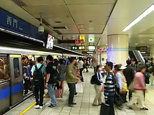
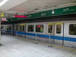
The station is a three-level,[4] underground structure with two island platforms and six exits, allowing possible connections to the shopping areas and Diary of Ximen hotel.[5] The two platforms are stacked, thus allowing for cross-platform interchange between Green Line and Blue Line. Washrooms are inside the entrance area. In November 2010, the daily ridership at Ximen station was 112,000,[6] making it the fourth busiest station on the network, just behind Taipei Main Station, Taipei City Hall and Zhongxiao Fuxing station.
It is situated under Zhonghua Rd, at the intersection of Chengdu Rd, Hengyang Rd, and Baoqing Rd. The station is also connected to the Ximen Intelligent Library (an unmanned branch of the Taipei Public Library).
Exit 6 is heavily used by those accessing the Ximending shopping area. The exit opening is set at the top of the pedestrian zone, although there is still vehicular traffic in that area. The station is often crowded on weekends, especially in the afternoon.
Station layout
| Street Level | Ground Level | Entrance/Exit |
| B1 | Concourse | Lobby, toilets, one-way ticket machine, information desk |
| shops, ATM | ||
| B2 | Platform 1 | |
| Island platform, doors open on the right, left | ||
| Platform 2 | ||
| B3 | Platform 3 | ← |
| Island platform, doors open on the left, right | ||
| Platform 4 | ← | |
History
During Japanese rule, a railway station at the current site was called Shinkichō Station (新起町乘降場) and opened on 5 November 1930. It was specifically for refueling and its location was roughly where the current MRT station is today.
After the war during post-war rebuilding, the station's name was changed to the current "Ximen". It was later closed due to illegal construction. An underground emergency station opened on 2 September 1987 as part of the Taipei Railway Underground Project.
Ximen railway station used to be a station on the TRA Western Line. However, the underground area is nowadays only used as an emergency station and not open for revenue service.
Construction of Ximen MRT station started in 1995, and the station opened on 24 December 1999 for the Blue line. On 30 August 2000, a service to CKS Memorial Hall opened, which would later become the Songshan–Xindian line on 15 November 2014.
References
| Wikimedia Commons has media related to Ximen Station. |
- "Chronicles". Taipei Metro. 5 December 2013. Retrieved 10 October 2018.
- "臺北市交通統計查詢系統". dotstat.taipei.gov.tw (in Chinese). Retrieved 15 September 2018.
- "Taiwan Quick Take: MRT line breaks ground". Taipei Times. 2006-08-20. Retrieved 2010-06-16.
- "營運路段 - 南港線西段". Department of Rapid Transit Systems. 2010-08-05. Retrieved 2010-11-28.
- "Route Map: Ximen Station". Department of Rapid Transit Systems. Retrieved 2010-06-16.
- 台北市政府交通局 首頁 > 業務資訊 > 統計資訊 > 交通統計月報 > 當期交通統計月報(另開視窗下載)