Xinhua County
Xinhua County (simplified Chinese: 新化县; traditional Chinese: 新化縣; pinyin: Xīnhuà Xiàn) is a county and the 4th most populous county-level division in the Province of Hunan, China; it is under the administration of Loudi City.
Xinhua County
新化县 Sinhwa | |
|---|---|
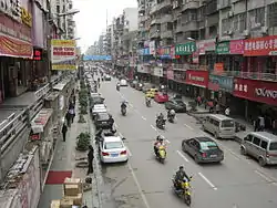 Tianhua South Road (天华南路) | |
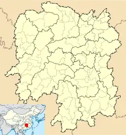 Xinhua Location in Hunan | |
| Coordinates: 27°44′13″N 111°18′29″E[1] | |
| Country | People's Republic of China |
| Province | Hunan |
| Prefecture-level city | Loudi |
| Area | |
| • Total | 3,634.98 km2 (1,403.47 sq mi) |
| Population (2010)[3] | |
| • Total | 1,110,910 |
| • Density | 310/km2 (790/sq mi) |
| Time zone | UTC+8 (China Standard) |
| Postal code | 4176XX |
Located along the middle reaches of the Zi River, it covers 3,635 square kilometers and has a population of 1,291,626 (2002). Xinhua shares the border with Lengshuijiang, Lianyuan, Xinshao, Xupu and Longhui counties and cities. As a county, it was founded at 1072 (Northern Song Dynasty) and now it is under jurisdiction of the Loudi City and subdivided into 7 townships and 19 towns, Shangmei is the county seat.
In 2011, media attention was attracted by a construction project started by the county's government. In the hope of attracting tourists, the officials wanted to build a lavish temple (Xiongshan Si - 熊山寺; 'Bear Mountain Temple'), diverting funds from more essential projects.[4][5]
Climate
| Climate data for Xinhua (1981−2010) | |||||||||||||
|---|---|---|---|---|---|---|---|---|---|---|---|---|---|
| Month | Jan | Feb | Mar | Apr | May | Jun | Jul | Aug | Sep | Oct | Nov | Dec | Year |
| Record high °C (°F) | 25.7 (78.3) |
30.1 (86.2) |
33.2 (91.8) |
35.9 (96.6) |
36.5 (97.7) |
37.5 (99.5) |
39.1 (102.4) |
39.8 (103.6) |
38.5 (101.3) |
35.7 (96.3) |
32.0 (89.6) |
24.1 (75.4) |
39.8 (103.6) |
| Average high °C (°F) | 8.8 (47.8) |
10.9 (51.6) |
15.4 (59.7) |
21.9 (71.4) |
26.8 (80.2) |
29.7 (85.5) |
33.0 (91.4) |
32.5 (90.5) |
28.6 (83.5) |
23.0 (73.4) |
17.8 (64.0) |
12.0 (53.6) |
21.7 (71.1) |
| Daily mean °C (°F) | 5.1 (41.2) |
7.1 (44.8) |
11.1 (52.0) |
17.1 (62.8) |
21.9 (71.4) |
25.2 (77.4) |
28.3 (82.9) |
27.3 (81.1) |
23.5 (74.3) |
18.2 (64.8) |
12.9 (55.2) |
7.5 (45.5) |
17.1 (62.8) |
| Average low °C (°F) | 2.4 (36.3) |
4.5 (40.1) |
8.0 (46.4) |
13.6 (56.5) |
18.2 (64.8) |
21.9 (71.4) |
24.6 (76.3) |
23.8 (74.8) |
19.9 (67.8) |
14.8 (58.6) |
9.4 (48.9) |
4.2 (39.6) |
13.8 (56.8) |
| Record low °C (°F) | −5.8 (21.6) |
−3.9 (25.0) |
−1.2 (29.8) |
3.1 (37.6) |
8.4 (47.1) |
13.5 (56.3) |
17.5 (63.5) |
16.8 (62.2) |
12.2 (54.0) |
3.7 (38.7) |
−1.3 (29.7) |
−8.5 (16.7) |
−8.5 (16.7) |
| Average precipitation mm (inches) | 69.5 (2.74) |
83.9 (3.30) |
120.4 (4.74) |
176.2 (6.94) |
189.8 (7.47) |
233.4 (9.19) |
169.1 (6.66) |
146.6 (5.77) |
78.9 (3.11) |
87.5 (3.44) |
70.6 (2.78) |
47.0 (1.85) |
1,472.9 (57.99) |
| Average relative humidity (%) | 80 | 80 | 80 | 80 | 79 | 81 | 76 | 78 | 77 | 77 | 76 | 75 | 78 |
| Source: China Meteorological Data Service Center[6] | |||||||||||||
References
- Google (2014-07-02). "Xinhua" (Map). Google Maps. Google. Retrieved 2014-07-02.
- Loudi City Land Use Plan (2006–20)/《娄底市土地利用总体规划(2006-2020年)》.(in Chinese) Accessed 8 July 2014.
- 娄底市2010年第六次全国人口普查主要数据公报 (in Chinese). Loudi People's Government. Archived from the original on July 14, 2014. Retrieved 9 July 2014.
- Poor Chinese county used relief fund to build temple. Reuters, 2011-09-26
- 湖南新化回应媒体曝“强扣水利款建旅游区”事宜 (Hunan's Xinhua [County] responds to media's claims of the diversion of irrigation funds to the construction of a tourist area).
- 中国地面气候标准值月值(1981-2010) (in Chinese). China Meteorological Data Service Center. Retrieved 20 October 2018.
External links