Yangebup, Western Australia
Yangebup is a southern suburb of Perth, Western Australia in the City of Cockburn. It takes its name from the nearby Yangebup Lake.
| Yangebup Perth, Western Australia | |||||||||||||||
|---|---|---|---|---|---|---|---|---|---|---|---|---|---|---|---|
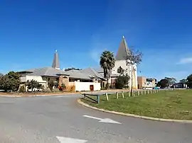 The Mater Christi Catholic Church in Yangebup | |||||||||||||||
 Yangebup | |||||||||||||||
| Coordinates | 32.129°S 115.819°E | ||||||||||||||
| Population | 7,479 (2016 census)[1] | ||||||||||||||
| Postcode(s) | 6164 | ||||||||||||||
| Location | 26 km (16 mi) from Perth | ||||||||||||||
| LGA(s) | City of Cockburn | ||||||||||||||
| State electorate(s) | Cockburn | ||||||||||||||
| Federal Division(s) | Fremantle | ||||||||||||||
| |||||||||||||||
History
The name Yangebup was first recorded in 1841 and may be derived from the Aboriginal word, Yanget, for the species of native flax or bullrush found around the lake. It was approved as the name for the suburb in 1977.[2]
Geography
The suburb is located 26 km from the Perth central business district. It is bounded by the freight rail line and North Lake Road to the north, Hammond Road to the east, Beeliar Drive to the south and Stock Road to the west.[3]
Community services
Yangebup Progress Association
The Yangebup Progress Association is the local residents' group in Yangebup; it meets on a monthly basis at the Yangebup Family Centre.
Child health nurse
Yangebup also has a child health nurse clinic located at the Yangebup Family Centre, which offers a range of services for families with babies and young children.
Facilities
Education
Yangebup has two primary schools: Yangebup Primary School, Mater Christi Catholic Primary School. It also has a school from primary to secondary school: Divine Mercy College.
Recreation
Yangebup Lake and Little Rush Lake, which forms part of the Beeliar Regional Park are located within the area. There are also several local parks in the area including:
- Ronsard Park
- Visco Park
- Levi Park, which is mainly bushland and enclosed dog exercise area
- Pereena Roche Reserve, which includes a long scenic path and a small duck lake, as well as several playgrounds
- Milgun Reserve, containing several playgrounds
- Nicholson Reserve, which serves as Yangebup Primary School's oval, and is also where the local football teams have their clubrooms
Medical
Yangebup has a medical centre, chemist and dental clinic located at the shopping centre on Swallow Drive. There is also a Child Health Nurse located at the Yangebup Family Centre on Dunraven Drive.
Vet
Yangebup has a vet clinic at the shopping centre on Swallow Drive.
References
- Australian Bureau of Statistics (27 June 2017). "Yangebup (State Suburb)". 2016 Census QuickStats. Retrieved 14 January 2018.

- Western Australian Land Information Authority. "History of metropolitan suburb names – Y". Retrieved 12 October 2007.
- Department of Land Information. StreetSmart Perth Street Directory (54th ed.). West Australian Newspapers Ltd. pp. Maps 461-462, 491–492. ISBN 978-0-909439-67-5.