Jandakot, Western Australia
Jandakot is a southern suburb of Perth, Western Australia, located within the City of Cockburn local government area. It is best known for its small but busy airport.
| Jandakot Perth, Western Australia | |||||||||||||||
|---|---|---|---|---|---|---|---|---|---|---|---|---|---|---|---|
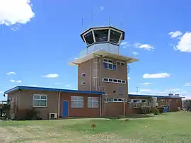 Rear of air traffic control tower, 2006 | |||||||||||||||
 Jandakot | |||||||||||||||
| Coordinates | 32.107°S 115.867°E | ||||||||||||||
| Population | 3,215 (2006 census)[1] | ||||||||||||||
| • Density | 179.6/km2 (465.2/sq mi) | ||||||||||||||
| Postcode(s) | 6164 | ||||||||||||||
| Area | 17.9 km2 (6.9 sq mi) | ||||||||||||||
| Location | 21 km (13 mi) from Perth | ||||||||||||||
| LGA(s) | City of Cockburn | ||||||||||||||
| State electorate(s) | Jandakot | ||||||||||||||
| Federal Division(s) | Fremantle | ||||||||||||||
| |||||||||||||||
History
Jandakot was originally named from Lake Jandakot, which was renamed lake Forrestdale in 1973. Maps of the Swan River Colony produced in the early 1830s show a lake of vast extent situated south west of Kelmscott. The original discoverer remains unknown but, in February 1833, Surveyor-General Septimus Roe found the size of the lake had been greatly exaggerated. It became well known as a watering place on the original track between the Canning River and Pinjarra and in 1844 its Aboriginal name was recorded as Jandacot by surveyor J.W. Gregory. During subsequent years, the name was recorded variously as Jandicott, Jandakoot and Jandakott, but the spelling eventually adopted was Jandakot. The Aboriginal meaning of the word is said to be "place of the Whistling Eagle".[2]
Geography
It is bounded to the north by the Roe Highway, Kwinana Freeway to the west, Johnston Road to the east and to the south by Fraser Road, Jandakot Road, Solomon Road and Armadale Road.[3] The northeastern boundary of the suburb is also the municipal boundary of the City of Melville and the eastern boundary is the municipal boundary of the City of Canning.
Jandakot Airport
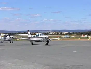
Jandakot is best known for Jandakot Airport located within it. Jandakot Airport serves pilot testing and domestic plane flights. It is the busiest secondary airport in Australia. A popular feature is the cafe that overlooks the runway. The airport was opened in 1963.
A land development company is keen to redevelop the land occupied by Jandakot Airport in exchange for a new airport more than 70 km from many airport customers. There is stiff opposition from the aviation community.[4] The aforementioned land development company received a further setback in 2006 when the Minister for Transport wrote advising them that the airport was to be operated in its current location and in accordance with their lease from the Federal Government. This will include major re-development of the airside facilities including a new parallel 12/30 runway.
Climate
Jandakot gets the comfortable climate of the Perth area with cool, wet winters and hot, dry summers. Summer temperatures can get as high as 45C, winter weather gets mild temperatures around 15C. Jandakot holds the record for the lowest temperature in the Perth metro area, of −3.4 °C (25.9 °F), and regularly drops below freezing in winter.
| Climate data for Jandakot Airport | |||||||||||||
|---|---|---|---|---|---|---|---|---|---|---|---|---|---|
| Month | Jan | Feb | Mar | Apr | May | Jun | Jul | Aug | Sep | Oct | Nov | Dec | Year |
| Record high °C (°F) | 45.7 (114.3) |
46.6 (115.9) |
43.0 (109.4) |
39.2 (102.6) |
33.4 (92.1) |
25.6 (78.1) |
25.9 (78.6) |
29.4 (84.9) |
34.2 (93.6) |
37.4 (99.3) |
40.3 (104.5) |
44.0 (111.2) |
46.6 (115.9) |
| Mean maximum °C (°F) | 40.3 (104.5) |
40.2 (104.4) |
38.5 (101.3) |
33.5 (92.3) |
28.2 (82.8) |
23.7 (74.7) |
22.3 (72.1) |
24.0 (75.2) |
26.9 (80.4) |
32.2 (90.0) |
36.6 (97.9) |
39.2 (102.6) |
42.0 (107.6) |
| Average high °C (°F) | 31.3 (88.3) |
31.6 (88.9) |
29.6 (85.3) |
25.8 (78.4) |
22.0 (71.6) |
19.2 (66.6) |
18.0 (64.4) |
18.7 (65.7) |
20.1 (68.2) |
22.9 (73.2) |
26.5 (79.7) |
29.2 (84.6) |
24.6 (76.3) |
| Average low °C (°F) | 16.8 (62.2) |
17.2 (63.0) |
15.6 (60.1) |
12.5 (54.5) |
9.3 (48.7) |
7.6 (45.7) |
6.9 (44.4) |
7.2 (45.0) |
8.2 (46.8) |
9.8 (49.6) |
12.7 (54.9) |
14.8 (58.6) |
11.6 (52.9) |
| Mean minimum °C (°F) | 9.4 (48.9) |
10.3 (50.5) |
7.2 (45.0) |
5.0 (41.0) |
2.5 (36.5) |
1.0 (33.8) |
−0.1 (31.8) |
0.8 (33.4) |
1.6 (34.9) |
3.0 (37.4) |
5.8 (42.4) |
7.9 (46.2) |
−0.9 (30.4) |
| Record low °C (°F) | 4.7 (40.5) |
6.5 (43.7) |
1.6 (34.9) |
2.3 (36.1) |
−0.6 (30.9) |
−3.4 (25.9) |
−2.8 (27.0) |
−1.4 (29.5) |
−1.3 (29.7) |
−1.0 (30.2) |
0.8 (33.4) |
3.2 (37.8) |
−3.4 (25.9) |
| Average rainfall mm (inches) | 16.1 (0.63) |
17.5 (0.69) |
16.4 (0.65) |
41.1 (1.62) |
105.2 (4.14) |
152.4 (6.00) |
173.1 (6.81) |
129.1 (5.08) |
84.2 (3.31) |
46.0 (1.81) |
27.1 (1.07) |
10.6 (0.42) |
819.6 (32.27) |
| Average precipitation days | 2.6 | 2.3 | 3.8 | 7.2 | 12.0 | 15.6 | 17.8 | 15.5 | 13.5 | 9.0 | 6.0 | 3.4 | 108.7 |
| Average afternoon relative humidity (%) (at 15:00) | 37 | 36 | 38 | 45 | 51 | 57 | 58 | 55 | 53 | 48 | 43 | 39 | 47 |
| Source: Bureau of Meteorology[5][6][7] Temperatures: 1989–2020; Rain data: 1972–2020; Relative humidity: 1990–2010 | |||||||||||||
References
- Australian Bureau of Statistics (25 October 2007). "Jandakot (State Suburb)". 2006 Census QuickStats. Retrieved 5 October 2008.
- Western Australian Land Information Authority. "History of metropolitan suburb names – J". Retrieved 7 November 2007.
- Department of Land Information. StreetSmart Perth Street Directory (54th ed.). West Australian Newspapers Ltd. pp. Maps 462-463. ISBN 978-0-909439-67-5.
- "Jandakot Airport Relocation Action group". Archived from the original on 25 December 2006. Retrieved 31 January 2020.
- "Climate statistics for Australian locations – Jandakot Airport". Bureau of Meteorology. Retrieved 16 July 2020.
- "Monthly highest temperature – Jandakot Airport". Bureau of Meteorology. Retrieved 16 July 2020.
- "Monthly lowest temperature – Jandakot Airport". Bureau of Meteorology. Retrieved 16 July 2020.