Yattendon
Yattendon is a small village and civil parish 7 miles (11 km) northeast of Newbury, Berkshire. The M4 motorway passes through the fields of the village which lie 0.5 miles (800 m) south and below the elevations of its cluster.
| Yattendon | |
|---|---|
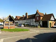 Yattendon village | |
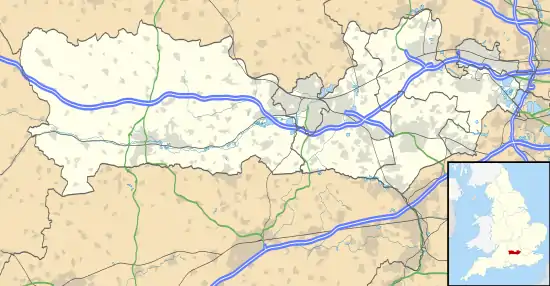 Yattendon Location within Berkshire | |
| Area | 0.63 km2 (0.24 sq mi) |
| Population | 369 (2011 census)[1] |
| • Density | 586/km2 (1,520/sq mi) |
| OS grid reference | SU5574 |
| Unitary authority | |
| Ceremonial county | |
| Region | |
| Country | England |
| Sovereign state | United Kingdom |
| Post town | Thatcham |
| Postcode district | RG18 |
| Dialling code | 01635 |
| Police | Thames Valley |
| Fire | Royal Berkshire |
| Ambulance | South Central |
| UK Parliament | |
Geography
Yattendon stretches from Everington in the west to the hamlet of Burnt Hill in the east and the woodland just east of Yattendon Court, including Mumgrove Copse, Bushy Copse, Clack's Copse and Gravelpit Copse. The motorway forms most of its southern boundary and some of the houses on the northern edge of Frilsham are actually in Yattendon. The River Pang flows through the west of the parish. It was in the hundred of Faircross, which was of little consequence after the Dissolution of the Monasteries and effectively ceased to function after 1886.
History
The village has had a shop since the 1600s.[2][3]
William Burham, a saddler and harness maker had a shop in the village from 1901 until his death in the early 1960s. A collection of his leather working tools is in the Museum of English Rural Life.[4]
Notable people
Notable residents of Yattendon include:
- Robert Bridges, who later became Poet Laureate, lived at Yattendon, where he compiled the Yattendon Hymnal, from 1882 until he moved to Boars Hill near Oxford.
- Thomas Carte, noted English historian, once held the rectory and was buried in the church.
- General Sir Miles Dempsey, British Army officer who fought in World War I and World War II.
- Edward Iliffe, 1st Baron Iliffe, the newspaper magnate who lived at Yattendon Court. From 1925 to 1940, he amalgamated several small farming estates and formed the Yattendon Estate in 1955. It covers nearly 9,000 acres (36 km2) of farmland, woodland, grazing and Christmas tree plantations.[5]
- Egon Ronay the restaurant critic, lived in Yattendon until his death in 2010.
- Alfred Waterhouse, the architect of the Natural History Museum who built himself a home at Yattendon Court (not the present building).
- Ruth Mott, presenter of the BBC's Victorian Kitchen and Wartime Kitchen and Garden series. Technical advisor on the 2001 Robert Altman film Gosford Park.
The fortified manor house or castle, Yattendon Castle was home of:
- Sir Henry Norreys, a Tudor courtier accused of adultery with Queen Anne Boleyn and the father of
- Henry Norris, 1st Baron Norreys, Ambassador to France and father of
- Sir John Norreys, the greatest soldier of Elizabethan England whose memorial is in the parish church
References
- Key Statistics: Dwellings; Quick Statistics: Population Density; Physical Environment: Land Use Survey 2005
- "Yattendon Village Stores and Post Office". Yattendon. Retrieved 27 February 2020.
- "Yattendon Stores". Retrieved 27 February 2020.
- "Burnham, William (saddler)". The Museum of English Rural Life. Retrieved 27 February 2020.
- "The thirty landowners who own half a county". Who owns England?.
External links
| Wikimedia Commons has media related to Yattendon. |
- Royal Berkshire History: Yattendon
- Royal Berkshire History: Yattendon Castle
- Royal Berkshire History: Yattendon Court
- Yattendon Estate