Combe, Berkshire
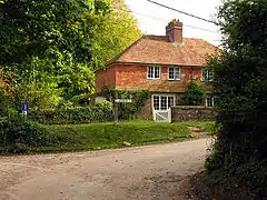
Combe is a village and civil parish in the English county of Berkshire. It is situated in the district of West Berkshire, on the top of the downs near Walbury Hill and Combe Gibbet, overlooking the village of Inkpen and the valley of the River Kennet. Historically part of Hampshire, Combe has been administered with Berkshire since 1895.[1] It is in the civil parish olf West Woodhay.
| Combe | |
|---|---|
 Intersection at Combe | |
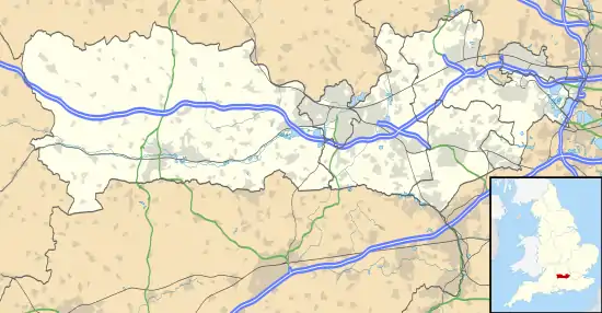
 Combe Location within Berkshire | |
| Population | 38 (2001) |
| OS grid reference | SU370608 |
| Civil parish |
|
| Unitary authority | |
| Ceremonial county | |
| Region | |
| Country | England |
| Sovereign state | United Kingdom |
| Post town | HUNGERFORD |
| Postcode district | RG17 |
| Dialling code | 01488 |
| Police | Thames Valley |
| Fire | Royal Berkshire |
| Ambulance | South Central |
| UK Parliament | |
History
Bronze Age people in this part of Europe constructed communal long barrows to bury their important dead and one is a Scheduled Ancient Monument in the civil parish beneath Gibbet Hill's peak which forms part of the same escarpment as larger Walbury Hill which is mostly in Combe, in the North Wessex Downs, altogether the highest point in the South East.
Both male and female bodies of the dead may have been left in the open to be reduced to skeletons by carrion before being collected and buried. In many cases the corpses were carefully assembled with the head to the south, men facing east, women facing west. It is unknown whether this was the case in the so-called Inkpen long barrow (named after the village to the north but within Combe), though it is on an east–west alignment.[2]
Landmarks
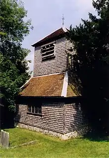
St Swithun's Church

The Church of England parish church of Saint Swithun is Norman, with the nave dating from the second half of the 12th century.[3][4] The interior has additions from the 17th century, such as the chancel roof. The tower is made of wood on flint, and the bell chamber above holds three bells; one pre-reformation, one dated 1616 and one dated 1831.[5]
Geography
Combe has a Site of Special Scientific Interest (SSSI) just to the south west of the village, called Combe Wood and Linkenholt Hanging.[7]
Combe is located to the south of Gallows Down, close to Combe Gibbet and Walbury Hill.
References
- Great Britain Historical GIS / University of Portsmouth, Coombe, Hampshire (historic map). Retrieved 2008-08-17.
- Historic England. "Details from listed building database (1013198)". National Heritage List for England. Retrieved 10 December 2014. Long barrow at Combe Gibbet, Gallows Down. Scheduled Ancient Monument.
- "St. Swithun, Combe". achurchnearyou.com. Church of England. Archived from the original on 3 January 2021. Retrieved 3 January 2021.
- "St. Swithun, Combe". walburybeaconbenefice.org.uk. Church of England. Archived from the original on 3 January 2021. Retrieved 3 January 2021.
- "Parishes: Combe". british-history.ac.uk. British History. Archived from the original on 3 January 2021. Retrieved 3 January 2021.
- 1221122
- "Magic Map Application". Magic.defra.gov.uk. Retrieved 19 March 2017.
