Zhangping
Zhangping (Chinese: 漳平; pinyin: Zhāngpíng; POJ: Chiang-pêng) is a city in the southwest of Fujian province, People's Republic of China. It is under the administration of the prefecture-level city of Longyan.
Zhangping
漳平市 Changping | |
|---|---|
 | |
 Zhangping in Longyan | |
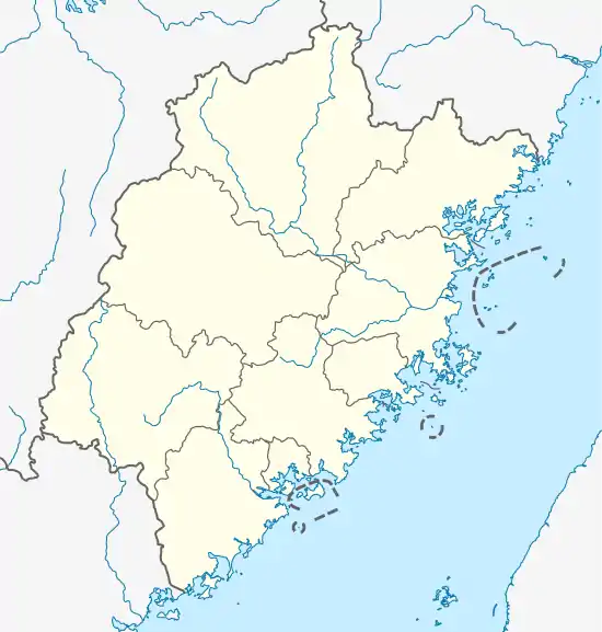
 Zhangping Location in Fujian | |
| Coordinates: 25°17′25″N 117°25′12″E | |
| Country | People's Republic of China |
| Province | Fujian |
| Prefecture-level city | Longyan |
| Elevation | 165 m (541 ft) |
| Time zone | UTC+8 (China Standard) |
Transport
Zhangping is a rail hub in southwestern Fujian, where the Yingtan–Xiamen Railway, Zhangping–Longchuan, and Zhangping–Quanzhou–Xiaocuo Railways converge.
Climate
| Climate data for Zhangping (1981−2010) | |||||||||||||
|---|---|---|---|---|---|---|---|---|---|---|---|---|---|
| Month | Jan | Feb | Mar | Apr | May | Jun | Jul | Aug | Sep | Oct | Nov | Dec | Year |
| Record high °C (°F) | 29.1 (84.4) |
34.5 (94.1) |
34.4 (93.9) |
36.5 (97.7) |
37.7 (99.9) |
38.7 (101.7) |
41.2 (106.2) |
40.0 (104.0) |
38.3 (100.9) |
36.5 (97.7) |
36.5 (97.7) |
29.9 (85.8) |
41.2 (106.2) |
| Average high °C (°F) | 18.5 (65.3) |
20.0 (68.0) |
22.3 (72.1) |
26.3 (79.3) |
29.5 (85.1) |
31.8 (89.2) |
34.8 (94.6) |
34.1 (93.4) |
31.8 (89.2) |
28.7 (83.7) |
24.4 (75.9) |
20.1 (68.2) |
26.9 (80.3) |
| Daily mean °C (°F) | 12.2 (54.0) |
14.1 (57.4) |
16.7 (62.1) |
20.7 (69.3) |
24.0 (75.2) |
26.4 (79.5) |
28.2 (82.8) |
27.6 (81.7) |
25.8 (78.4) |
22.2 (72.0) |
17.3 (63.1) |
12.8 (55.0) |
20.7 (69.2) |
| Average low °C (°F) | 8.3 (46.9) |
10.2 (50.4) |
13.0 (55.4) |
17.0 (62.6) |
20.1 (68.2) |
22.8 (73.0) |
23.8 (74.8) |
23.7 (74.7) |
22.0 (71.6) |
17.8 (64.0) |
12.8 (55.0) |
8.5 (47.3) |
16.7 (62.0) |
| Record low °C (°F) | −3.2 (26.2) |
−1.7 (28.9) |
−1.3 (29.7) |
7.2 (45.0) |
11.5 (52.7) |
15.0 (59.0) |
19.0 (66.2) |
19.1 (66.4) |
14.5 (58.1) |
6.1 (43.0) |
−0.3 (31.5) |
−5.4 (22.3) |
−5.4 (22.3) |
| Average precipitation mm (inches) | 52.2 (2.06) |
103.1 (4.06) |
173.9 (6.85) |
179.4 (7.06) |
214.6 (8.45) |
243.2 (9.57) |
139.2 (5.48) |
180.4 (7.10) |
127.8 (5.03) |
46.0 (1.81) |
37.6 (1.48) |
37.4 (1.47) |
1,534.8 (60.42) |
| Average relative humidity (%) | 77 | 77 | 79 | 79 | 79 | 81 | 76 | 79 | 78 | 75 | 75 | 77 | 78 |
| Source: China Meteorological Data Service Center | |||||||||||||
Administrative divisions
Subdistricts:[1]
- Jingcheng Subdistrict (菁城街道), Guilin Subdistrict (桂林街道)
Towns:
- Xinqiao (新桥镇), Yongfu (永福镇), Xinan (溪南镇), Shuangyang (双洋镇), Heping (和平镇), Gongqiao (拱桥镇), Xianghu (象湖镇), Chishui (赤水镇)
Townships:
- Luzhi Township (芦芝乡), Xiyuan Township (西园乡), Nanyang Township (南洋乡), Guantian Township (官田乡), Wuci Township (吾祠乡), Lingdi Township (灵地乡)
This article is issued from Wikipedia. The text is licensed under Creative Commons - Attribution - Sharealike. Additional terms may apply for the media files.