Datian County
![]() Datian (simplified Chinese: 大田县; traditional Chinese: 大田縣; pinyin: Dàtián Xiàn; Pe̍h-ōe-jī: Tāi-chhân-koān) is a county of central Fujian province, People's Republic of China. It is placed under the jurisdiction of the Sanming City.
Datian (simplified Chinese: 大田县; traditional Chinese: 大田縣; pinyin: Dàtián Xiàn; Pe̍h-ōe-jī: Tāi-chhân-koān) is a county of central Fujian province, People's Republic of China. It is placed under the jurisdiction of the Sanming City.
Datian County
大田县 Tatien | |
|---|---|
 | |
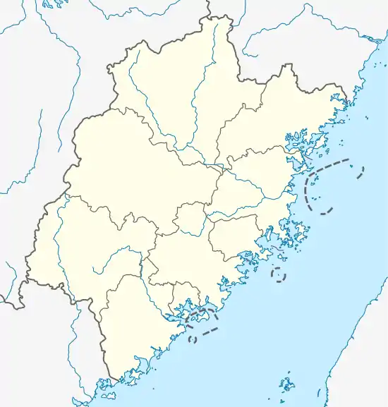 Datian Location in Fujian | |
| Coordinates: 25°46′N 117°50′E | |
| Country | People's Republic of China |
| Province | Fujian |
| Prefecture-level city | Sanming |
| Time zone | UTC+8 (China Standard) |
History
Before the year 1535, this area belonged to four counties: Youxi, Dehua, Yong'an and Zhangping. Datian County was set up and affiliated to Yanping Fu (延平府, mordern Nanping) in 1535. The county changed affiliate to Yongchun Zhou (永春州, modern Yongchun County) in 1734, then to Yong'an Division (永安专区, mordern Sanming Prefecture) in 1949.
Administrative divisions
Towns:[1]
- Junxi (均溪镇), Shangjing (上京镇), Guangping (广平镇), Taoyuan (桃源镇), Taihua (太华镇), Jianshe (建设镇), Shipai (石牌镇), Qitao (奇韬镇)
Townships:
- Huaxing Township (华兴乡), Pingshan Township (屏山乡), Wushan Township (吴山乡), Jiyang Township (济阳乡), Wuling Township (武陵乡), Xieyang Township (谢洋乡), Wenjiang Township (文江乡), Meishan Township (梅山乡), Humei Township (湖美乡), Qianping Township (前坪乡)
Demographics
The population of the district was 362,566 inhabitants in 1999.[2]
The people speak Datian Min, which is sometimes considered a dialect of Southern Min (Minnan), although due to its low intelligibility with the latter is also considered a separate branch of Min Chinese.
Climate
| Climate data for Datian (1981−2010) | |||||||||||||
|---|---|---|---|---|---|---|---|---|---|---|---|---|---|
| Month | Jan | Feb | Mar | Apr | May | Jun | Jul | Aug | Sep | Oct | Nov | Dec | Year |
| Record high °C (°F) | 28.7 (83.7) |
33.9 (93.0) |
33.8 (92.8) |
34.9 (94.8) |
35.8 (96.4) |
37.7 (99.9) |
39.6 (103.3) |
39.5 (103.1) |
37.6 (99.7) |
35.6 (96.1) |
35.4 (95.7) |
29.7 (85.5) |
39.6 (103.3) |
| Average high °C (°F) | 16.4 (61.5) |
17.5 (63.5) |
20.6 (69.1) |
24.9 (76.8) |
28.1 (82.6) |
30.5 (86.9) |
33.5 (92.3) |
32.8 (91.0) |
30.0 (86.0) |
26.5 (79.7) |
22.1 (71.8) |
17.9 (64.2) |
25.1 (77.1) |
| Daily mean °C (°F) | 10.3 (50.5) |
11.9 (53.4) |
14.9 (58.8) |
19.3 (66.7) |
22.5 (72.5) |
25.2 (77.4) |
27.1 (80.8) |
26.4 (79.5) |
24.2 (75.6) |
20.3 (68.5) |
15.6 (60.1) |
11.0 (51.8) |
19.1 (66.3) |
| Average low °C (°F) | 6.6 (43.9) |
8.4 (47.1) |
11.2 (52.2) |
15.4 (59.7) |
18.7 (65.7) |
21.5 (70.7) |
22.7 (72.9) |
22.6 (72.7) |
20.6 (69.1) |
16.3 (61.3) |
11.5 (52.7) |
6.8 (44.2) |
15.2 (59.4) |
| Record low °C (°F) | −4.2 (24.4) |
−3.0 (26.6) |
−3.1 (26.4) |
4.1 (39.4) |
8.6 (47.5) |
13.5 (56.3) |
18.4 (65.1) |
16.7 (62.1) |
11.9 (53.4) |
4.9 (40.8) |
−1.0 (30.2) |
−6.7 (19.9) |
−6.7 (19.9) |
| Average precipitation mm (inches) | 56.5 (2.22) |
104.1 (4.10) |
167.6 (6.60) |
190.7 (7.51) |
225.4 (8.87) |
243.8 (9.60) |
122.5 (4.82) |
191.9 (7.56) |
121.9 (4.80) |
51.9 (2.04) |
37.0 (1.46) |
36.9 (1.45) |
1,550.2 (61.03) |
| Average relative humidity (%) | 79 | 80 | 81 | 80 | 80 | 81 | 76 | 80 | 80 | 77 | 78 | 78 | 79 |
| Source: China Meteorological Data Service Center | |||||||||||||
Notes and references
- "三明市-行政区划网 www.xzqh.org" (in Chinese). XZQH. Retrieved 2012-05-24.
- National Population Statistics Materials by County and City - 1999 Period,infas.harvard.edu / ~ chgis/work/downloads/faqs/1999_pop_faq.html China City & County Population 1999, Harvard China Historical GIS Archived 2013-08-10 at the Wayback Machine