Điện Biên Province
Điện Biên (![]() listen) is a province in the Northwest region of Vietnam. It is bordered by Lai Châu to the northeast, Sơn La to the southeast, Pu'er City, Yunnan, China, to the northwest, and Phongsaly Province in Laos to the west.
listen) is a province in the Northwest region of Vietnam. It is bordered by Lai Châu to the northeast, Sơn La to the southeast, Pu'er City, Yunnan, China, to the northwest, and Phongsaly Province in Laos to the west.
Điện Biên Province
Tỉnh Điện Biên | |
|---|---|
 Mường Ảng district | |
| Nickname(s): Stable frontier | |
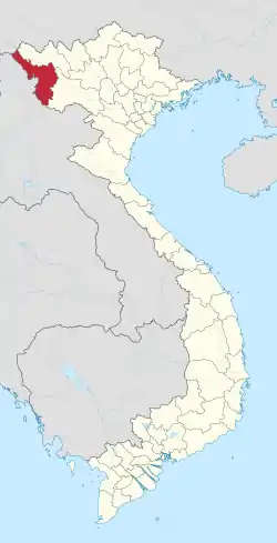 Location of Điên Biên within Vietnam | |
| Coordinates: 21°23′N 103°1′E | |
| Country | |
| Region | Northwest |
| Capital | Điện Biên |
| Area | |
| • Total | 9,560 km2 (3,690 sq mi) |
| Population (2017) | |
| • Total | 567,000 |
| • Density | 59/km2 (150/sq mi) |
| Demographics | |
| • Ethnicities | Vietnamese/Kinh, H'Mông, Dao, Thai |
| Time zone | UTC+7 (ICT) |
| Area codes | 215 |
| ISO 3166 code | VN-71 |
| Website | www |
History
The name "Điện Biên" means "stable frontier" (referring to Điện Biên's location on the border between Lan Xang and Vietnam).[1] Điện Biên has various ancient monuments including the caves Thẩm Khương, as well as Thẩn Búa in Tuần Giáo. The original settlers were the Ai Lao or Tai people who are a direct ancestor of Lao people in Laos today. The names of some villages and towns still use words of Lao origin, such as Mường (city) and Tham (cave).
In the 9th and 10th centuries, the Lự ở Mường Thanh people were the most developed in the area and controlled Sìn Hồ, Mường Lay, and Tuần Giáo.
In the 11th and 12th centuries, Tai (not to be confused with the Thai people of Thailand) people from Mường Ôm and Mường Ai occupied Mường Lò in Nghĩa Lộ and Mường Thanh in Điện Biên. They eventually gained control of the whole area between Mường Lò and Mường Thanh (Điện Biên).
Administrative divisions
Điện Biên is subdivided into 10 district-level sub-divisions:
| Second Tier subdivisions |
Area (km²) |
Third Tier subdivisions | ||
|---|---|---|---|---|
| Ward | Township | Commune | ||
| Điện Biên Phủ city | 64.27 | 7 | 2 | |
| Mường Lay town | 114.03 | 2 | 1 | |
| Điện Biên District | 1639.85 | 25 | ||
| Điện Biên Đông District | 1206.39 | 1 | 13 | |
| Mường Ảng District | 443.52 | 1 | 9 | |
| Mường Chà District | 1199.42 | 1 | 11 | |
| Mường Nhé District | 1573.73 | 11 | ||
| Nậm Pồ District | 1498.00 | 15 | ||
| Tủa Chùa District | 679.41 | 1 | 11 | |
| Tuần Giáo District | 1136.29 | 1 | 18 | |
They are further subdivided into five commune-level towns (or townlets), 116 rural communes, and nine wards.
Places in Điện Biên
References
- "Điện Biên, hành trình trở về cội nguồn" (in Vietnamese).
External links
| Wikimedia Commons has media related to Dien Bien. |
Places adjacent to Điện Biên Province | ||||||||||
|---|---|---|---|---|---|---|---|---|---|---|
| ||||||||||