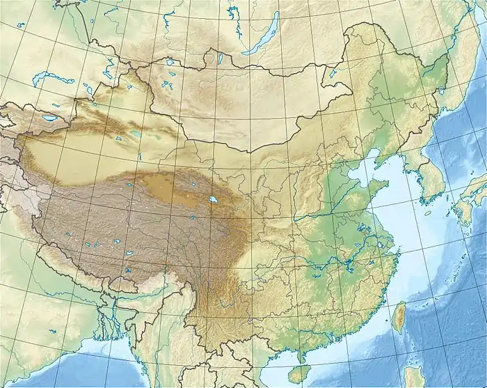
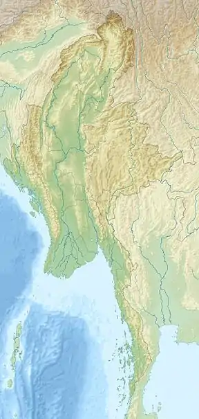
1988 Lancang earthquake
On November 6, 1988 at 21:03 CST, the Lancang earthquake (simplified Chinese: 澜沧江大地震; traditional Chinese: 瀾滄江大地震; pinyin: Láncāngjiāng dà dìzhèn) struck Lancang County, Yunnan, near the border with Shan State, Burma (Myanmar) with a moment magnitude of Mw 7.7. The earthquake had a maximum intensity of IX to X on the Mercalli intensity scale, destroying many buildings and triggering landslides. It was followed up by a large aftershock a few minutes later, adding more casualties and damages. More than 900 people were killed, and at least 3,900 were injured in both earthquakes making it the worst in the country since 1976.[1] Much information of the earthquake and its devastation was hidden by the Chinese government as the country was going through major political and cultural revolutions.[2]
 | |
 1988 Lancang earthquake (Myanmar) | |
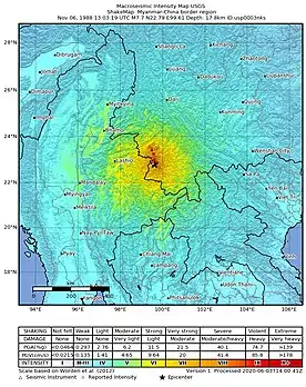
| UTC time | 1988-11-06 13:03:19 |
|---|---|
| ISC event | 419867 |
| 419869 | |
| USGS-ANSS | ComCat |
| ComCat | |
| Local date | 6 November 1988 |
| Duration | 19 seconds |
| Magnitude | 7.7 Mw |
| Depth | 17.8 km |
| Epicenter | 22.789°N 99.611°E |
| Type | Strike-slip |
| Areas affected | China, Myanmar and Thailand |
| Total damage | $270 million USD |
| Max. intensity | X (Extreme) |
| Landslides | Yes |
| Aftershocks | Largest: Ms 7.2, Total: 600 + |
| Casualties | 730-939 fatalities, 3,900 injured |
It is the largest earthquake to affect both Yunnan Province and Shan State since 1970 and 1912, respectively. In January 1970, a Mw 7.1 struck Tonghai County, resulting in over 15,000 deaths, and in May 1912, Shan State was hit with a Mw 7.7 that caused serious damage in the region.
Tectonic setting
The Shan Plateau is crisscrossed with numerous strike-slip structures to accommodating crustal rotation of the Sunda Block and deformation as a result of the India-Asia collision where the Indian Plate is underthrusted beneath the Eurasian Plate. The Shan Plateau was formed from uplift along the Shan Scarp Fault Zone, an inactive shear zone and reverse or thrust fault along its western base.[3][4] East of the Shan Scarp Fault is the active Sagaing Fault, a dextral transform fault, and the northern boundary of the Shan Plateau lies the Red River Fault, an active dextral fault.[5] The earthquake originated along the Longlin-Lancang Fault Zone, a northwest striking, 210 kilometres (130 mi) structure. Its northern section is a single strand, unlike the northern section consisting of a set of clustered faults. It formed in the early to middle Miocene. The fault has a dextral sense of slip with a maximum displacement of 17 kilometres (11 mi). Estimated slip rate is 3.4 mm/yr. During the 1988 quake, 70 kilometres (43 mi) of fault ruptured, and new faults were created. Maximum dextral offset reached 1.4 m, and vertical offset was 0.5 metres (1 ft 8 in).[6][7] Fault rupture velocity was estimated to be at 2 km/s.[8]
Earthquake
The earthquake struck in a remote location near the Myanmar-China border on Sunday. Shaking from this event earned X (Extreme) on the Mercalli intensity scale.[9] More shaking was felt in Thailand, Laos, Vietnam and Bangladesh as well. Right-lateral (dextral) offset of 1.4 to 1.5 metres (4 ft 7 in to 4 ft 11 in) were measured. Very small dip-slip (reverse) component were also measured. Ground rupture followed a north northwest strike for about 24 kilometres (15 mi).
Impact
Damage and casualties
After the earthquake, it was reported that at least 600 inhabitants were reported dead, mainly from the village of Shanmato that was leveled by the temblor. Telecommunication services were cut and severely disrupted around the Yunnan and Shan State border region, which meant that provincial government officials could not provide any figures on the dead.[10] Other figures for fatalities were 18 and 37, which could not updated due to the communication disruptions. The majority of homes constructed of wood and mud, and resided by farmers did not survive the extreme ground motions.[10]
On November 9, the death toll was totaled to 938, at least 3,900 people were seriously injured, more than 3 million people had been affected with 267,000 left homeless.[11] Heavy damages were reported in Lancang County and 16 other surrounding counties. Most homes, roads and communication lines in Lancang and Mengliang were destroyed.[12] An estimated 200,000 including 144,000 houses had collapsed, 500,000 buildings including 253,000 homes were badly damaged.[12] About 1,000 schools, 98 clinics and 29 reservoirs were destroyed. Landslides in the area also damaged highways. Kunming, the capital of Yunnan Province did not report any damage, although the earthquake was felt strongly. More damage was reported in Chiang Rai, Thailand. Total damage is estimated at US$269 million.
Aftershocks
A large aftershock of Ms 7.2 occurred thirteen minutes after the main shock, this event was located 60 kilometres (37 mi) north northwest of the main shock and was felt in Burma, Laos and Thailand as well.[13] By December 20, over 600 aftershocks had been recorded.
Rescue
Due to its remote location and the lack of communication and damaged roads, rescue and aid transportation efforts faced difficulties getting to the affected areas. The Yunnan government ordered an airlift of medical and relief supplies to help those affected. The governor of Yunnan Province, He Zhiqiang, along several medical doctors were also brought to the disaster scene.[10] Several thousand troops and many military vehicles also visited the affected areas, according to the Ministry of Civil Affairs.[14]
References
- Ramirez, Marizen; Peek-Asa, Corinne (2005). "Epidemiology of Traumatic Injuries from Earthquakes". Epidemiologic Reviews. 21 (1): 47–55. doi:10.1093/epirev/mxi005.
- Associated Press (10 July 2010). "Hundreds injured in China earthquake". The Guardian. Retrieved 22 January 2021.
- Soe Min. "Fault segmentation and active tectonic criteria of the Shan Scarp Fault Zone, Shan Plateau Region, Myanmar". MNCES 2019.
- Socquet, Pubellier, Anne, Manuel (29 March 2004). "Cenozoic deformation in western Yunnan (China–Myanmar border)" (PDF). Journal of Asian Earth Sciences. 24 (4): 495–515. doi:10.1016/j.jseaes.2004.03.006.
- Li, Yujiang; Shao, Zhigang; Shi, Fuqiang; Chen, Lianwang (2020). "Stress evolution on active faults in the southwestern Yunnan region, southeastern Tibetan Plateau, and implications for seismic hazard". Journal of Asian Earth Sciences. 200: 104470. Bibcode:2020JAESc.20004470L. doi:10.1016/j.jseaes.2020.104470.
- Yu Wang. "Earthquake Geology of Myanmar" (PDF). Dissertation – via Caltech.
- GUO Shunmin1 , XIANG Hongfa1 , ZHOU Ruiqi , XU Xiwei , DONG Xingquan & ZHANG Wanxia (2000). "Longling-Lancang fault zone in southwest Yunnan, China——A newly-generated rupture zone in Continental crust". Chinese Science Bulletin. 45: 376–379. doi:10.1007/BF02909774. S2CID 130422667.CS1 maint: multiple names: authors list (link)
- Mozaffari, Parviz; Wu, Zhong-Liang; Chen, Yun-Tai (1998). "Rupture process of November 6, 1988, Lancang-Gengma, Yunnan, China, earthquake ofM s=7.6 using empirical Green's function deconvolution method". Acta Seismologica Sinica. 11 (1): 1–12. Bibcode:1998AcSSn..11....1M. doi:10.1007/BF02650450. S2CID 129586363.
- Wang, Hui; Qiang, Zuji; Yuan, Zhuzhong; Wang, Yanglong; Zhang, Hua; Zhao, Xiang; Gu, Yishan (1992). "Distribution of seismic intensities of the November 6, 1988, Lancang-Gengma earthquakes and their surface ruptures in Yunnan Province, China". Acta Seismologica Sinica. 5 (2): 343–354. Bibcode:1992AcSSn...5..343W. doi:10.1007/BF02651701. S2CID 129529222.
- Associated Press (8 November 1988). "Chinese quake registers 7.6, death toll hits 600" (PDF). The Observer. Retrieved 22 January 2021.
- Kristof, Nicholas D. (Nov 9, 1988). "Toll Reported in China Earthquake Reaches 938". The New York Times.
- UN Department of Humanitarian Affairs. "China - Earthquake Nov 1988 UNDRO Information Reports 1-7". reliefweb.
- Chen, Yuntai; Wu, Francis T. (1989). "Lancang—Gengma Earthquake: A Preliminary Report on the November 6, 1988, Event and its Aftershocks". Eos, Transactions American Geophysical Union. 70 (49): 1527. Bibcode:1989EOSTr..70.1527C. doi:10.1029/89EO00376.
- Tyson, James L. (9 November 1988). "Peking sends help to Yunnan, `China's earthquake center'". The Christian Science Monitor. Retrieved 22 January 2021.