Menglian Dai, Lahu and Va Autonomous County
Menglian Dai, Lahu and Va Autonomous County (simplified Chinese: 孟连傣族拉祜族佤族自治县; traditional Chinese: 孟連傣族拉祜族佤族自治縣; pinyin: Mènglián Dǎizú Lāhùzú Wǎzú Zìzhìxiàn) is an autonomous county in the southwest of Yunnan Province, China, bordering Ximeng County to the north, Lancang County to the north, northeast, and east, and Burma's Shan State to the south and west. It is the westernmost county-level division of Pu'er City
Menglian County
孟连县 | |
|---|---|
| 孟连傣族拉祜族佤族自治县 Menglian Dai, Lahu and Va Autonomous County | |
.png.webp) Location of Menglian County (pink) and Pu'er City (yellow) within Yunnan province | |
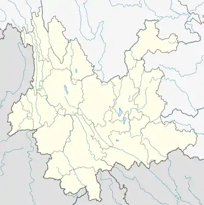 Menglian Location of the seat in Yunnan | |
| Coordinates: 22°19′44″N 99°35′02″E | |
| Country | People's Republic of China |
| Province | Yunnan |
| Prefecture-level city | Pu'er |
| GB/T 2260 CODE[1] | 530827 |
| Area | |
| • Total | 1,957 km2 (756 sq mi) |
| Elevation | 1,300 m (4,300 ft) |
| Population | |
| • Total | 107,908 |
| • Density | 55/km2 (140/sq mi) |
| Time zone | UTC+8 (China Standard Time) |
| Postal code | 665800[2] |
| Area code(s) | 0879[2] |
| Website | www |
| 1Yunnan Statistics Bureau 2Puer Gov. 3Yunnan Portal | |
Administrative divisions
In the present, Menglian Dai, Lahu and Va Autonomous County has 5 towns and 2 townships.
- 5 towns
- Nayun (娜允镇)
- Mengma (勐马镇)
- Mangxin (芒信镇)
- Fuyan (富岩镇)
- 2 townships
- Jingxin (景信乡)
- Gongxin (公信乡)
Climate
| Climate data for Menglian (1981−2010) | |||||||||||||
|---|---|---|---|---|---|---|---|---|---|---|---|---|---|
| Month | Jan | Feb | Mar | Apr | May | Jun | Jul | Aug | Sep | Oct | Nov | Dec | Year |
| Record high °C (°F) | 29.7 (85.5) |
32.0 (89.6) |
33.2 (91.8) |
35.8 (96.4) |
36.0 (96.8) |
34.7 (94.5) |
35.2 (95.4) |
34.4 (93.9) |
32.7 (90.9) |
32.5 (90.5) |
30.1 (86.2) |
28.8 (83.8) |
36.0 (96.8) |
| Average high °C (°F) | 24.2 (75.6) |
26.0 (78.8) |
29.0 (84.2) |
30.6 (87.1) |
30.2 (86.4) |
29.2 (84.6) |
28.2 (82.8) |
28.7 (83.7) |
28.7 (83.7) |
27.9 (82.2) |
25.5 (77.9) |
23.5 (74.3) |
27.6 (81.8) |
| Daily mean °C (°F) | 14.0 (57.2) |
15.8 (60.4) |
19.0 (66.2) |
21.6 (70.9) |
23.3 (73.9) |
24.0 (75.2) |
23.7 (74.7) |
23.6 (74.5) |
22.8 (73.0) |
21.2 (70.2) |
17.7 (63.9) |
14.5 (58.1) |
20.1 (68.2) |
| Average low °C (°F) | 7.5 (45.5) |
8.2 (46.8) |
11.2 (52.2) |
14.8 (58.6) |
18.5 (65.3) |
21.0 (69.8) |
21.1 (70.0) |
21.0 (69.8) |
19.8 (67.6) |
17.8 (64.0) |
13.5 (56.3) |
9.5 (49.1) |
15.3 (59.6) |
| Record low °C (°F) | 1.8 (35.2) |
2.3 (36.1) |
4.2 (39.6) |
7.4 (45.3) |
12.7 (54.9) |
17.1 (62.8) |
17.3 (63.1) |
16.8 (62.2) |
12.1 (53.8) |
9.6 (49.3) |
5.0 (41.0) |
−0.7 (30.7) |
−0.7 (30.7) |
| Average precipitation mm (inches) | 8.3 (0.33) |
12.8 (0.50) |
17.7 (0.70) |
39.5 (1.56) |
135.5 (5.33) |
204.7 (8.06) |
285.3 (11.23) |
265.6 (10.46) |
188.0 (7.40) |
130.1 (5.12) |
57.7 (2.27) |
17.5 (0.69) |
1,362.7 (53.65) |
| Average relative humidity (%) | 79 | 73 | 69 | 71 | 77 | 84 | 86 | 86 | 86 | 86 | 85 | 83 | 80 |
| Source: China Meteorological Data Service Center | |||||||||||||
See also
References
- "Archived copy". Archived from the original on 2009-02-21. Retrieved 2009-01-29.CS1 maint: archived copy as title (link)
- "Area Code and Postal Code in Yunnan Province". Archived from the original on 2007-11-07. Retrieved 2009-01-29.
External links
This article is issued from Wikipedia. The text is licensed under Creative Commons - Attribution - Sharealike. Additional terms may apply for the media files.